Wheldrake facts for kids
Quick facts for kids Wheldrake |
|
|---|---|
| Village and civil parish | |
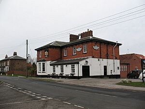 The Wenlock Arms |
|
| Population | 2,107 (2011 census) |
| OS grid reference | SE682449 |
| Civil parish |
|
| Unitary authority | |
| Ceremonial county | |
| Region | |
| Country | England |
| Sovereign state | United Kingdom |
| Post town | YORK |
| Postcode district | YO19 |
| Dialling code | 01904 |
| Police | North Yorkshire |
| Fire | North Yorkshire |
| Ambulance | Yorkshire |
| EU Parliament | Yorkshire and the Humber |
| UK Parliament |
|
| Website | Wheldrake Parish Council website |
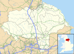
Wheldrake is a lovely village located about 7 km south-east of York in England. It's part of the City of York area, which is in North Yorkshire. In 2011, about 2,107 people lived here.
Historically, Wheldrake was part of the East Riding of Yorkshire. It became part of the City of York in 1996. The village covers a large area of about 4,300 acres. It has been around since before 1066!
Wheldrake is special because it has a protected conservation area. It also has a very important nature reserve called Wheldrake Ings. This area is full of beautiful wild flowers and rare birds. Most people living in Wheldrake travel to work in nearby towns. The village has a primary school, a church, a shop with a post office, and a local pub.
Contents
About Wheldrake's People
In 2001, Wheldrake had 1,909 people living there. The average age was around 41.73 years. This was a bit older than the national average. There were 379 young people under 16 and 368 people over 64. The village had 761 homes.
Most people who worked traveled by car. Only a few used public transport. The average trip to work was about 21.73 km.
Wheldrake's Location and Travel
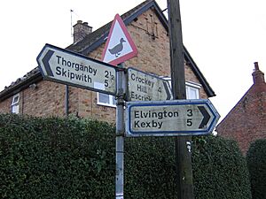
Wheldrake is in the southern part of the Vale of York. It sits between the A19 main road and the River Derwent. You can reach it by a smaller road that leaves the A19. Other small roads from nearby villages like Thorganby and Elvington also meet in Wheldrake.
There is a bus service that goes to York every two hours. The bus ride to York takes about 20 minutes.
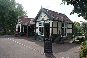
From 1912 to 1926, Wheldrake had a passenger train service. This was on the Derwent Valley Light Railway. The train line carried goods until 1968. The old station building is now kept at the Yorkshire Museum of Farming near York.
What is the Land Like?
The ground under Wheldrake is mostly made of old sand and rock. However, it's covered by layers of dirt and stones left behind by glaciers. The village sits on a slightly raised area called the Escrick moraine. This is a ridge of material left when the ice melted after the last ice age.
Because of this, the soil can be very different. Some areas have thick clay, while others have sand or alluvium (river deposits). The River Derwent flows along the eastern edge of the village. The land height in Wheldrake ranges from about 7 to 17 meters.
What's the Weather Like?
Wheldrake is in the northern part of England. It has a typical English temperate climate. This means it has mild summers and cool winters. The Gulf Stream ocean current helps keep it from getting too cold.
In summer, the highest average temperature is 20 °C, and the lowest is 11 °C. In winter, the highest average is 7 °C, and the lowest is 2 °C. It rains most in August (68 mm) and least in March (37 mm). In summer, the sun shines for about six hours a day. In winter, it's only about one hour. The weather can change a lot from day to day.
Nature in Wheldrake
The Wheldrake Ings are a very important part of the Lower Derwent Valley. This area is a special nature reserve known worldwide. The Ings are flood meadows along the River Derwent. They get flooded during certain seasons. This makes them a perfect home for many wild animals and plants.
The Ings are famous for their many different birds. But they also have lots of mammals, plants, and insects. Wheldrake Woods, in the north of the area, has mostly conifer trees. The open farmland isn't as rich in wildlife. However, the hedgerows and roadsides support small mammals and many types of grasses and flowers.
Wheldrake's History
Long ago, in the Iron Age or Roman times, there were farms and fields here. We can see signs of them from air photographs. In 2002, a Roman farm was found in Wheldrake. Digging showed old buildings, four Roman graves, animal bones, and pottery. There was even part of a main Roman road.
During Saxon times, Wheldrake was in an area called the Danelaw. This means it was likely a group of small family farms. After the Norman Conquest in 1066, the new king, William I, gave Wheldrake to one of his followers.
By 1086, when the Domesday Book was written, the land belonged to William de Percy. It was known as Coldrid. At that time, Wheldrake had lots of woodland, meadows, three places to fish, a water mill, and a church.
Over time, the cultivated land grew. In the 14th century, farmers used large open fields and shared common land for grazing animals. Many gifts of land were given to monasteries. By the late 1400s, Fountains Abbey owned a big part of Wheldrake.
When King Henry VIII closed the monasteries, their land in Wheldrake was taken. It was then given or sold to private people. These new owners became the landlords. They collected rent from the farmers and people living in the village.
In 1609, Wheldrake still had open fields. There were 58 people who rented land and 13 who owned their land. There were 65 houses. Some people just rented their homes, like a weaver and a miller. There was even a windmill in the village.
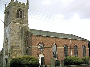
In 1773, the landlords decided to enclose the land. This meant putting fences and ditches around farms. This changed the way farming was done. Around 1778–1779, the main part of the village church was rebuilt in the Georgian style. However, its old 13th-century stone tower was kept.
In the early 1800s, there were 30 to 40 farmers in Wheldrake. Many had farmhouses with yards and barns right in the village. They grew crops like oats, peas, and turnips. Much of the land was also used for animals or hay. Most of the land was still rented from a landlord. At this time, Wheldrake had many shops and traders. They provided for the needs of the farmers and people in nearby villages.
In the 20th century, the main landowner sold many farms and houses. Farmers and other people bought them. As cars became common, people could travel to work and bigger shops in towns. This meant village shops and craft businesses started to close. But, people who worked in towns found Wheldrake's countryside attractive. They chose to live there. This led to more houses being built. Now, new homes surround the old part of the village.
Buildings and History
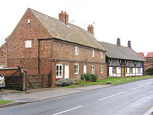
The Wheldrake Conservation Area was created in 1979. It includes the historic Main Street, Church Lane, and the Back Lanes. These streets were part of the planned Medieval village. The parish church and 21 other buildings are listed as important historical sites.
Fun Things to Do in Wheldrake
The Wheldrake Singers are a local group that performs concerts. They often sing old music and are joined by local musicians. The local pub, The Wenlock, is a place for people to meet. There's also an annual art show by local artists.
The Wheldrake Recreational Association offers places for sports and social events. St Helen's Church also has social groups. A mobile library visits every two weeks. There's a playground with basketball for older kids.
Local clubs use the tennis, football, and cricket fields at the village hall. Swallow Hall is the local golf course. There are two fishing lakes, Raker Lakes and Westerly Lake. You can also walk on public paths through the fields. Wheldrake Woods and Wheldrake Ings are popular for walks too.
The village has a monthly magazine called Parish News. It shares local information with about 600 homes. You can listen to BBC Radio York and 96.9 Viking FM. The local newspaper is The York Press.
Businesses in Wheldrake
The Millfield industrial estate has seven businesses. These are involved in light industry and trade. Many farmers and self-employed people, like decorators and builders, run businesses from their homes.
On Main Street, you'll find The Wenlock Arms pub, a village shop with a post office, a hairdresser, and an undertaker. There used to be another pub called the Alice Hawthorne, named after a racehorse. There was also a fish and chip shop, but it closed.
Learning in Wheldrake
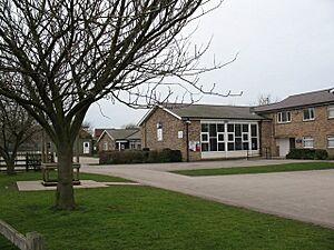
Wheldrake with Thorganby C of E (Aided) Primary School teaches children up to age 11. The school moved to its current spot in 1973. It recently added an extension because more younger children are moving to the area. Older students usually go to Fulford School in York.
 | Audre Lorde |
 | John Berry Meachum |
 | Ferdinand Lee Barnett |


