Williamtown, New South Wales facts for kids
Quick facts for kids WilliamtownNewcastle, New South Wales |
|||||||||||||||
|---|---|---|---|---|---|---|---|---|---|---|---|---|---|---|---|

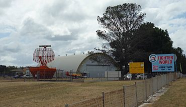
Fighter World Museum at RAAF Base Williamtown
|
|||||||||||||||
| Population | 762 (2021 census) | ||||||||||||||
| • Density | 16.97/km2 (44.0/sq mi) | ||||||||||||||
| Postcode(s) | 2318 (Williamtown), 2314 (Williamtown RAAF) |
||||||||||||||
| Elevation | 5 m (16 ft) | ||||||||||||||
| Area | 44.9 km2 (17.3 sq mi) | ||||||||||||||
| Time zone | AEST (UTC+10) | ||||||||||||||
| • Summer (DST) | AEDT (UTC+11) | ||||||||||||||
| Location |
|
||||||||||||||
| LGA(s) | Port Stephens Council | ||||||||||||||
| Region | Hunter | ||||||||||||||
| County | Gloucester | ||||||||||||||
| Parish | Stowell | ||||||||||||||
| State electorate(s) | Port Stephens | ||||||||||||||
| Federal Division(s) | Paterson | ||||||||||||||
|
|||||||||||||||
|
|||||||||||||||
Williamtown is a small, mostly rural area (called a suburb) in New South Wales, Australia. It's part of the Port Stephens local government area, which is in the Hunter Region. You can find Williamtown on the main road connecting Newcastle and Nelson Bay.
Contents
Exploring Williamtown's Landscape
The eastern part of Williamtown is home to two important places. These are RAAF Base Williamtown, a Royal Australian Air Force base, and Newcastle Airport.
The western side of Williamtown is more rural. It has some large residential areas spread out along Cabbage Tree Road. This road is a main way to get to Port Stephens from the Pacific Highway.
Waterways and Beaches
To the south, Williamtown reaches Fullerton Cove. This is a large bay connected to the Hunter River.
The very south-eastern corner of Williamtown touches the Tasman Sea at Stockton Beach. You can even drive onto the beach here with special off-road vehicles using Lavis Lane.
Who Lives in Williamtown?
In 2016, a survey counted 885 people living in Williamtown. Most of these people, about 70.9%, were born in Australia.
When it came to languages spoken at home, 80.7% of residents spoke only English. The most common religion reported was Anglican, at 22.8%.
Williamtown's Water Source
Most of Williamtown sits on top of something called the Tomago sandbeds. This is like a giant underground sponge, or an aquifer, that holds a lot of water. It's a super important source of drinking water for the lower Hunter Region.
The sandbeds get refilled mainly by rain. They also get water that leaks from Grahamstown Dam, which is nearby in Ferodale. The water from both the sandbeds and the dam is cleaned and made safe to drink in Tomago.
 | Madam C. J. Walker |
 | Janet Emerson Bashen |
 | Annie Turnbo Malone |
 | Maggie L. Walker |


