Wilson Inlet facts for kids
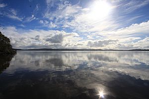
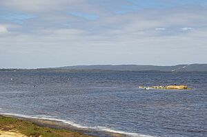
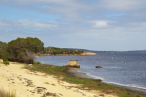
Wilson Inlet is a beautiful, shallow body of water in Western Australia. It's an estuary, which means it's where a river meets the sea. This special place is found on the coast of the Great Southern region in Western Australia.
Contents
What is Wilson Inlet Like?
Wilson Inlet gets its water from two main rivers: the Denmark River and the Hay River. Smaller streams like the Sleeman River, Little River, and Cuppup Creek also flow into it. The inlet is about 2 kilometers (1.2 miles) southeast of the town of Denmark.
This estuary is often shaped by ocean waves. It has an opening to the sea that is about 100 meters (328 feet) wide. However, a sandbar often blocks this opening from late January until August. The inlet is divided into two parts: an eastern basin and a western basin.
The estuary sits on a flat coastal area. It has granite hills to the north and west, and sand dunes along the coast to the south. The inlet covers a large area of about 48 square kilometers (18.5 square miles). It's quite shallow, with an average depth of 1.8 meters (5.9 feet). The deepest spot is about 5 meters (16 feet) deep. From east to west, the inlet stretches about 14 kilometers (8.7 miles) long and is about 4 kilometers (2.5 miles) wide.
The land area that drains water into the inlet is called its catchment. This catchment is huge, covering about 2,263 square kilometers (874 square miles). It includes parts of the Shire of Plantagenet, the Shire of Denmark, and the City of Albany.
When the sandbar is open, the inlet's water flows out into the Southern Ocean. This happens at Ratcliffe Bay, near Nullaki Point and Ocean Beach. Sometimes, the Water Corporation will even open the sandbar on purpose at Ocean Beach to help prevent flooding. The land around the inlet is often low and swampy, with lakes to the east.
A Look Back in Time: History of Wilson Inlet
Wilson Inlet was formed a very long time ago, between 6,000 and 8,000 years ago. At that time, sea levels rose and flooded an old river valley, creating the inlet we see today.
The first people to live around the inlet were the Aboriginal Australian people, specifically the Noongar community. They have lived here for thousands of years. Many old Aboriginal items have been found in the area, such as fish traps, special gathering places called corroboree sites, and places where they dug for ochre (a natural pigment).
The Noongar name for the inlet is Koorabup, which means Place of the Black Swan. This name tells us how important the black swan is to the area.
The first European to visit the inlet was Dr Thomas Wilson in 1829. He was on an expedition from King George Sound. Later, Governor Stirling named the inlet after Dr. Wilson.
European families, like the Randalls and Youngs, started settling in the area in the 1890s. Timber mills were built in 1895, and people began clearing land for farming in the 1920s. By 1982, nearly half (46%) of the land around the inlet was privately owned. Today, about 44% of the land has been cleared, while 38% remains as forest and national parks.
In 1911, a sad event happened on the inlet. A local farmer, William Leonard Smeed, and six members of his family drowned. Their small yacht, the Little Wonder, was overturned by a sudden strong wind while they were sailing near Pelican Island.
To help control water levels and prevent floods, the sandbar at Ocean Beach is sometimes opened by people. This has happened in recent years, including 2014, 2017, 2018, and 2020.
Plants of Wilson Inlet
The area around the mouth of the inlet is mostly covered by tall rushes. These rushes belong to a single species from South Africa called Juncus kraussi. You can also find Melaleuca cuticularis, a type of paperbark tree that can handle salty water. These trees grow along the edges of the inlet and in the river channels. The salt marsh areas are mainly made up of Juncus kraussi, Sarcocornia quinqueflora, and Samolus repens.
Animals of Wilson Inlet
Wilson Inlet is a popular spot for fishing because many different kinds of fish live here. You might catch cobbler, King George whiting, tailor, mullet, salmon trout, and flathead. Other fish found in the estuary include sandy sprat, yellow eye mullet, sea mullet, and blue mackerel.
The inlet is a very important nursery for many young fish, especially pink snapper. These young fish grow up in the inlet before moving out to the ocean to become adults and have their own babies. Because of this, the minimum size for pink snapper that can be caught from the inlet was increased in 2007, from 28 centimeters (11 inches) to 41 centimeters (16 inches). This helps protect the young fish.
Many different waterbirds also live in and around the inlet. Some common ones include the silver gull, Australian pelican, black swan, little black cormorant, red-necked stint, little pied cormorant, grey teal, red-necked avocet, blue-billed duck, and the Australasian shoveller. In fact, 22 different types of migratory shorebirds (birds that travel long distances) have been seen here.
The inlet is also home to a mussel and oyster farm. This farm started in 2002 and is located on a 12-hectare (30-acre) area on the south side of the inlet. They had their first harvest of mussels and oysters in 2005–2006. They grow Blue mussels and Belon oysters using special farming methods. An earlier attempt to farm mussels in the 1970s was unfortunately destroyed by Cyclone Alby just before the mussels were ready to be harvested.
 | Bayard Rustin |
 | Jeannette Carter |
 | Jeremiah A. Brown |


