Windtower (Alberta) facts for kids
Quick facts for kids Windtower |
|
|---|---|

Windtower
|
|
| Highest point | |
| Elevation | 2,695 m (8,842 ft) |
| Prominence | 175 m (574 ft) |
| Parent peak | Mount Lougheed (3107 m) |
| Listing | Mountains of Alberta |
| Geography | |
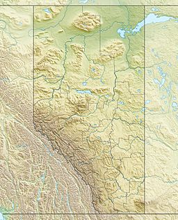
| Location | Alberta, Canada |
| Parent range | Canadian Rockies |
| Topo map | NTS 82J/14 |
| Geology | |
| Age of rock | Cambrian |
| Type of rock | Palliser limestone |
| Climbing | |
| Easiest route | Scramble |
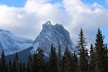
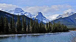
Windtower is a tower-shaped mountain in the Canadian Rockies of Alberta, Canada. It stands about 2,695 meters (8,842 feet) high. You can find it in the beautiful Wind Valley, which is part of Kananaskis Country. Windtower is a famous landmark that you can easily spot from Highway 1, also known as the Trans-Canada Highway, near Canmore.
Even though it's not the highest mountain around, its steep north face looks very impressive. It reminds some climbers of famous peaks in The Bugaboos. Its closest taller neighbor is Mount Lougheed, located about 3 kilometers (1.9 miles) to the southeast.
Contents
Climbing Windtower
People enjoy climbing Windtower using different routes. Some routes are very challenging rock climbs, while others are easier hikes.
Rock Climbing Routes
- The Iron Butterfly is a very difficult rock climbing route on the northwest face. It is about 450 meters (1,476 feet) long. Jeff Marshall and Steve DeMaio first climbed it in 1988. It is known for being very hard to repeat.
- The Northeast Ridge is another climbing route. It was first climbed in July 1965 by B. Corbeau, G. Crocker, and K. Hahn.
- The Northeast Face is a longer route, about 570 meters (1,870 feet) long. G. Homer and R. Wood first climbed it in 1972.
West Slope Scramble
The West Slope offers an easier way to reach the top. This route involves a hike and an easy scramble over loose rocks. You can access it from Highway 742, also known as the Smith-Dorrien/Spray Trail. Scrambling is a mix of hiking and basic climbing, often using your hands for balance.
History of Windtower's Name
Windtower got its name in 1950. The mountain's name was officially approved in 1982 by the Geographical Names Board of Canada. This board is responsible for naming places across Canada.
Geology of the Mountain
Windtower is made mostly of a type of rock called Palliser limestone. Limestone is a sedimentary rock, which means it formed from layers of tiny bits of sand, mud, and shells that settled at the bottom of ancient seas.
These rock layers were laid down over millions of years, from the Precambrian to the Jurassic periods. Later, during a time called the Laramide orogeny, huge forces pushed these sedimentary rocks eastward. This movement caused them to fold and break, eventually forming mountains like Windtower.
Climate Around Windtower
Windtower is located in a subarctic climate zone. This means the area has cold, snowy winters and mild summers. Temperatures can often drop below −20 °C (−4 °F). With the wind, it can feel even colder, sometimes below −30 °C (−22 °F).
The snow and rain that fall on Windtower eventually melt and flow into the Bow River. The Bow River is a major river that flows into the Saskatchewan River.


