
Winneconne, Wisconsin facts for kids
Quick facts for kids
Winneconne, Wisconsin
|
|
|---|---|

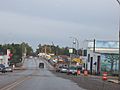
Downtown Winneconne
|
|

Location of Winneconne in Winnebago County, Wisconsin.
|
|
| Country | |
| State | |
| County | Winnebago |
| Area | |
| • Total | 1.92 sq mi (4.97 km2) |
| • Land | 1.48 sq mi (3.84 km2) |
| • Water | 0.44 sq mi (1.13 km2) |
| Elevation | 748 ft (228 m) |
| Population
(2010)
|
|
| • Total | 2,544 |
| • Estimate
(2019)
|
2,484 |
| • Density | 1,673.85/sq mi (646.29/km2) |
| Time zone | UTC-6 (Central (CST)) |
| • Summer (DST) | UTC-5 (CDT) |
| Area code(s) | 920 |
| FIPS code | 55-87925 |
| GNIS feature ID | 1576880 |
Winneconne is a small village in Winnebago County, Wisconsin. About 2,383 people lived there in 2010. The village is part of the Town of Winneconne. It sits right on the Wolf River, surrounded by a group of lakes called the Wolf Chain. These lakes include Poygan, Winneconne, and Butte des Morts. Because of its great location, Winneconne is a popular spot for bass fishing tournaments.
Contents
History of Winneconne Village
Long ago, different groups of Native American people lived in this area. The Menominee people were here when Europeans first arrived. French fur traders from Quebec were among the first Europeans to meet them. Later, Catholic missionaries also came. The area was once ruled by Great Britain, then it became part of the United States.
Early European Settlement
European-American settlers started coming to Winneconne in the mid-1800s. Many came from New England, and later, immigrants from Ireland, Germany, and Norway also settled here.
The name "Winneconne" used to be spelled in many ways, like Winneconnah or Winnikning. These names came from the Menominee and other Native American languages. They meant things like "land of dirty water" or "land of skull and bones." This last meaning referred to an old burial mound that the French called Butte des Morts. In 1851, the village leaders officially decided on the spelling "Winneconne."
Joseph Edwards was the first postmaster in Winneconne. He moved here with his family in 1849 and built the village's first wooden house.
Village Growth and River Crossings
After the Treaty of Poygan in 1852, the Menominee people gave more land in this area to the United States. This allowed Winneconne to grow west of the Wolf River. Chief Oshkosh worked to keep some lands for his people, as many Menominee did not want to move away. Today, the Menominee Indian Tribe of Wisconsin is a recognized tribe.
As the village grew, people needed to cross the river more often. At first, the Menominee used canoes to move people and goods. In 1853, a settler named J.D. Rush built a floating bridge and charged a small fee to cross it. Since then, four bridges have been built, including the one used today.
Early Industries and Recreation
In Winneconne's early days, mills were built along the river. These mills processed wood and grain. There were also tanneries (places that make leather). Commercial fishing was also a big business. Many shipyards built and fixed wooden boats.
With its many rivers and lakes, Winneconne became known as a great place for "hunting and fishing." Some vacation homes have also been built in the area.
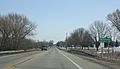
Improvements to the area continue. The Wolf River Bridge, which carries WIS 116, was built in 1934. This happened during the Great Depression, with help from the government's WPA projects. This bridge is now old and narrow. Because it's so important to the village's Main Street, a new bridge is planned. The new bridge will also have fishing platforms, just like the current one.
The "Sovereign State of Winneconne" Event
In 1967, something funny happened. The village's name was accidentally left off the official Wisconsin road map. This made some local leaders upset! A group led by Vera Wentzel-Kitchen decided to pretend to secede (break away) from Wisconsin.
They planned to set up toll booths on local roads. They even joked about taking over nearby cities like Oshkosh to form the Sovereign State of Winneconne. Another idea was to join a state with better weather.
On July 21, 1967, they made a statement. They named James Coughlin as the "president" of the new state and Vera Kitchen as "prime minister." Of course, no real government recognized this "secession." It was just a way for the village to show how unhappy they were with state officials.
Wisconsin Governor Warren P. Knowles met with the village leaders. The next day, July 22, 1967, Winneconne "reconciled" with Wisconsin. Today, the village celebrates this event every year with "Sovereign State Days." Their fun logo shows poison ivy, a skunk, a sheepshead fish, and a dodo bird.
Geography and Location
Winneconne is located at about 44 degrees North latitude and 88 degrees West longitude.
The village covers about 1.95 square miles (5.05 square kilometers). Most of this area is land (1.53 sq mi or 3.96 sq km), and the rest is water (0.42 sq mi or 1.09 sq km).
The village was built along the Wolf Chain of lakes. These include Lake Poygan, Lake Winneconne, and Lake Butte des Morts. Many bass fishing tournaments are held in Winneconne because it's in the middle of this lake system.
Population Information
| Historical population | |||
|---|---|---|---|
| Census | Pop. | %± | |
| 1870 | 1,159 | — | |
| 1880 | 978 | −15.6% | |
| 1890 | 1,086 | 11.0% | |
| 1900 | 1,042 | −4.1% | |
| 1910 | 940 | −9.8% | |
| 1920 | 745 | −20.7% | |
| 1930 | 821 | 10.2% | |
| 1940 | 931 | 13.4% | |
| 1950 | 1,078 | 15.8% | |
| 1960 | 1,273 | 18.1% | |
| 1970 | 1,611 | 26.6% | |
| 1980 | 1,935 | 20.1% | |
| 1990 | 2,059 | 6.4% | |
| 2000 | 2,401 | 16.6% | |
| 2010 | 2,383 | −0.7% | |
| 2019 (est.) | 2,484 | 4.2% | |
| U.S. Decennial Census | |||
2010 Census Details
In 2010, there were 2,383 people living in Winneconne. There were 1,027 households and 678 families. The village had about 1,557.5 people per square mile.
Most residents (97.5%) were White. A small number were African American (0.2%), Native American (0.4%), or Asian (0.3%). About 1.3% of the population was Hispanic or Latino.
About 29.4% of households had children under 18. Most households (54.3%) were married couples. The average household had 2.32 people, and the average family had 2.87 people.
The average age in the village was 43.7 years. About 22.6% of residents were under 18. About 16.7% were 65 or older. The population was almost evenly split between males (49.1%) and females (50.9%).
Winneconne Public Library
The Winneconne Public Library is located at 31 South 2nd Street. It offers many services for the community. You can use the Internet there, join adult book clubs, or take part in children's programs.
The library has about 35,000 items. Most of these are books (around 30,000). They also have videos, audio, and other digital materials. The library hosts a special database called the Winneconne Vital Records Database. This helps people research birth, marriage, and death records from old Winneconne newspapers.
The Winneconne Library is part of the Winnefox Library System. This system serves over 300,000 people in several counties, including Fond du Lac, Green Lake, Marquette, Waushara, and Winnebago counties.
Images for kids
-
City welcome sign
-
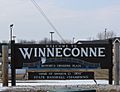
Welcome sign
-
WIS 116 bridge over the Wolf River
-
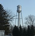
Water tower
-
Arthur Marble Memorial Park
-
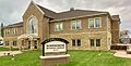
Village hall


See also
 In Spanish: Winneconne (Wisconsin) para niños
