
Wirt County, West Virginia facts for kids
Quick facts for kids
Wirt County
|
||
|---|---|---|

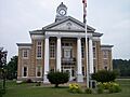
The Wirt County Courthouse in Elizabeth
|
||
|
||

Location within the U.S. state of West Virginia
|
||
 West Virginia's location within the U.S. |
||
| Country | ||
| State | ||
| Founded | January 19, 1848 | |
| Named for | William Wirt | |
| Seat | Elizabeth | |
| Largest town | Elizabeth | |
| Area | ||
| • Total | 235 sq mi (610 km2) | |
| • Land | 233 sq mi (600 km2) | |
| • Water | 2.3 sq mi (6 km2) 1.0%% | |
| Population
(2020)
|
||
| • Total | 5,194 | |
| • Estimate
(2021)
|
5,063 |
|
| • Density | 22.10/sq mi (8.534/km2) | |
| Time zone | UTC−5 (Eastern) | |
| • Summer (DST) | UTC−4 (EDT) | |
| Congressional district | 2nd | |

Wirt County is a small area in the state of West Virginia in the United States. In 2020, about 5,194 people lived there. This makes it the county with the fewest people in West Virginia. The main town and government center is Elizabeth.
Wirt County was created in 1848. It was named after William Wirt, who was a U.S. Attorney General and even ran for president. The county is part of the larger Parkersburg-Vienna, WV Metropolitan Statistical Area. Students in the county go to Wirt County High School.
Contents
History of Wirt County
Wirt County was formed on January 19, 1848. It was made from parts of two other counties, Jackson and Wood. The county got its name from William Wirt (1772–1834).
The first European settler in the area was William Beauchamp. He arrived in 1796. He was a veteran and a minister. Beauchamp claimed 1400 acres of land near the Little Kanawha River. He started a farm and built a mill. He also planned the town of Elizabeth, naming it after his daughter.
Oil Rush and the Civil War
In the 1860s, a place called Burning Springs became very important. There was a big oil rush there. People came to find oil. But in 1863, during the Civil War, Confederate soldiers burned the town. They also destroyed about 100,000 gallons of oil.
On June 20, 1863, West Virginia became a new state. Wirt County was one of the fifty counties from Virginia that joined the Union as West Virginia. After this, counties in West Virginia were divided into smaller areas called townships. This was to help local governments. But it was hard to do in rural areas. So, in 1872, townships became "magisterial districts."
Wirt County was first divided into seven districts:
- Burning Springs
- Clay
- Elizabeth
- Newark
- Reedy
- Spring Creek
- Tucker
These seven districts stayed mostly the same for over 100 years. In the 1980s, they were combined into three new districts: Central, Northeast, and Southwest.
Geography and Roads
Wirt County covers about 235 square miles. Most of this is land (233 square miles). A small part, about 2.3 square miles, is water.
Main Roads in Wirt County
 West Virginia Route 5
 West Virginia Route 14
 West Virginia Route 47
 West Virginia Route 53
Neighboring Counties
Wirt County shares borders with several other counties:
- Wood County (to the northwest)
- Ritchie County (to the northeast)
- Calhoun County (to the southeast)
- Roane County (to the south)
- Jackson County (to the southwest)
Population Information
| Historical population | |||
|---|---|---|---|
| Census | Pop. | %± | |
| 1850 | 3,353 | — | |
| 1860 | 3,751 | 11.9% | |
| 1870 | 4,804 | 28.1% | |
| 1880 | 7,104 | 47.9% | |
| 1890 | 9,411 | 32.5% | |
| 1900 | 10,284 | 9.3% | |
| 1910 | 9,047 | −12.0% | |
| 1920 | 7,536 | −16.7% | |
| 1930 | 6,358 | −15.6% | |
| 1940 | 6,475 | 1.8% | |
| 1950 | 5,119 | −20.9% | |
| 1960 | 4,391 | −14.2% | |
| 1970 | 4,154 | −5.4% | |
| 1980 | 4,922 | 18.5% | |
| 1990 | 5,192 | 5.5% | |
| 2000 | 5,873 | 13.1% | |
| 2010 | 5,717 | −2.7% | |
| 2020 | 5,194 | −9.1% | |
| 2021 (est.) | 5,063 | −11.4% | |
| U.S. Decennial Census 1790–1960 1900–1990 1990–2000 2010–2020 |
|||
In 2010, there were 5,717 people living in Wirt County. Most people (97.5%) were white. About 1.5% were Black or African American. A small number of people were Asian or American Indian. About 0.5% of the population was of Hispanic or Latino origin.
The average age in the county was 44.4 years old. The average income for a family was about $43,517 per year. About 19.2% of all people in the county lived below the poverty line. This included 31.6% of children under 18.
Notable People from Wirt County
- Howard B. Lee - He was the Attorney General of West Virginia from 1925 to 1933. He worked to stop government corruption.
- Jessica Dawn Lynch - Born in 1983, she is a teacher and actress. She was a soldier in the United States Army and served in the 2003 invasion of Iraq.
- Charles Brooks Smith - He was a soldier in the Union Army during the Civil War. He later became a businessman and a Republican politician. He served in the United States House of Representatives.
Towns and Districts
Town
- Elizabeth (This is the county seat, where the main government offices are.)
Magisterial Districts
These are the local government areas within the county.
Current Districts
- Central
- Northeast
- Southwest
Historic Districts
These were the original districts before they were combined:
- Burning Springs
- Clay
- Elizabeth
- Newark
- Reedy
- Spring Creek
- Tucker
Other Communities
Many smaller communities are not officially towns. They are called unincorporated communities.
Images for kids
-
The Wirt County Courthouse in Elizabeth
See also
 In Spanish: Condado de Wirt para niños
