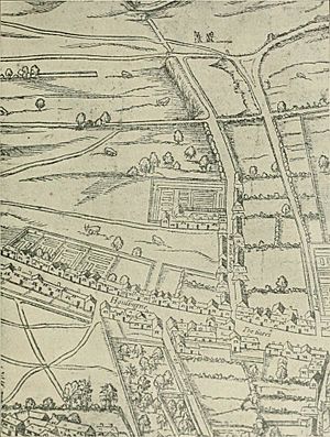
Woodcut map of London facts for kids
The "Woodcut" map of London is a very old and important map of London. Its official name is Civitas Londinum. People often call it the "Agas" map of London. It is one of the first real maps of the City of London and the areas around it. Before this, most images were just panoramic views, like pictures from a distance.
The first version of this map was likely made in the early 1560s. However, only later copies, which are slightly changed, still exist today. The map was printed using woodcut blocks, which are carved pieces of wood. It was made from eight separate sheets. When put together, it measures about 2 feet 4 inches (71 cm) tall and 6 feet (180 cm) wide. Some of the original wood blocks were damaged, so the map might have been a bit bigger at first.
The Woodcut map is a copy of an even older map called the "Copperplate" map. That map was surveyed, or measured, between 1553 and 1559. The Copperplate map only exists in parts today. The Woodcut map is a bit smaller and less detailed than the Copperplate map. The Woodcut map also looks a lot like a map of London found in a book called Civitates Orbis Terrarum. This book was published in 1572 by Georg Braun and Frans Hogenberg.
For a long time, people thought the Woodcut map was made by a mapmaker named Ralph Agas. But experts now believe he did not create it.
Contents
Surviving Copies of the Map
Three copies of the Woodcut map still exist from its earliest known version, made around c. 1633. These copies are kept in important places. You can find them at the London Metropolitan Archives, the Pepys Library at Magdalene College, Cambridge, and The National Archives in Kew.
When Was the Map Made?

The three oldest copies of the map have a date of around c. 1633. However, we know the map itself is much older. It has been updated over time. For example, the royal arms (the king's symbol) in the top left corner are from the House of Stuart (1603–1649). These arms were clearly added later, likely replacing the older Tudor arms. You can still see tiny Tudor arms on the royal barge shown on the Thames.
Also, the Royal Exchange building appears on the map. This building was built between 1566 and 1570 and opened in 1571. It was also clearly added to the map later. The Woodcut map is a close copy of the "Copperplate" map, which was surveyed between 1553 and 1559. But there is one key difference: St Paul's Cathedral is shown on the Woodcut map without its tall spire. The spire was destroyed in a fire in 1561. This means the Woodcut map cannot be older than 1561.
Because of these clues, experts now believe the Woodcut map was most likely made in the 1560s. A record from 1562–1563 mentions a "Carde of London," which might be this very map.
The Woodcut map also changed the way London was shown compared to the Copperplate map. It uses more perspective. This is very clear in the northern and western parts of the map, like near Shoreditch and in the Westminster area. This makes the map look more like a bird's-eye view of the city. It's like looking down from above the south bank of the Thames. Some historians think this change made the map easier for more people to understand.
How the Map Has Been Reproduced
Printed Copies
The Woodcut map has been printed many times in modern history.
- In 1849, Taperell & Innes published a version based on a "pewter" copy.
- A facsimile (exact copy) was published in 1874. It included an introduction by W. H. Overall.
- In 1978, the London Topographical Society published a large book version. It was called The A to Z of Elizabethan London. This version had street names and a grid added, along with notes and an index.
Online Versions
You can also find the map online today.
- British History Online has a digital version you can zoom in on.
- The "Map of Early Modern London" from the University of Victoria also has a version. This one marks important places on the map.
- The map can also be seen on the Layers of London website.
 | Sharif Bey |
 | Hale Woodruff |
 | Richmond Barthé |
 | Purvis Young |


