Yarlung Tsangpo facts for kids
Quick facts for kids Yarlung Tsangpoyar klung gtsang po ཡར་ཀླུང་གཙང་པོ། 雅鲁藏布江 |
|
|---|---|
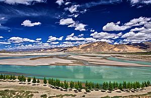
Yarlung Tsangpo, Shigatse Prefecture
|
|
| Country | China, India, Bangladesh |
| Physical characteristics | |
| Main source | Angsi Glacier in Shigatse, Tibet Autonomous Region, China |
| Length | 2,840 km (1,760 mi) |
| Basin features | |
| Basin size | 340,000 km2 ([convert: unit mismatch]) |
| Tributaries |
|
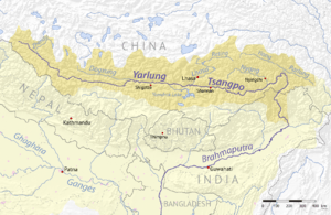
The Yarlung Tsangpo is a very important river. It is also known as Yarlung Zangbo (Tibetan: ཡར་ཀླུངས་གཙང་པོ་, Wylie: yar kLungs gTsang po, ZYPY: Yarlung Zangbo) or Yalu Zangbu River (Chinese: 雅鲁藏布江; pinyin: Yǎlǔzàngbù Jiāng). This river is the upper part of the famous Brahmaputra River. It flows through the Tibet Autonomous Region in China.
The Yarlung Tsangpo is the longest river in Tibet. It is also the fifth longest river in all of China. The very first part of the river is sometimes called Dangque Zangbu. This name means "Horse River."
The river starts high up at the Angsi Glacier in western Tibet. This area is near Mount Kailash and Lake Manasarovar. As it flows, it creates the South Tibet Valley. It also carves out the amazing Yarlung Tsangpo Grand Canyon. After this, the river flows into Arunachal Pradesh, which is a state in India.
Once it enters Arunachal Pradesh, the river gets much wider. Here, it is called the Siang. When it reaches Assam, another state in India, it becomes known as the Brahmaputra. From Assam, the river then flows into Bangladesh. In Bangladesh, the main part of the river is called the Jamuna River. This river then joins with the Ganges, which is called the Padma in Bangladesh.
When the Yarlung Tsangpo leaves the Tibetan Plateau, it forms the largest and deepest canyon in the world. This incredible natural wonder is called the Yarlung Tsangpo Grand Canyon.
About the Yarlung Tsangpo River
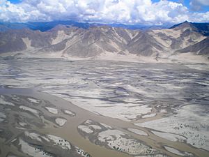
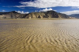
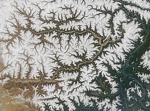
The Yarlung Tsangpo River is known as the highest major river on Earth. This means it flows at a very high elevation. Its longest branch, or tributary, is the Nyang River. Other important tributaries that flow into the Yarlung Tsangpo include the Nyangchu River, Lhasa River, and Parlung Tsangpo.
In Tibet, the river flows through a long area called the South Tibet Valley. This valley is about 1,200 kilometres (750 mi) long and 300 kilometres (190 mi) wide. As the river flows down the valley, the land drops from about 4,500 metres (14,800 ft) to 3,000 metres (9,800 ft) above sea level.
The plants along the river change as the elevation drops. You can see cold desert plants at higher parts. Then, you'll find dry steppe plants. Lower down, there are deciduous scrub plants. Finally, you'll see conifer and rhododendron forests. Trees usually stop growing around 3,200 metres (10,500 ft) of elevation.
The area around the Yarlung River is special. It is surrounded by the Himalayas to the south. To the north are Kang Rinpoche and the Nyenchen Tanglha Mountains. This basin has a milder climate than other high parts of Tibet. Because of this, most of the people in the Tibetan Autonomous Region live here.
The Yarlung Tsangpo Grand Canyon is a truly amazing place. It is formed where the river makes a big U-turn. This is where it leaves the Tibetan Plateau and flows around Namcha Barwa. It is the deepest canyon in the world. It might also be the longest.
The Yarlung Tsangpo River has three main waterfalls. The biggest one is called the "Hidden Falls." People in the West did not know about this waterfall until 1998. When it was seen by Westerners, it was a big deal. It was thought to be the famous waterfall that Tibetan hunters and Buddhist monks had talked about for a long time.
Kayaking Adventures
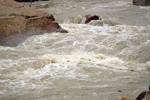
Since the 1990s, the Yarlung Tsangpo River has been a popular spot for explorers. Many teams have come here to try whitewater kayaking. The river is so difficult and dangerous that it is called the "Everest of Rivers." This name shows how extreme the conditions are.
The first group to try kayaking the river was from Japan in 1993. Sadly, one person from their team was lost on the river.
In October 1998, a kayaking trip was sponsored by the National Geographic Society. They tried to go through the Yarlung Tsangpo Grand Canyon. The water levels were much higher than they expected. The trip ended sadly when an expert kayaker named Doug Gordon died.
In early 2002, an international team made history. Scott Lindgren, Steve Fisher, Mike Abbott, Allan Ellard, Dustin Knapp, and Johnnie and Willie Kern were part of this group. They were the first to successfully go down the upper part of the Tsangpo gorge.
Dams and Power Projects
In November 2020, a big announcement was made. The head of PowerChina said they would build a "super" dam on the Yarlung Zangbo. This dam would be the largest hydroelectric project in the world. It would use the river's power to make electricity.
See also
 In Spanish: Yarlung Tsangpo para niños
 | James Van Der Zee |
 | Alma Thomas |
 | Ellis Wilson |
 | Margaret Taylor-Burroughs |


