
Zuzgen facts for kids
Quick facts for kids
Zuzgen
|
||
|---|---|---|
 |
||
|
||

Zuzgen
Location in Switzerland

Zuzgen
Location in Canton of Aargau
|
||
| Country | Switzerland | |
| Canton | Aargau | |
| District | Rheinfelden | |
| Area | ||
| • Total | 8.39 km2 (3.24 sq mi) | |
| Elevation | 382 m (1,253 ft) | |
| Population
(Dec 2020 )
|
||
| • Total | 881 | |
| • Density | 105.01/km2 (272.0/sq mi) | |
| Postal code |
4315
|
|
| Localities | Lohnberg, Erfleten | |
| Surrounded by | Buus (BL), Obermumpf, Mumpf, Zeiningen, Hellikon | |
| Twin towns | N/A | |

Zuzgen is a small town, also called a municipality, in Switzerland. It's located in the Rheinfelden District in the canton of Aargau. Zuzgen is in the western part of the Fricktal region. It's about three kilometers southwest of the German border and also borders the Canton of Basel-Landschaft.
Contents
Geography of Zuzgen

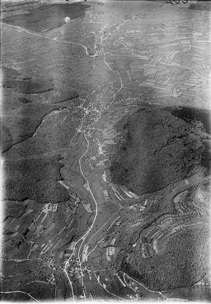
Zuzgen is located in the middle part of the Möhlin valley, known as the Möhlintal. The Möhlinbach stream flows through this valley towards the Rhine river. The valley floor is mostly flat and about 200 meters wide. Hills from the Tabel Jura (Tafeljura) border the valley on both sides. These hills have steep lower parts but flat tops, which are used for farming.
Hills and Plateaus Around Zuzgen
To the north of Zuzgen, you'll find the round-shaped Chriesiberg hill, which is 558 meters high. To the east is the Lohnberg hill, standing at 581 meters, with a small village of the same name. This flat area is about one kilometer wide and stretches for over four kilometers to the southwest. This area is also known as the Wabrig plateau above Hellikon and the Hersberg above Wegenstetten.
South of the village, there's a two-kilometer-long area called Reckental. To the west, another flat area is home to the small village of Erfleten.
Land Use in Zuzgen
Zuzgen covers an area of about 8.39 square kilometers. A large part of this land, about 59.2%, is used for farming. Forests cover 34.4% of the area. The remaining land, about 5.4%, is used for buildings and roads. A very small part, 0.1%, is made up of rivers or lakes.
Most of the built-up area (3.2%) is for homes and other buildings. Roads and other transport areas make up 1.7%. In the forested areas, 33.0% is dense forest, and 1.4% has orchards or small groups of trees. For farming, 29.4% is used for crops, 26.5% for pastures, and 3.3% for orchards or vineyards. All the water in Zuzgen is flowing water, like streams.
The highest point in Zuzgen is 637 meters high, located at the southern border. The lowest point is 360 meters high, found at the Möhlinbach stream.
Neighboring Villages
Zuzgen shares borders with several other villages. In Canton Aargau, its neighbors are Zeiningen to the northwest, Mumpf to the north, Obermumpf to the northeast, and Hellikon to the southeast. To the southwest, Zuzgen borders Buus in Canton Baselland.
History of Zuzgen
The area around Zuzgen has been settled for a very long time, even in Roman times. We know this because Roman coins and parts of old walls have been found here. Later, the Alemanni, a group of Germanic tribes, lived here, and their well-preserved graves have been discovered.
The first time Zuzgen was mentioned in official papers was on June 10, 1288. This was in a document from the Sovereign Military Order of Malta in Rheinfelden. The name Zuzgen might come from an Alemanni tribal leader named Zuzo. An important early landowner in the area was the monastery of Bad Säckingen.
Early Rulers and Conflicts
The first known rulers of Zuzgen were the Habsburgers. After a war called the Waldshut war in 1468, the entire Fricktal region was given to the Duchy of Burgundy. However, the Burgundians were badly defeated by the Old Swiss Confederacy during the Burgundian Wars. This meant that Hellikon (and Zuzgen) returned to Austrian (Habsburg) control by 1477.
Later, in 1491, the Austrian King Maximilian I made some changes to the country. As a result, Hellikon became part of "Further Austria". The Möhlinbach area, including Hellikon, was then managed by the Kameralherrschaft Rheinfelden.
The 17th century was a difficult time with little peace. During the Rappenkrieg, a farmers' uprising from 1612 to 1614, and the Thirty Years' War (1633–38), the village's economy suffered greatly. Foreign troops also marched through the region during the Pfälzer-Erbfolge Wars (1688–97).
Becoming Part of Switzerland
In 1797, after the Treaty of Campo Formio, the Fricktal region became a French protectorate. This meant it was a front line between the French Revolutionary and Austrian armies during the War of the Second Coalition. On February 20, 1802, Rheinfelden became the main town of the new Canton of Fricktal. This canton then joined the Helvetic Republic in August. Finally, on February 19, 1803, the Canton Fricktal, including Zuzgen, became part of Canton Aargau.
Challenges and Growth
On July 2, 1801, a big fire destroyed almost all the houses in Zuzgen. After this, there were also diseases and bad harvests, which forced many people to leave the village. Besides farming, there were not many jobs, only a small thread mill. For many years, the population stayed the same or even dropped a little.
However, in the early 1980s, a lot of new buildings were constructed. More and more people started moving to Zuzgen from Basel and its nearby towns. Since then, the population has grown by more than 50%.
Notable Sights in Zuzgen
At the upper entrance to the village, two churches stand across from each other. One is the Christ Catholic St. Georg church, built in the Barock style. The other is the Roman Catholic St. Georg church, built in the Neogothic style.
The Flag of Zuzgen
The blazon (official description) of Zuzgen's municipal coat of arms says: "Over blue, three green hills with five green trees under a yellow six-pointed star." This means the flag has a blue background with three green hills. On these hills are five green pine trees, and above them is a yellow star with six points.
The flag with five trees was officially chosen in 1872, but the colors weren't written down at first. The green and blue colors were added in 1945. Some people think this design isn't the best because the green and blue colors can be hard to see when the flag is flying far away. In 2002, there was a suggestion to change the flag to add a gold shield and a red star, but this idea was not accepted.
People and Population (Demographics)
Zuzgen has a population of 881 people. As of June 2009, about 9.5% of the people living in Zuzgen are from other countries. Over the past 10 years (1997–2007), the population has grown by about 10.5%. Most people in Zuzgen (97.8%) speak German. Albanian is the second most common language (1.1%), followed by Italian (0.4%).
Age Groups in Zuzgen
As of 2008, here's how the population of Zuzgen is divided by age:
- 12.9% are children aged 0 to 9 years old.
- 12.3% are teenagers aged 10 to 19 years old.
- 7.7% are young adults aged 20 to 29 years old.
- 12.0% are adults aged 30 to 39 years old.
- 20.2% are adults aged 40 to 49 years old.
- 16.2% are adults aged 50 to 59 years old.
- 10.0% are seniors aged 60 to 69 years old.
- 5.3% are seniors aged 70 to 79 years old.
- 3.1% are seniors aged 80 to 89 years old.
- 0.5% are seniors aged 90 and older.
Homes and Households
In 2000, there were 272 private homes and apartments in Zuzgen. On average, there were 2.7 people living in each home.
- 18 homes had 1 or 2 people.
- 115 homes had 3 or 4 people.
- 136 homes had 5 or more people.
In 2008, 195 homes (56.4% of all homes) were single-family houses. Only 1 apartment was empty, meaning a very low vacancy rate of 0.3%. In 2007, about 2.5 new homes were built for every 1000 residents.
Voting in Zuzgen
In the 2007 Swiss federal election, the most popular political party was the SVP, which received 35.96% of the votes. The next most popular parties were the SP (16.38%), the CVP (14.74%), and the Green Party (13.17%). A total of 244 votes were cast in Zuzgen, and about 42.1% of eligible voters participated.
Historical Population Growth
The table below shows how Zuzgen's population has changed over time:
| Historical population | ||
|---|---|---|
| Year | Pop. | ±% |
| 1900 | 606 | — |
| 1930 | 575 | −5.1% |
| 1950 | 587 | +2.1% |
| 1960 | 624 | +6.3% |
| 1975 | 620 | −0.6% |
| 1980 | 576 | −7.1% |
| 1990 | 651 | +13.0% |
| 2000 | 736 | +13.1% |
Economy of Zuzgen
In 2007, Zuzgen had a low unemployment rate of 1.57%. This means most people who wanted to work had jobs.
Jobs and Businesses
As of 2005, there were 98 people working in the primary economic sector. This sector includes jobs like farming and forestry. About 30 businesses were involved in this sector.
In the secondary sector, which includes manufacturing and construction, 27 people were employed. There were 6 businesses in this sector.
The tertiary sector includes jobs in services, like shops, offices, and healthcare. In Zuzgen, 74 people worked in this sector, with 21 businesses.
Commuting and Transportation for Work
In 2000, 364 people who lived in Zuzgen had jobs. Most of them, about 71.2%, worked outside of Zuzgen. Only 32 people came into Zuzgen for work. In total, there were 137 jobs in the municipality that required at least 6 hours of work per week.
For getting to work, 17.2% of the working population used public transportation. A larger number, 53.6%, used a private car. Most people who live in Zuzgen travel to bigger towns in the Fricktal region or to the Basel area for their jobs.
Transport Links in Zuzgen
Zuzgen is located on a local road that runs through the Möhlintal valley, connecting Möhlin to Wegenstetten. A smaller road also leads to Buus. The closest entrance to the A3 motorway, a major highway, is in Rheinfelden.
For public transport, Zuzgen is connected by the Postauto bus service. You can take a bus in either direction, towards Möhlin or Wegenstetten.
Religion in Zuzgen
Based on the 2000 census:
- 395 people (54.2%) were Roman Catholic.
- 198 people (27.2%) belonged to the Swiss Reformed Church.
- 50 people (about 6.86%) belonged to the Christian Catholic faith.
- 1.2% of the population was Muslim.
- 0.5% followed other beliefs.
Education in Zuzgen
In Zuzgen, about 78.9% of adults (aged 25–64) have completed either non-mandatory upper secondary education or higher education, like university or a specialized college (Fachhochschule).
Schools in Zuzgen and Nearby
In the 2008/2009 school year, 87 students were attending primary school in Zuzgen.
The municipality has one kindergarten and one primary school. For middle and secondary schools, students from Zuzgen go to schools in Möhlin, which are shared by the entire Möhlintal area. There are also other secondary schools in Wegenstetten and Zeiningen for students who do not plan to go to university. Thanks to an agreement between cantons, young people from the Fricktal region can attend college in Muttenz (in Canton Baselland).
See also
 In Spanish: Zuzgen para niños
