49-Mile Scenic Route facts for kids
The 49-Mile Scenic Route is a special path in San Francisco, California. It's a fun way to explore the city without needing a car! This route is perfect for walking, biking, or using public transport. It's like a big adventure that shows you many famous spots.
In 2019, two writers from the San Francisco Chronicle, Peter Hartlaub and Heather Knight, thought up this new route. They tried out the old scenic drive without a car to see what worked. After lots of research, they shared this new, kid-friendly route on November 15, 2019.
Quick facts for kids 49-Mile Scenic Route |
|
|---|---|
| Lua error in Module:Infobox_road/map at line 15: attempt to index field 'wikibase' (a nil value). | |
| Route information | |
| Length | 49.4 mi (79.5 km) |
| Existed | November 15, 2019–present |
| Major junctions | |
| Loop around San Francisco | |
|
|
Contents
- Starting Your Adventure
Starting Your Adventure
The 49-Mile Scenic Route begins at the San Francisco Chronicle building. This is located at 5th and Mission streets. Just like the older Scenic Drive, this route goes in a big circle around the city. It moves in a counter-clockwise direction.
Through Downtown and Chinatown
From the start, you'll head towards Market Street. Then you'll turn towards Larkin Street, passing the Civic Center. Next, you'll go to Post Street and then to Grant Avenue. This takes you right through the amazing Dragon Gate. You are now entering Chinatown!
In Chinatown, you'll walk along California, Mason, Washington, and Clay streets. You'll see the heart of this vibrant neighborhood. Then you'll head north on Kearny and Columbus. This leads you through North Beach. You'll then turn onto Lombard Street and Mason Street. This takes you all the way to the San Francisco Bay.
Fisherman's Wharf and the Marina
At the Bay, you'll be on Jefferson Street. Walk west through Fisherman's Wharf. You'll pass the famous cable car turntable. Keep going west past Ghirardelli Square.
After this, you'll weave through streets like Larkin, North Beach, Polk, and Bay. This part of the route goes along the edge of Fort Mason. You'll also pass by the beautiful Palace of Fine Arts. Then you'll enter the Marina district.
Exploring the Presidio
Your journey continues into the Presidio. This is a large national park. You'll enter through the Lombard Gate. A path here takes you past Lucasfilm's Letterman Digital Arts Center. Look for the cool fountain with a life-sized statue of Yoda!
You'll follow different drives and avenues. You'll pass the historic Presidio Officer's Club. This is one of the oldest buildings in San Francisco. You'll also see the San Francisco National Cemetery. You can even take a short detour to see Fort Point.
Golden Gate Bridge Views
The route continues to the Golden Gate Overlook. This spot gives you an amazing view of the Golden Gate Bridge. Across from the overlook, you'll find Ralston Avenue. This leads you to Washington Boulevard. Here, you'll find another great viewpoint called Immigrant Point. Washington Boulevard winds along the high ridge of the Presidio. It then turns into Arguello and exits the Presidio at Arguello Gate.
Golden Gate Park and Beyond
After the Presidio, you can take a short detour through Presidio Terrace. Then, you'll head to Lake Street. You'll walk through a nice shopping area on Clement Street. Finally, you'll arrive at Golden Gate Park.
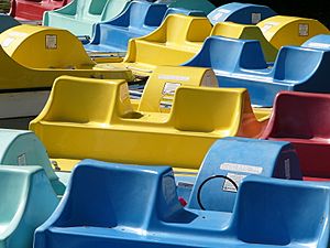
Inside Golden Gate Park, you'll loop around the Conservatory of Flowers. You'll pass the AIDS Memorial Grove. Then you'll go past the Academy of Sciences and the de Young Museum. You'll also see the beautiful Japanese Tea Garden. A path near the Tea Garden leads you up a hill to Stow Lake. You can even rent pedal boats at the Boathouse! The route then takes you past Lloyd Lake and Spreckels Lake. You'll exit the park via 36th Avenue.
Ocean Beach and Southern San Francisco
You'll head north on 36th Avenue to Balboa Street. Turn west and enjoy another interesting shopping area. At 46th, you'll turn north. Then turn left on Point Lobos Avenue. This road goes down past the Sutro Baths ruins and Cliff House. It then becomes the Great Highway. You can walk on a path next to the highway or even on the beach!
You'll walk south along the coast for a couple of miles to Taraval Street. Then you'll turn east. At 33rd Avenue, turn south. Find the entrance to Pine Lake / Stern Grove park. Walk east through the park to 19th Avenue.
You'll walk a short distance south on 19th Avenue. Be careful, as there can be a lot of traffic here. Then you'll turn onto Ocean Avenue. You'll weave through some smaller streets like Cerritos Avenue and Urbano Drive. This takes you to the 28-foot-tall Urbano Sundial. You'll then head back to Ocean Avenue. You'll pass City College and continue through different neighborhoods. You'll eventually reach Glen Canyon Park.
Glen Canyon to Twin Peaks
Footpaths through Glen Canyon take you all the way up to Portola Drive. Then you'll turn onto Twin Peaks Boulevard. This road goes up to Twin Peaks with many turns. From the top, you get amazing 360-degree views of the city! The route then goes down past Tank Hill.
You'll follow Clayton Street and Ashbury Street. This leads you to the famous Haight-Ashbury District. This area is known for its unique shops and colorful history.
Victorian Houses and the Castro
You'll walk east on Haight Street past Buena Vista Park. Then you'll head north to Fulton Street. This takes you to Alamo Square. Here, you can see the famous Painted Ladies. These are colorful Victorian houses that are very popular for photos.
From Alamo Square, you'll follow a path called The Wiggle. This path helps you avoid big hills. It takes you through streets like Haight, Pierce, Waller, and Steiner. You'll pass Duboce Park. Then you'll head south on Castro Street through the historic Castro District.
Mission District and Bernal Heights
You'll go east on 19th Street to the edge of Dolores Park. Then you'll head north on Church Street to 16th Street. A short walk east on 16th takes you to Mission Dolores. This is the oldest building in the entire city!
Continue east on 16th to Mission Street. Then head south a bit to Clarion Alley. This alley is famous for its ever-changing murals and street art. Clarion Alley leads you to Valencia Street. Both Valencia and Mission streets are lively areas with lots of shops and restaurants.
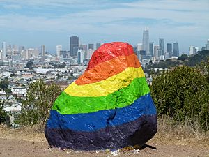
Follow Mission Street south to Cortland Avenue. Then turn east and climb into Bernal Heights. You'll follow Andover Street up to Bernal Heights Boulevard. Part of this path is a stairway. You can choose different paths through Bernal Heights Park. You'll end up on Folsom Street at the Bernal Heights Rock.
Bayview and Oracle Park
You'll go down Cortland to Bayshore. Then head north to Oakdale. Oakdale eventually takes you to 3rd Street. Here, you can see the Bayview Opera House. You'll head north on 3rd Street. Be careful of traffic.
You'll then weave through streets like Cargo Way, Illinois, and 24th Street. You'll cross a bridge over India Basin. Continue on Illinois to Terry Francois Boulevard. This road follows the bay shore. You'll pass the Chase Center basketball arena. The street eventually turns west at McCovey Cove. It takes you to 3rd Street. Here, you can cross the Lefty O'Doul Bridge to Some Big Corporation Park. This is the home of the San Francisco Giants baseball team!
Finishing the Route
Past the ballpark, you'll turn onto King Street. This street becomes The Embarcadero. There's a wide sidewalk here where bikes are allowed. At the Ferry Building, you'll turn onto Market Street.
You'll then walk along Main and Mission streets. You'll pass the Transbay Transit Center. You'll also go by the SF MoMA and the Moscone Center convention complex. You'll weave through the complex. You'll come out on Mission Street across from the Contemporary Jewish Museum. Finally, you'll walk one more block to 5th Street. The 49-Mile Scenic Route ends right where it began, at the Chronicle Building. You will have traveled about 49.4 miles!


