49-Mile Scenic Drive facts for kids
Quick facts for kids
|
|
|---|---|
|
49-Mile Scenic Drive highlighted in red
|
|
| Route information | |
| Length | 48.8 mi (78.5 km) |
| Existed | September 14, 1938–present |
| Major junctions | |
| Loop around San Francisco | |
|
|
| Highway system | |
| State highways in California(list • pre-1964) History • Unconstructed • Deleted • Freeway • Scenic |
|
The 49-Mile Scenic Drive is a special road trip that shows off many cool places in San Francisco, California. It was created in 1938 to help visitors see the city's main sights and beautiful nature. This was just before the big 1939 Golden Gate International Exposition, a huge fair held in San Francisco.
The drive used to start at San Francisco City Hall and end on Treasure Island. But it has changed a few times since then. Today, the route is a loop that goes in a big circle. It starts and ends near Civic Center Plaza. The drive is about 48.8 miles long. Because it's so long and goes through busy city streets, it can be a bit tricky to follow.
Exploring the 49-Mile Scenic Drive
The 49-Mile Scenic Drive takes you on an amazing tour of San Francisco. You'll see famous buildings, beautiful parks, and stunning views. Let's explore some of the highlights you'll pass along the way.
Starting Your Adventure: Civic Center to Nob Hill
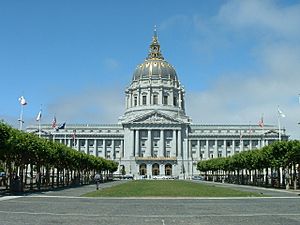
Your journey begins right across from San Francisco City Hall. You'll drive around Civic Center Plaza. Here, you can spot the Bill Graham Civic Auditorium and the main San Francisco Public Library. You'll also pass the Asian Art Museum.
The route then heads north through Little Saigon. After that, it goes west up Cathedral Hill. You'll enter Japantown and then loop back towards Union Square.
Through Chinatown and Iconic Hills
Next, the drive turns north and enters Chinatown through its famous Dragon Gate. You'll then go up Nob Hill, passing its grand hotels. You'll also see Grace Cathedral and the San Francisco Cable Car Museum.
The route then winds through North Beach. You'll pass City Lights Bookstore and climb Telegraph Hill. Near the top, you'll see Coit Tower. After that, you'll head towards Fisherman's Wharf.
Waterfront Wonders and Golden Gate Views
At Fisherman's Wharf, you'll drive along the busy waterfront. You'll pass Aquatic Park and the San Francisco Maritime Museum. The drive then takes you into the Marina District.
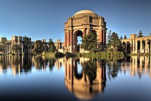
In this area, you'll pass many parts of the Golden Gate National Recreation Area. You'll also see the amazing Palace of Fine Arts. This building is a reminder of the 1915 Panama–Pacific International Exposition. The route then enters the Presidio.
Inside the Presidio, you'll pass the Letterman Digital Arts Center. You'll also get incredible views of the Golden Gate Bridge. The drive goes above Crissy Field and Baker Beach. It then leaves the Presidio and goes through Sea Cliff. You'll enter Lincoln Park and pass the Legion of Honor art museum.
Coastal Beauty and Golden Gate Park
The drive continues along the Pacific coast on Great Highway. You'll pass Ocean Beach and the edge of Golden Gate Park. You'll also see the San Francisco Zoo and Lake Merced.
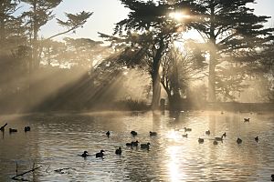
After that, the route enters Golden Gate Park itself. You'll spend about five miles winding through this huge park. You'll circle Stow Lake and pass the Japanese Tea Garden. You'll also see the San Francisco Botanical Garden and the California Academy of Sciences.
Climbing Twin Peaks and City Views
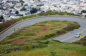
The drive then goes up Parnassus Street, passing the University of California, San Francisco campus. You'll curve around Mount Sutro before climbing up to Twin Peaks. From here, you'll get amazing, clear views of the entire city below! It's a perfect spot for photos.
After enjoying the views, the route goes down into Corona Heights. You'll pass the Randall Museum. Then, the drive descends into The Castro, a famous neighborhood.
Mission District to the Financial Hub
The route continues south along Dolores Street. You'll pass Mission San Francisco de Asís and Mission Dolores Park. This area splits the Castro, Mission District, and Noe Valley neighborhoods.
After going through Potrero Hill, the drive takes you onto I-280. You'll travel on this freeway for a short distance. Then, you'll exit near Mission Bay and Oracle Park, where the San Francisco Giants play baseball.
The drive then winds along The Embarcadero. You'll go under the San Francisco–Oakland Bay Bridge. At Market Street, you'll cross in front of the Ferry Building. The route then enters the Financial District.
Finally, the drive goes through the SoMA neighborhood. You'll pass the SFMOMA, Yerba Buena Gardens, and Moscone Center. The route ends where it began, back in front of City Hall.
History of the Scenic Drive
How the 49-Mile Drive Began
In the late 1930s, people in San Francisco were excited about the new Golden Gate Bridge and San Francisco–Oakland Bay Bridge. In 1938, the San Francisco Down Town Association created a special route. It went from City Hall to Treasure Island. They called it the "50-Mile Scenic Drive" at first. They marked the way with blue and gold triangle signs.
The name was soon changed to "49-Mile Scenic Drive." This was a clever marketing idea! It matched San Francisco's size, which is about 46.9 square miles. It also reminded people of the California Gold Rush of 1849. People from that time were called "forty-niners." The Down Town Association made brochures to help tourists enjoy the drive.
On September 14, 1938, the 49-Mile Scenic Drive officially opened. A famous pilot named Douglas Corrigan helped open it. He was known as "Wrong Way" Corrigan because he once flew to Dublin when he meant to go to Los Angeles. He even drove part of the route backward that day!
Changes to the Route and New Signs
After the Golden Gate International Exposition closed in 1940, the drive had to change. Treasure Island became a U.S. Navy base. During World War II, parts of the route were closed.
In 1947, the drive reopened with some new sections. It went further south, past Mission San Francisco de Asís. It then returned to The Embarcadero.
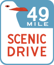
In 1954, a contest was held to design a new sign for the route. A local artist named Rex May won with his design. It showed a seagull on a blue background with white and orange writing. These signs are still used today. However, they are sometimes stolen, so not all parts of the route have signs. The city tries to replace them when they can.
The drive was changed again in 1976. It went through Japantown to show off the new Japan Center. A new part of the route went up Nob Hill. It also had a longer path through Golden Gate Park. This included circling Stow Lake. A new section on Interstate 280 helped the drive return to The Embarcadero.
In 1999, the route was updated one more time. It started at Civic Center Plaza instead of Van Ness Avenue. It also changed some streets near the end of the route.
 | Jackie Robinson |
 | Jack Johnson |
 | Althea Gibson |
 | Arthur Ashe |
 | Muhammad Ali |


