A' Mharconaich facts for kids
Quick facts for kids A' Mharconaich |
|
|---|---|

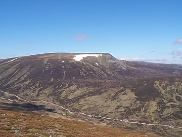
A' Mharconaich from the south, the track up Coire Dhomhain is clearly in view.
|
|
| Highest point | |
| Elevation | 975 m (3,199 ft) |
| Prominence | 114 m (374 ft) |
| Listing | Munro |
| Naming | |
| English translation | The Horse Place |
| Language of name | Gaelic |
| Geography | |
| Parent range | Grampian Mountains |
| OS grid | NN604763 |
| Topo map | OS Landranger 42, OS Explorer 394 |
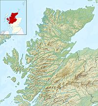
A' Mharconaich is a cool Scottish mountain. It's found about 29 kilometers (18 miles) northwest of Blair Atholl in the Highland area of Scotland. This mountain is part of a group called the Drumochter Hills. These hills are located west of the main A9 road, close to the highest point of the Pass of Drumochter. A' Mharconaich is just inside the Cairngorms National Park, but it's not part of the main Cairngorms mountains.
Contents
What is A' Mharconaich?
A' Mharconaich is known as a Munro. This means it's a Scottish mountain that is over 3,000 feet (914.4 meters) high. A' Mharconaich stands at 975 meters (3,199 feet) tall.
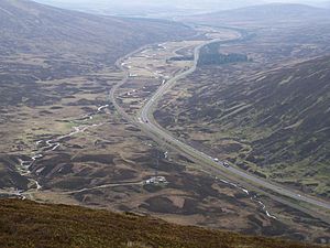
Drivers on the A9 road get a great view of this mountain. From the road, you can see its steeper eastern side. There's also a large, bowl-shaped valley called a corrie right below the top.
What does the name mean?
The name A' Mharconaich comes from the Gaelic language. It means "the horse place." Long ago, horses were very important for people living in this area. Places where horses would gather were often given special names like this one.
The mountain also sits on an old border. This border used to separate the areas of Perthshire and Inverness-shire. Today, it marks the line between Perth and Kinross and Highland areas. You can still see old, rusty fence posts along this line. These posts can be helpful if you're hiking on the mountain, guiding your way.
Exploring the Mountain's Shape
A' Mharconaich has a long ridge at its top, stretching for over a kilometer (about 0.6 miles). This ridge runs from southwest to northeast and has high points at both ends.
The Summit Points
The northeast end of the ridge is considered the highest point of the mountain. While there was some confusion in the past, it's now confirmed that the northeast top is a few meters higher than the southwest top, which is called Bruach nan Iomairean.
Ridges and Valleys
The mountain has two impressive, steep ridges that extend from either side of the eastern corrie.
- The northeast ridge starts as a steep rock face. It then becomes gentler and continues for three kilometers (about 1.8 miles). This ridge reaches the A9 road near Balsporran Cottages.
- The eastern ridge goes steeply down from Bruach nan Iomairean. It leads to a lower area (a col) that connects A' Mharconaich to another hill.
The Boar of Badenoch
The eastern ridge links to a hill called the Boar of Badenoch, also known as An Torc. You can follow the line of old fence posts all the way to it. The Boar of Badenoch is 739 meters (2,425 feet) high. It offers a fantastic view looking down into the Pass of Drumochter.
Connecting to Other Mountains
To the southwest, A' Mharconaich connects to another Munro called Beinn Udlamain. You can follow the fence posts for about four kilometers (2.5 miles) across rolling land. This area is often full of deer because it's part of the Dalnaspidal deer forest.
About 2.5 kilometers (1.5 miles) north is another Munro, Geal-chàrn. To reach it, you go down to a height of 739 meters and walk around the top of Coire Fhar.
Water Flow
The water that drains from A' Mharconaich eventually reaches the east coast of Scotland. However, the Pass of Drumochter divides the water. Some water flows north to join the River Spey, while other water flows south to meet the River Tay.
How to Climb A' Mharconaich
There are a couple of main ways to climb A' Mharconaich directly. Many hikers choose to climb it along with other nearby mountains.
Starting Points
- One popular route starts from the A9 road at the top of the Pass of Drumochter (grid reference NN632755). You walk up Coire Dhomhain for a bit over a kilometer. Then, you head northwest to the low point between A' Mharconaich and the Boar of Badenoch. From there, you follow the fence posts steeply up to the summit ridge. This starting point is also great if you want to hike a full loop around Coire Dhomhain, including the Munros of Sgairneach Mhòr and Beinn Udlamain.
- Another starting point is at Balsporran cottages (NN627791). From here, you can climb directly up the northeast ridge. Or, you can take a longer walk that includes the nearby Munro of Geal-chàrn.
The Summit View
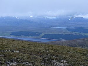
The very top of A' Mharconaich has a large pile of stones. It's not a typical cairn (a pile of stones marking a summit) but has been shaped into a shelter to protect from the wind. From the summit, you can enjoy amazing views. You can see Loch Ericht and Loch Pattack to the northwest, as well as the large Ben Alder mountain area.
 | Sharif Bey |
 | Hale Woodruff |
 | Richmond Barthé |
 | Purvis Young |


