
Baldwin Hills (mountain range) facts for kids
Quick facts for kids Baldwin Hills |
|
|---|---|

Location in California
|
|
| Highest point | |
| Elevation | 156 m (512 ft) |
| Geography | |
| Country | United States |
| State | California |
| District | Los Angeles County |
| Range coordinates | 33°59′43″N 118°21′50″W / 33.99528°N 118.36389°W |
| Topo map | USGS Inglewood |
The Baldwin Hills are a group of small hills in central Los Angeles County, California. They are surrounded by the flat lands of the Los Angeles Basin. From the top of these hills, you can see many famous places.
To the west, you can see the Pacific Ocean. To the north are the Santa Monica Mountains. Downtown Los Angeles is to the northeast. And to the south, you can spot the Palos Verdes Hills. It's a great spot for views!
Exploring the Baldwin Hills: Geography
The Baldwin Hills are an important part of the local landscape. A river called Ballona Creek starts in the Santa Monica Mountains. It flows right past the northern side of the Baldwin Hills. This creek then continues all the way to the Santa Monica Bay in the Pacific Ocean.
A main road, La Cienega Boulevard, cuts through the hills. It connects the cities of Inglewood and Culver City. This road also passes by the Inglewood Oil Field. This area has many oil wells.


A Look Back: History of the Hills
The Baldwin Hills have a long history. In the past, this land was part of large ranches. These ranches were called Rancho La Cienega o Paso de la Tijera and Rancho Rincón de los Bueyes.
An old building called the Sanchez Adobe was once the center of one of these ranches. Later, it became a clubhouse for a golf course.
In 1963, a dam in the Baldwin Hills had a problem. This event led to flooding from the Baldwin Hills Reservoir. It was a significant event in the area's history.
Fun Things to Do: Recreation
The Baldwin Hills are a great place for outdoor activities.
- Kenneth Hahn State Recreation Area: This park is a wonderful spot for many activities. You can go for walks or enjoy a picnic. It's also a good place for birdwatching. The park helps protect the natural land and its animal homes. You can find the park entrance on South La Cienega Boulevard.
Images for kids
-
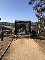
Park To Playa Trail Wildlife Crossing and Pedestrian Bridge

