
Barnwell County, South Carolina facts for kids
Quick facts for kids
Barnwell County
|
|||
|---|---|---|---|

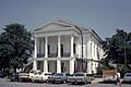
Barnwell County Courthouse
|
|||
|
|||

Location within the U.S. state of South Carolina
|
|||
 South Carolina's location within the U.S. |
|||
| Country | |||
| State | |||
| Founded | 1800 | ||
| Named for | John Barnwell | ||
| Seat | Barnwell | ||
| Largest community | Barnwell | ||
| Area | |||
| • Total | 557.26 sq mi (1,443.3 km2) | ||
| • Land | 548.38 sq mi (1,420.3 km2) | ||
| • Water | 8.88 sq mi (23.0 km2) 1.59% | ||
| Population
(2020)
|
|||
| • Total | 20,589 | ||
| • Estimate
(2023)
|
20,447 | ||
| • Density | 37.55/sq mi (14.50/km2) | ||
| Time zone | UTC−5 (Eastern) | ||
| • Summer (DST) | UTC−4 (EDT) | ||
| Congressional district | 2nd | ||

Barnwell County is a county in the state of South Carolina. In 2020, about 20,589 people lived there. It is part of the Central Savannah River Area. The main town and government center is Barnwell.
Contents
Discovering Barnwell County's Past
The area now known as Barnwell County started as the Barnwell District in 1797. It officially began in 1800. It was formed from a part of the Orangeburg District, near the Savannah River. The district was named after John Barnwell, an important local person during the American Revolutionary War.
In 1868, after the Reconstruction period, South Carolina changed its districts into counties. This made the government more fair. Now, male citizens aged 21 and older could vote for county officials. Before this, state lawmakers chose these officials.
In 1871, a part of Barnwell County was used to create Aiken County. This was the only new county made during Reconstruction. Later, in 1874, the border with Aiken County was slightly changed. During this time, some groups tried to stop certain people from voting in elections.
In 1895, a new state constitution was passed. This made it harder for many Black citizens to register and vote for over 60 years.
More changes to the county's size happened later. In 1897, the eastern part became Bamberg County. Then, in 1919, most of the southern half became Allendale County. These changes made Barnwell County the size it is today.
Exploring Barnwell County's Geography
Barnwell County covers about 557 square miles (1,443 square kilometers). Most of this area is land, about 548 square miles (1,419 square kilometers). The rest, about 8.88 square miles (23 square kilometers), is water.
Special Natural and Historic Places
- Banksia Hall
- Barnwell State Park
- Long Branch Bay Heritage Preserve
Major Rivers and Lakes
- Georges Creek
- Par Pond
- Salkehatchie River
- Savannah River
- South Fork Edisto River
Neighboring Counties
- Aiken County – to the north
- Bamberg County – to the east
- Orangeburg County – to the east
- Allendale County – to the southeast
- Burke County, Georgia – to the southwest
Main Roads and Highways
 US 78
US 78
US 78 Bus. US 278
 SC 3
SC 3 SC 37
SC 37 SC 39
SC 39 SC 64
SC 64 SC 70
SC 70 SC 125
 SC 300
 SC 304
Important Facilities
- Barnwell Regional Airport
- Savannah River Site (a part of it is in the county)
Understanding Barnwell County's People
| Historical population | |||
|---|---|---|---|
| Census | Pop. | %± | |
| 1800 | 7,376 | — | |
| 1810 | 12,280 | 66.5% | |
| 1820 | 14,750 | 20.1% | |
| 1830 | 19,236 | 30.4% | |
| 1840 | 21,471 | 11.6% | |
| 1850 | 26,608 | 23.9% | |
| 1860 | 30,743 | 15.5% | |
| 1870 | 35,724 | 16.2% | |
| 1880 | 39,857 | 11.6% | |
| 1890 | 44,613 | 11.9% | |
| 1900 | 35,504 | −20.4% | |
| 1910 | 34,209 | −3.6% | |
| 1920 | 23,081 | −32.5% | |
| 1930 | 21,221 | −8.1% | |
| 1940 | 20,138 | −5.1% | |
| 1950 | 17,266 | −14.3% | |
| 1960 | 17,659 | 2.3% | |
| 1970 | 17,176 | −2.7% | |
| 1980 | 19,868 | 15.7% | |
| 1990 | 20,293 | 2.1% | |
| 2000 | 23,478 | 15.7% | |
| 2010 | 22,621 | −3.7% | |
| 2020 | 20,589 | −9.0% | |
| 2023 (est.) | 20,447 | −9.6% | |
| U.S. Decennial Census 1790–1960 1900–1990 1990–2000 2010 2020 |
|||
Population in 2020
| Race | Num. | Perc. |
|---|---|---|
| White (non-Hispanic) | 10,352 | 50.28% |
| Black or African American (non-Hispanic) | 8,785 | 42.67% |
| Native American | 61 | 0.3% |
| Asian | 161 | 0.78% |
| Pacific Islander | 14 | 0.07% |
| Other/Mixed | 696 | 3.38% |
| Hispanic or Latino | 520 | 2.53% |
In 2020, there were 20,589 people living in Barnwell County. There were 8,360 households and 5,260 families.
Population in 2010
In 2010, the county had 22,621 people. There were 8,937 households and 6,055 families. About 52.6% of the people were white, and 44.3% were Black or African American. Other groups made up smaller parts of the population. About 1.8% of people were of Hispanic or Latino origin.
The average age of people in the county was 38.8 years. The average income for a household was about $33,816. For families, it was about $41,764. About 25.4% of all people lived below the poverty line. This included about 39.6% of those under 18 years old.
Barnwell County's Economy
In 2022, Barnwell County's total economic output (GDP) was about $556.3 million. This means about $27,018 for each person. The unemployment rate in the county has changed over time. It was highest at 6.3% in January 2022 and lowest at 3.2% in April 2023.
As of April 2024, Walmart is one of the biggest employers in Barnwell County. Many people also work in manufacturing, healthcare, and education.
| Industry | Employment Counts | Employment Percentage (%) | Average Annual Wage ($) |
|---|---|---|---|
| Accommodation and Food Services | 372 | 7.8 | 16,900 |
| Administrative and Support and Waste Management and Remediation Services | 83 | 1.7 | 54,080 |
| Agriculture, Forestry, Fishing and Hunting | 68 | 1.4 | 39,884 |
| Construction | 172 | 3.6 | 62,972 |
| Educational Services | 613 | 12.8 | 41,392 |
| Finance and Insurance | 64 | 1.3 | 40,716 |
| Health Care and Social Assistance | 715 | 14.9 | 36,296 |
| Information | 9 | 0.2 | 32,188 |
| Manufacturing | 1,039 | 21.7 | 59,956 |
| Other Services (except Public Administration) | 161 | 3.4 | 36,348 |
| Professional, Scientific, and Technical Services | 108 | 2.3 | 50,024 |
| Public Administration | 422 | 8.8 | 38,948 |
| Retail Trade | 797 | 16.6 | 26,624 |
| Transportation and Warehousing | 134 | 2.8 | 57,512 |
| Wholesale Trade | 33 | 0.7 | 47,164 |
| Total | 4,790 | 100.0% | 41,546 |
Towns and Communities
City
- Barnwell (This is the county seat and the largest community.)
Towns
Learning in Barnwell County
The county has several school districts:
- Barnwell School District 19
- Barnwell School District 29
- Barnwell School District 45
A small part of the county, which includes the Savannah River Site, is not part of any school district.
Famous People from Barnwell County
- James Brown (1933–2006), a very famous singer.
- Rosa Louise Woodberry (1869–1932), a journalist and someone who started schools.
- Sarah Lowe Twiggs (1839–1920), a poet.
Images for kids
-
Barnwell County Courthouse
See also
 In Spanish: Condado de Barnwell para niños
