Baxter Estates, New York facts for kids
Quick facts for kids
Baxter Estates, New York
|
|
|---|---|
| Incorporated Village of Baxter Estates | |
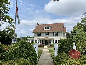
Baxter Estates Village Hall on August 10, 2021.
|
|
| Nickname(s):
VBE
|
|
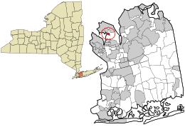
Location in Nassau County and the state of New York
|
|
| Country | |
| State | |
| County | Nassau |
| Town | North Hempstead |
| Incorporated | 1931 |
| Named for | The Baxter family |
| Area | |
| • Total | 0.18 sq mi (0.47 km2) |
| • Land | 0.18 sq mi (0.47 km2) |
| • Water | 0.00 sq mi (0.00 km2) |
| Elevation | 39 ft (12 m) |
| Population
(2020)
|
|
| • Total | 991 |
| • Density | 5,445.05/sq mi (2,096.79/km2) |
| Demonym(s) | Baxter Estatesian Port Washingtonian |
| Time zone | UTC-5 (Eastern (EST)) |
| • Summer (DST) | UTC-4 (EDT) |
| ZIP code |
11050
|
| Area codes | 516, 363 |
| FIPS code | 36-04803 |
| GNIS feature ID | 0943176 |
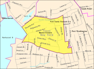
Baxter Estates is a small village located in Nassau County. It's on the North Shore of Long Island, in New York, United States. It's considered part of the larger Port Washington area. In 2020, about 991 people lived there.
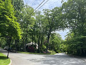
The Incorporated Village of Baxter Estates is found on the Cow Neck Peninsula. It's part of the Town of North Hempstead. The village is also known as a Tree City USA, which means it cares about its trees.
Contents
Village History: Baxter Estates
The Village of Baxter Estates officially became a village in 1931. Its history is closely tied to the "Cow Neck" area. An old house, built in 1673 by John Betts and Robert Hutchings, still stands today. This house is located at Central Drive and Shore Road, looking out over Manhasset Bay.
The Baxter Family and Their Home
Around 1741, Oliver Baxter bought this property. Maps from that time show that a village of Matinecock Native Americans might have been on Baxter's land. The Baxter family were shipbuilders, whalers, and sea captains. They owned the property for many years.
During the Revolutionary War, Hessian soldiers stayed in the Baxter House. Later, in 1895, the first library of Port Washington met in the house's living room. The Baxter House was named a historic building. Sadly, in 2017, a big fire heavily damaged the home. The reason for the fire was not found. The village is named after the Baxter family because they owned a lot of land here.
Geography and Landscape
Baxter Estates covers about 0.18 square miles (0.47 square kilometers) of land. It has no water area. The village is part of the Manhasset Bay Watershed. This means that water from the village flows into Manhasset Bay. Manhasset Bay then connects to the larger Long Island Sound and the Atlantic Ocean.
Hills and Sea Level
Like other parts of Long Island's North Shore, Baxter Estates sits on a special type of hill. This hill is called a terminal moraine. It's known as the Harbor Hill Moraine. These hills were formed by huge glaciers during the Ice Age. Harbor Hill is the highest point in Nassau County.
The highest point in Baxter Estates is on Hilltop Road, about 113 feet (34 meters) above sea level. The lowest point is Manhasset Bay, which is at sea level.
Local Climate
Baxter Estates has a climate that is usually warm and humid in summer. It can also have cold winters. The average temperature in January is about 31.8°F (-0.1°C). In July, it's about 75.3°F (24.1°C).
Population and People
| Historical population | |||
|---|---|---|---|
| Census | Pop. | %± | |
| 1940 | 760 | — | |
| 1950 | 862 | 13.4% | |
| 1960 | 932 | 8.1% | |
| 1970 | 1,026 | 10.1% | |
| 1980 | 911 | −11.2% | |
| 1990 | 961 | 5.5% | |
| 2000 | 1,006 | 4.7% | |
| 2010 | 999 | −0.7% | |
| 2020 | 991 | −0.8% | |
| U.S. Decennial Census | |||
Recent Population Numbers
In 2020, the village had 991 people living there. In 2010, there were 999 people. Most residents were White, with smaller groups of African American and Asian people. About 16.82% of the population identified as Hispanic or Latino.
Education and Learning
School District
All children living in Baxter Estates attend public schools in the Port Washington Union Free School District. This means they go to schools in Port Washington.
Library Services
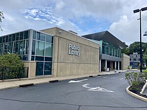
Baxter Estates is part of the Port Washington Library District. The Port Washington Public Library serves the village. The library building itself is also located within Baxter Estates.
Village Services
Getting Around (Transportation)
Important roads in Baxter Estates include Central Drive, Main Street, and Shore Road. The village also has bus service. The n23 bus route, run by Nassau Inter-County Express, serves the area.
Utilities (Power, Water, Gas)
- Natural Gas: National Grid USA provides natural gas to homes and businesses.
- Electricity: PSEG Long Island supplies electricity to everyone in Baxter Estates.
- Sewage: The village's sewage system is managed by the Port Washington Water Pollution Control District.
- Water: The Port Washington Water District provides water to all homes and businesses in Baxter Estates.
Healthcare and Safety Services
Healthcare
There are no hospitals directly in Baxter Estates. The closest hospital is St. Francis Hospital, located in nearby Flower Hill.
Fire Department
The entire Village of Baxter Estates is protected by the Port Washington Fire District.
Police Department
The Port Washington Police District provides police services to Baxter Estates.
Important Landmarks
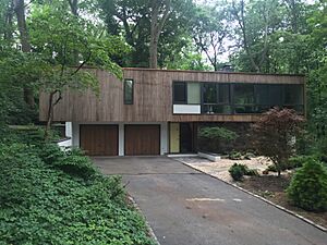
The William Landsberg House is a notable building in Baxter Estates. It is located at 5 Tianderah Road. This house is listed on the National Register of Historic Places, which means it's an important historical site.
Famous People from Baxter Estates
Many interesting people have lived in Baxter Estates:
- Tallulah Bankhead – a famous actress who lived in the historic Baxter House.
- William Landsberg – an architect who designed his own home in Baxter Estates.
- Addison Mizner – an architect known for his work in South Florida; he also lived in the historic Baxter Home.
- George Pickow – a photographer and husband of Jean Ritchie.
- Jean Ritchie – a folk singer who lived on Locust Avenue.
See also
 In Spanish: Baxter Estates para niños
 | James B. Knighten |
 | Azellia White |
 | Willa Brown |


