Bee Sellers Hollow facts for kids
Quick facts for kids Bee Sellers Hollow |
|
|---|---|

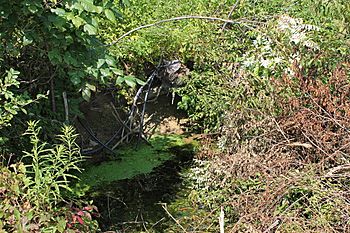
Bee Sellers Hollow at Kline Road
|
|
| Physical characteristics | |
| Main source | valley in the western part of Stillwater, Columbia County, Pennsylvania between 780 and 800 feet (240 and 240 m) |
| River mouth | Fishing Creek in Stillwater, Columbia County, Pennsylvania 686 ft (209 m) 41°08′01″N 76°21′45″W / 41.1336°N 76.3624°W |
| Length | 1.8 mi (2.9 km) |
| Basin features | |
| Progression | Fishing Creek → Susquehanna River → Chesapeake Bay |
| Basin size | 1.58 sq mi (4.1 km2) |
Bee Sellers Hollow is a small stream, also called a tributary, in Columbia County, Pennsylvania. It flows into a larger stream called Fishing Creek. This stream is about 1.8 miles (2.9 km) long. It flows through a town called Stillwater. The land area that drains water into Bee Sellers Hollow is about 1.58 square miles (4.09 km2). This stream is clean and healthy. The ground around it is mostly made of solid rock, but also includes some loose soil and rocks.
Contents
Where Bee Sellers Hollow Flows
Bee Sellers Hollow starts in a valley. This valley is in the western part of Stillwater. It begins near a road called Beecellar Road.
The Stream's Journey
The stream first flows east for a short distance. Then, it turns to flow east-southeast. After a while, the stream moves away from Beecellar Road. It also leaves its valley.
Next, it turns south-southeast. It flows in this direction for several tenths of a mile. During this part of its journey, it crosses Kline Road. Finally, it turns east-southeast for a short distance. It crosses Pennsylvania Route 487 and then joins Fishing Creek. This meeting point is near the southern edge of Stillwater.
Bee Sellers Hollow joins Fishing Creek about 17.26 miles (27.78 km) upstream from where Fishing Creek ends.
Water, Land, and Rocks Around the Stream
The land where Bee Sellers Hollow meets Fishing Creek is about 686 feet (209 meters) above sea level. Where the stream begins, its source, the land is higher. It is between 780 and 800 feet (238 and 244 meters) above sea level.
Geology of the Area
The ground along the upper and middle parts of Bee Sellers Hollow is made of different types of soil and rocks. Along the valley floor, you can find colluvium and alluvium. Alluvium is made of layers of sand, silt, and gravel. It can also have some large boulders. Colluvium is made of clasts. These are pieces of shale and sandstone that have broken off hillsides.
There are also small areas with Illinoian Till and Illinoian Lag. These are types of soil left behind by ancient glaciers. However, most of the ground near the stream is solid bedrock. This bedrock is made of sandstone and shale.
The valley of Karnes Hollow is also part of the area that drains into Bee Sellers Hollow. The stream itself is considered healthy and clean.
The Stream's Watershed
The watershed of Bee Sellers Hollow is the entire land area that collects and drains water into the stream. This watershed covers about 1.58 square miles (4.09 km2). The end of the stream's valley is on maps from the United States Geological Survey called the Stillwater quadrangle. However, where the stream starts is on the Benton quadrangle map.
Bee Sellers Hollow is mostly located in the western part of the town of Stillwater. The entire stream flows within this town.
History and Name of Bee Sellers Hollow
The valley of Bee Sellers Hollow was officially added to the Geographic Names Information System on August 2, 1979. This system keeps track of place names. Its special ID number is 1169089.
How the Stream Got Its Name
Bee Sellers Hollow is a stream that doesn't have an official name. It is named after the valley it flows through. In the early 1900s, a man named John McHenry lived in the area. He kept bees and sold their honey to people nearby. He kept his bees in a special concrete cave. This cave was known as the Bee Cellar. Because of this, the stream and valley became known as Bee Sellers Hollow.
 | Laphonza Butler |
 | Daisy Bates |
 | Elizabeth Piper Ensley |

