Broken Bow, Oklahoma facts for kids
Quick facts for kids
Broken Bow, Oklahoma
|
|
|---|---|

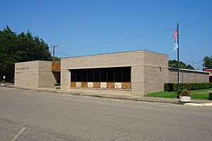
Broken Bow Municipal Offices
|
|

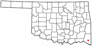
Location of Broken Bow, Oklahoma
|
|
| Country | United States |
| State | Oklahoma |
| County | McCurtain |
| Government | |
| • Type | Council-manager |
| Area | |
| • Total | 6.23 sq mi (16.13 km2) |
| • Land | 6.15 sq mi (15.93 km2) |
| • Water | 0.07 sq mi (0.20 km2) |
| Elevation | 453 ft (138 m) |
| Population
(2020)
|
|
| • Total | 4,228 |
| • Density | 687.26/sq mi (265.36/km2) |
| Time zone | UTC-6 (Central (CST)) |
| • Summer (DST) | UTC-5 (CDT) |
| ZIP code |
74728
|
| Area code(s) | 580 |
| FIPS code | 40-09100 |
| GNIS feature ID | 2409915 |
Broken Bow is a city in McCurtain County, Oklahoma, United States. In 2020, about 4,228 people lived there. The city got its name from Broken Bow, Nebraska, which was the former home of the city's founders, the Dierks brothers. You can still see their legacy in town with places like Dierks Elementary School and Dierks Street.
Contents
History of Broken Bow
Broken Bow was built on land that once belonged to the Choctaw tribe. The city grew quickly around a lumber company started by two brothers. Just ten years after it became a city in 1911, its population was almost 2,000 people.
Broken Bow is in a part of Oklahoma called "Little Dixie." Many people from the Southern states moved here after the American Civil War to start fresh. In 1984, a criminal named Richard Snell was captured in Broken Bow after a shootout with local police.
When Broken Bow was founded, it was part of Bok Tuklo County in the Apukshunubbee District of the Choctaw Nation.
Geography and Nature
Broken Bow covers about 6.23 square miles (16.13 km²). Most of this area is land, with a small amount of water.
The city is served by major roads like US Route 70 and US Route 259. You can also find bus service from a nearby city.
Broken Bow is in a special area where the Red River basin meets the Ouachita Mountains. The Ouachita Mountains have rough, rocky land, while the Red River basin has fertile soil.
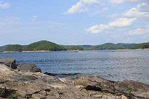
North of Broken Bow, you'll find Broken Bow Lake. This lake was created by the United States Army Corps of Engineers by building a dam on the Mountain Fork River. The lake is huge, covering over 14,000 acres (57 km²) and having 180 miles (290 km) of shoreline. It's known for its small islands, bass fish, and surrounding pine trees. When the lake was made, the town of Hochatown had to move to a new spot.
The city is also at the base of the Kiamichi Mountains. These mountains are part of the larger Ouachita Mountains. They are home to many animals like black bears, coyotes, bobcats, deer, and various birds like bald eagles and woodpeckers.
Broken Bow's Climate
| Climate data for Broken Bow, Oklahoma | |||||||||||||
|---|---|---|---|---|---|---|---|---|---|---|---|---|---|
| Month | Jan | Feb | Mar | Apr | May | Jun | Jul | Aug | Sep | Oct | Nov | Dec | Year |
| Mean daily maximum °F (°C) | 51.7 (10.9) |
56.4 (13.6) |
65.4 (18.6) |
74.6 (23.7) |
81.0 (27.2) |
88.4 (31.3) |
93.1 (33.9) |
93.4 (34.1) |
86.0 (30.0) |
76.4 (24.7) |
64.8 (18.2) |
54.9 (12.7) |
73.8 (23.2) |
| Mean daily minimum °F (°C) | 26.9 (−2.8) |
31.0 (−0.6) |
39.0 (3.9) |
48.4 (9.1) |
56.9 (13.8) |
64.4 (18.0) |
68.0 (20.0) |
67.0 (19.4) |
61.3 (16.3) |
48.8 (9.3) |
39.7 (4.3) |
30.6 (−0.8) |
48.5 (9.2) |
| Average precipitation inches (mm) | 2.9 (74) |
3.5 (89) |
5.3 (130) |
4.7 (120) |
6.6 (170) |
4.3 (110) |
3.9 (99) |
3.1 (79) |
4.7 (120) |
4.3 (110) |
4.5 (110) |
4.1 (100) |
51.9 (1,320) |
| Source: Weatherbase.com | |||||||||||||
Population of Broken Bow
| Historical population | |||
|---|---|---|---|
| Census | Pop. | %± | |
| 1920 | 1,983 | — | |
| 1930 | 2,291 | 15.5% | |
| 1940 | 2,367 | 3.3% | |
| 1950 | 1,838 | −22.3% | |
| 1960 | 2,087 | 13.5% | |
| 1970 | 2,980 | 42.8% | |
| 1980 | 3,965 | 33.1% | |
| 1990 | 3,961 | −0.1% | |
| 2000 | 4,230 | 6.8% | |
| 2010 | 4,120 | −2.6% | |
| 2020 | 4,228 | 2.6% | |
| U.S. Decennial Census | |||
In 2010, there were 4,120 people living in Broken Bow. About 31.5% of households had children under 18. The average age of people in the city was 35.3 years old.
Economy and Tourism
Broken Bow has seen a lot of growth in its timber and tourism industries recently. The city also has a chicken-processing plant owned by Tyson Industries.
Tourism in Broken Bow
Broken Bow is a popular spot for tourists. It's the main entry point for visitors going to Beavers Bend Resort Park, Hochatown State Park, and Cedar Creek Golf Course. Many hunters also come to the area, which calls itself the "deer capital of the world."
The city has two museums with Native American artifacts. The Gardner Mansion and Museum was built in 1884 and was the home of a Choctaw Chief. The Indian Memorial Museum displays ancient Indian pottery, fossils, and crystals.
Timber Industry
The forest industry is the biggest business in the area. A lot of lumber is harvested in McCurtain County each year. People take great care to make sure the local pine and hardwood forests stay healthy. The Oklahoma State Department of Agriculture Forestry Division and the United States Forest Service work hard to prevent wildfires.
Large companies like Weyerhaeuser and International Paper have big plants nearby. Weyerhaeuser also has many pine tree farms in McCurtain County. Other companies like Pan Pacific and J.M. Huber Corporation also have large wood product plants in Broken Bow, creating many jobs for the community.
Education and Sports
Broken Bow is known for its high school sports, especially football.
High School Athletics
The Broken Bow Savages football team is one of the top high school programs in Oklahoma. They have won four state football championships. They have also played in many state championship games. Their home field is the Historic Broken Bow Memorial Stadium, which was built in the 1930s and is one of the oldest and largest high school football stadiums in Oklahoma.
Broken Bow High School became integrated in 1964. LeVell Hill and Larry Taylor were the first Black athletes to play for the school. They helped lead the football team to its first state championship game in 1965. They also led the track team to its first State Track Championship in 1966.
High School Band
The Broken Bow High School Band has done very well in recent years. They have received "Superior Rating" at the McAlester Regional Marching Contest for ten years in a row. The band was once called the "Savage Pride" but changed its name to the "Black and Gold Regiment" in 2006.
Famous People from Broken Bow
- Harry Brecheen – a former baseball pitcher for the St. Louis Cardinals
- James Butler – a former sprinter and NCAA champion
- Gail Davies – a singer and songwriter with several popular country songs
- Randy Rutherford – a former basketball player for Oklahoma State
Broken Bow in Popular Culture
Broken Bow has appeared in books and TV shows:
- In 1951, Snowden Miller wrote a book called 'Gene Autry And The Badmen Of Broken Bow'.
- The 2001 TV show Star Trek: Enterprise had its first episode named "Broken Bow". In the show, Broken Bow was where humans first met the Klingons in the year 2151.
- The TV series Millennium had an episode called "19:19" set in Broken Bow.
- The 2010 movie Leaves of Grass also featured Broken Bow as a location.
Images for kids
See also
 In Spanish: Broken Bow (Oklahoma) para niños
 | Calvin Brent |
 | Walter T. Bailey |
 | Martha Cassell Thompson |
 | Alberta Jeannette Cassell |


