Brookings County, South Dakota facts for kids
Quick facts for kids
Brookings County
|
|
|---|---|

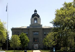
Brookings County Courthouse in Brookings
|
|

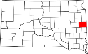
Location within the U.S. state of South Dakota
|
|
 South Dakota's location within the U.S. |
|
| Country | |
| State | |
| Founded | 1862 (created) July 3, 1871 (organized) |
| Named for | Wilmot Wood Brookings |
| Seat | Brookings |
| Largest city | Brookings |
| Area | |
| • Total | 805 sq mi (2,080 km2) |
| • Land | 792 sq mi (2,050 km2) |
| • Water | 13 sq mi (30 km2) 1.6% |
| Population
(2020)
|
|
| • Total | 34,375 |
| • Estimate
(2023)
|
35,980 |
| • Density | 42.702/sq mi (16.487/km2) |
| Time zone | UTC−6 (Central) |
| • Summer (DST) | UTC−5 (CDT) |
| Congressional district | At-large |
Brookings County is a county located in the eastern part of South Dakota, a state in the United States. Think of a county as a smaller area within a state, often with its own local government.
In 2020, about 34,375 people lived here. This makes it the fifth most populated county in South Dakota. The main city and where the county government is located is Brookings. The county was first created in 1862 and officially started operating in 1871.
Brookings County is also home to South Dakota State University, a large college.
Contents
History
Brookings County officially began on July 3, 1871. It was named after Wilmot Wood Brookings. He was an important person in the early days of South Dakota. He helped shape the area as a politician and a pioneer, meaning he was one of the first settlers.
The very first county seat, or main town, was Medary. This lasted from 1871 until 1879. After that, the county seat moved to the city of Brookings, where it is today.
Geography
Brookings County is on the eastern side of South Dakota. Its eastern border touches the state of Minnesota. The Big Sioux River flows through the eastern middle part of the county. The lowest point in the county is where this river enters Moody County, which is about 1,568 feet (478 meters) above sea level.
The land in the county is mostly flat, with gentle slopes. You'll find many lakes and ponds, especially in the western areas. A lot of the land is used for farming. The county covers a total area of 805 square miles (2,085 square kilometers). Most of this is land (782 sq mi or 2,025 sq km), and a smaller part is water (13 sq mi or 34 sq km).
Major Highways
 U.S. Highway 14 Bypass
 U.S. Highway 81
 South Dakota Highway 13
 South Dakota Highway 30
 South Dakota Highway 324
Airports
- Brookings Regional Airport
- Arlington Municipal Airport
Transit
- Jefferson Lines
Neighboring Counties
- Deuel County – north
- Lincoln County, Minnesota – east
- Pipestone County, Minnesota – southeast
- Moody County – south
- Lake County – southwest
- Kingsbury County – west
- Hamlin County – northwest
Lakes
- Brush Lake
- Johnson Lake
- Lake Campbell
- Lake Goldsmith
- Lake Hendricks (part of it)
- Lake Poinsett
- Lake Sinai
- Lake Tetonkaha
- Oak Lake
- Oakwood Lake
Protected Areas
- Aurora Prairie Nature Preserve
- Black Slough State Game Production Area
- Brookings County State Game Production Area
- Brookings Prairie Park
- Dakota Nature Park
- Deer Creek State Game Production Area
- Kvernmoe Slough State Game Production Area
- Lake Hendricks State Lakeside Use Area
- Lake Poinsett State Recreation Area
- Mehegan State Game Production Area
- Moe Slough State game Production Area
- Nelson State Game Production Area
- Oak Lake State Game Production Area
- Oakwood Lake State Game Production Area
- Oakwood Lakes State Park
Population Information
| Historical population | |||
|---|---|---|---|
| Census | Pop. | %± | |
| 1870 | 163 | — | |
| 1880 | 4,965 | 2,946.0% | |
| 1890 | 10,132 | 104.1% | |
| 1900 | 12,561 | 24.0% | |
| 1910 | 14,178 | 12.9% | |
| 1920 | 16,119 | 13.7% | |
| 1930 | 16,847 | 4.5% | |
| 1940 | 16,560 | −1.7% | |
| 1950 | 17,851 | 7.8% | |
| 1960 | 20,046 | 12.3% | |
| 1970 | 22,158 | 10.5% | |
| 1980 | 24,332 | 9.8% | |
| 1990 | 25,207 | 3.6% | |
| 2000 | 28,220 | 12.0% | |
| 2010 | 31,965 | 13.3% | |
| 2020 | 34,375 | 7.5% | |
| 2023 (est.) | 35,980 | 12.6% | |
| US Decennial Census 1790-1960 1900-1990 1990-2000 2010-2020 |
|||
2020 Census
According to the 2020 census, Brookings County had 34,375 people. There were 13,120 households, which are groups of people living together. The population density was about 43 people per square mile.
2010 Census
In the 2010 census, there were 31,965 people living in the county. Most people (93.2%) identified as white. Other groups included Asian (2.7%), American Indian (0.9%), and Black or African American (0.8%). About 2.0% of the population was of Hispanic or Latino background.
Many people in Brookings County have German (47.9%) or Norwegian (24.3%) family backgrounds. The average age of people in the county was 26.3 years old.
Communities
Cities
Towns
Census-designated places
These are areas that are like towns but are not officially incorporated as cities or towns.
- Lake Poinsett
- Newdale Colony
- Norfeld Colony
- Rolland Colony
Unincorporated communities
These are small settlements that don't have their own local government.
Townships
Townships are smaller divisions of a county, often used for local administration.
- Afton
- Alton
- Argo
- Aurora
- Bangor
- Brookings
- Elkton
- Eureka
- Lake Hendricks
- Lake Sinai
- Laketon
- Medary
- Oaklake
- Oakwood
- Oslo
- Parnell
- Preston
- Richland
- Sherman
- Sterling
- Trenton
- Volga
- Winsor
See also
 In Spanish: Condado de Brookings para niños

