Capers Island, South Carolina facts for kids
|
Capers Island (South Carolina)
|
|
| Geography | |
|---|---|
| Location | Atlantic Ocean |
| Coordinates | 32°51′07″N 79°41′49″W / 32.852°N 79.697°W |
| Area | 1.66 sq mi (4.3 km2) |
| Length | 3.11 mi (5.01 km) |
| Width | .53 mi (0.85 km) |
| Administration | |
|
United States
|
|
| State | |
| County | Charleston County |
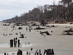
Capers Island is a special barrier island located in South Carolina, along the Atlantic Ocean. It's about 15 miles north of the city of Charleston. A barrier island is a long, narrow island that protects the mainland from ocean waves and storms.
This island is owned by the state and is kept wild and natural. Salt marshes and the Intracoastal Waterway separate it from the mainland. To its southwest is Dewees Island, and to its northwest is Bulls Island. The island got its name from Bishop William Theodotus Capers, who was from South Carolina.
Contents
Visiting Capers Island
Capers Island is a great place for nature lovers because it's undeveloped. This means there are no big buildings or stores. The State of South Carolina keeps it this way.
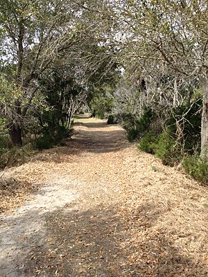
There's a small dock on Capers Inlet. From there, a boardwalk crosses the marsh. This leads to a nature trail that is about 1 mile long. The trail takes you all the way to the beach.
Camping on the Island
You can even go primitive camping on Capers Island! Primitive camping means you'll be roughing it, with no modern facilities. You need a free permit from the State Department of Natural Resources. Only 80 campers are allowed per night, in groups of 20 or less. This helps protect the island's natural beauty.
Exploring Natural Habitats
Capers Island is home to many different natural areas. These areas are called habitats, and each one supports different kinds of plants and animals.
The main habitats on the island include:
- Maritime uplands: These are higher areas with forests, away from the direct ocean.
- Sandy beach: The wide, open sandy areas along the ocean.
- Salt marsh: Wet, grassy areas flooded by saltwater, often found between the island and the mainland.
- Brackish ponds: Ponds where fresh water mixes with saltwater.
Island Plants (Flora)
One important plant you'll find on Capers Island is the Sabal palm. This is the state tree of South Carolina! It's a tall palm tree with fan-shaped leaves.
Island Animals (Fauna)
Many different animal species live on Capers Island. Some live there all the time, while others visit during certain seasons. You can find animals in the water, marshes, and on the land.
Mammals You Might See
Keep an eye out for these furry creatures:
- Raccoons, known for their masked faces.
- White-tailed deer, often seen grazing in the uplands.
- Bottlenose dolphins, swimming in the waters around the island.
Birds of Capers Island
Capers Island is a fantastic spot for birdwatching. Many different types of birds call this island home or stop here during migration:
- Bald eagle, a majestic bird of prey.
- Osprey, often seen diving for fish.
- Egrets and Herons, tall wading birds.
- Ibis and Bittern, also wading birds.
- Brown pelican, famous for their large pouches.
Reptiles on the Island
Be aware of these reptiles, especially if you're hiking:
- American alligator, found in freshwater and brackish areas.
- Loggerhead sea turtle, a large sea turtle that nests on beaches.
- eastern diamondback rattlesnake, a venomous snake.
- timber rattlesnake, another venomous snake.
- carolina pygmy rattlesnake, a smaller venomous snake.
- cottonmouth, a venomous water snake.
Fish in the Waters
The waters around Capers Island are full of different fish species:
- Bull shark and White shark, larger sharks.
- Bonnethead shark, a smaller shark.
- Sea trout and Red drum, popular sport fish.
- Flounder, a flatfish.
- Black drum and King whiting.
- Spot and Pompano.
- Croaker, a noisy fish.
Crustaceans and Mollusks
These small creatures are vital to the island's ecosystem:
- Crustaceans:
- Shrimp
- Ghost crab
- Blue crab
- Fiddler crab
- Mollusks:
 | Kyle Baker |
 | Joseph Yoakum |
 | Laura Wheeler Waring |
 | Henry Ossawa Tanner |


