Cardwell, Queensland facts for kids
Quick facts for kids CardwellQueensland |
|||||||||||||||
|---|---|---|---|---|---|---|---|---|---|---|---|---|---|---|---|
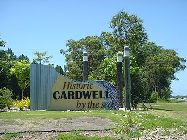
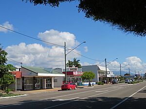
Entrance to Cardwell, Highway 1
|
|||||||||||||||
| Population | 1,320 (2021 census) | ||||||||||||||
| • Density | 28.03/km2 (72.6/sq mi) | ||||||||||||||
| Postcode(s) | 4849 | ||||||||||||||
| Elevation | 5 m (16 ft) | ||||||||||||||
| Area | 47.1 km2 (18.2 sq mi) | ||||||||||||||
| Time zone | AEST (UTC+10:00) | ||||||||||||||
| Location |
|
||||||||||||||
| LGA(s) | Cassowary Coast Region | ||||||||||||||
| State electorate(s) | Hinchinbrook | ||||||||||||||
| Federal Division(s) | Kennedy | ||||||||||||||
|
|||||||||||||||
|
|||||||||||||||
Cardwell is a lovely coastal town in Queensland, Australia. It's part of the Cassowary Coast Region. In 2021, about 1,320 people lived there. Cardwell is known for its beautiful natural surroundings and as a gateway to amazing islands.
Contents
Exploring Cardwell's Location
Cardwell is a long, narrow town right on the coast. It's connected to bigger cities like Cairns and Townsville by the Bruce Highway and the North Coast railway line. You can even find the Cardwell railway station right in town!
Just west of Cardwell, you'll see Greenwood Hill, which is about 64 meters (210 feet) high. The Cardwell Range mountains are also nearby. These mountains catch the wind, bringing lots of rain to the area. Because of this, the coast is covered in lush rainforest. As you go further west, the landscape changes to open woodlands and tropical grasslands. Many of these natural areas are protected as National Parks and World Heritage sites.
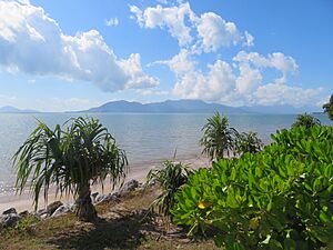
Looking out from Cardwell, you'll see the Hinchinbrook Channel and Rockingham Bay, which are both part of the Coral Sea. The famous Great Barrier Reef is also further out to the east.
You can also spot several islands from Cardwell, including Hinchinbrook Island, Goold Island, and the Brook Islands Group. These islands are also protected natural areas.
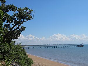
South of Cardwell is Oyster Point. This area is important because it was once the site of a big environmental debate in Australia. Today, the Port Hinchinbrook marina here offers easy access to the protected waters of Hinchinbrook Channel, its rivers, islands, and the Great Barrier Reef. The Cardwell Jetty is a great place for visitors to relax, enjoy the coastal views, and go fishing.
Cardwell's Weather
Cardwell has a tropical climate. This means it's generally warm all year round, with a wet season and a dry season. The wet season brings a lot of rain, especially from January to March.
| Climate data for Cardwell, Queensland (1991–2020 normals, extremes 1957–present) | |||||||||||||
|---|---|---|---|---|---|---|---|---|---|---|---|---|---|
| Month | Jan | Feb | Mar | Apr | May | Jun | Jul | Aug | Sep | Oct | Nov | Dec | Year |
| Record high °C (°F) | 41.7 (107.1) |
41.8 (107.2) |
38.7 (101.7) |
34.7 (94.5) |
31.7 (89.1) |
31.1 (88.0) |
30.2 (86.4) |
32.5 (90.5) |
36.0 (96.8) |
36.6 (97.9) |
40.0 (104.0) |
42.6 (108.7) |
42.6 (108.7) |
| Mean daily maximum °C (°F) | 31.4 (88.5) |
31.3 (88.3) |
30.7 (87.3) |
29.1 (84.4) |
26.9 (80.4) |
25.2 (77.4) |
24.7 (76.5) |
25.5 (77.9) |
27.4 (81.3) |
28.6 (83.5) |
30.0 (86.0) |
31.1 (88.0) |
28.5 (83.3) |
| Daily mean °C (°F) | 27.6 (81.7) |
27.6 (81.7) |
26.8 (80.2) |
25.1 (77.2) |
22.9 (73.2) |
20.8 (69.4) |
19.9 (67.8) |
20.5 (68.9) |
22.6 (72.7) |
24.4 (75.9) |
26.0 (78.8) |
27.2 (81.0) |
24.3 (75.7) |
| Mean daily minimum °C (°F) | 23.7 (74.7) |
23.8 (74.8) |
22.9 (73.2) |
21.1 (70.0) |
18.8 (65.8) |
16.4 (61.5) |
15.1 (59.2) |
15.6 (60.1) |
17.8 (64.0) |
20.1 (68.2) |
22.0 (71.6) |
23.3 (73.9) |
20.1 (68.2) |
| Record low °C (°F) | 17.2 (63.0) |
16.8 (62.2) |
14.4 (57.9) |
11.0 (51.8) |
6.1 (43.0) |
3.3 (37.9) |
2.8 (37.0) |
4.2 (39.6) |
6.5 (43.7) |
9.2 (48.6) |
14.4 (57.9) |
15.1 (59.2) |
2.8 (37.0) |
| Average precipitation mm (inches) | 427.0 (16.81) |
499.8 (19.68) |
342.0 (13.46) |
161.6 (6.36) |
90.9 (3.58) |
36.7 (1.44) |
37.2 (1.46) |
23.8 (0.94) |
49.9 (1.96) |
65.0 (2.56) |
126.0 (4.96) |
208.5 (8.21) |
2,068.4 (81.43) |
| Average precipitation days (≥ 1.0 mm) | 16.5 | 15.9 | 14.7 | 14.2 | 10.2 | 6.4 | 5.7 | 4.7 | 4.5 | 6.0 | 8.9 | 11.9 | 119.6 |
| Average dew point °C (°F) | 24.2 (75.6) |
24.4 (75.9) |
23.2 (73.8) |
21.7 (71.1) |
19.3 (66.7) |
17.1 (62.8) |
16.3 (61.3) |
16.9 (62.4) |
19.1 (66.4) |
20.6 (69.1) |
22.1 (71.8) |
23.5 (74.3) |
20.7 (69.3) |
| Source 1: National Oceanic and Atmospheric Administration | |||||||||||||
| Source 2: Bureau of Meteorology | |||||||||||||
Cardwell's Past
The land around Cardwell has a rich history, especially for Aboriginal people. Two main language groups, the Dyirbal and Warrgamay, lived in this area. The Warrgamay people lived around the Herbert River, including places like Ingham and Hinchinbrook Island. The Girramay people also lived in the Herbert River area, including Cardwell and Ingham.
The first Europeans arrived in January 1864. They wanted to create a port, first called "Port Hinchinbrook." Later that year, explorer George Elphinstone Dalrymple renamed the town Cardwell. He named it after Edward Cardwell, 1st Viscount Cardwell, who was an important government official at the time.
Cardwell was the very first port settlement on the Queensland coast north of Bowen. The first group of non-Indigenous people arrived in January 1864, led by George Elphinstone Dalrymple. They came by boat, hoping to build a road from the coast to a place called Valley of Lagoons Station.
The Cardwell Post Office opened on 10 July 1864.
In the late 1860s and early 1870s, Cardwell became a busy place for gold prospectors. These adventurers would travel through Cardwell to reach the goldfields about 200 kilometers (124 miles) inland.
Cardwell Provisional School opened on 1 October 1870. It later became Cardwell State School on 22 August 1887.
In 1985, there was a plan to build a large marina and resort called Port Hinchinbrook at Oyster Point. This idea caused many environmental discussions and debates. Construction finally began in 1999.
The Cardwell Library opened in 2008, giving the community a new place to learn and read.
In February 2011, Cardwell was hit by a very strong storm called Cyclone Yasi. It was a Category 5 cyclone and caused a lot of damage, especially to the marina and boats.
Around 2013, Cardwell became the target of a strange online hoax. Rumors spread that the town's Christmas lights competition was canceled because of a local Muslim community. This was completely false! The local council had to tell everyone that the rumors were untrue. Even though the original fake posts were deleted, screenshots still pop up online sometimes. The mayor at the time even said that Muslim leaders from other cities encouraged Cardwell to keep their Christmas lights.
Who Lives in Cardwell?
In 2016, Cardwell had a population of 1,309 people. About 8.9% of the people were Aboriginal and Torres Strait Islander. Most people (72.5%) were born in Australia, and 83.0% spoke only English at home. When asked about religion, the most common answers were No Religion (25.6%), Catholic (22.6%), and Anglican (20.6%).
By 2021, the population of Cardwell had grown slightly to 1,320 people.
Cardwell's Special Places
Cardwell has several places that are listed as important heritage sites:
- The Stone Bridge, Dalrymple Gap Track on Valley of Lagoons Road, Damper Creek.
- The Cardwell Divisional Board Hall (which later became the Cardwell Shire Hall) at 51 Victoria Street.
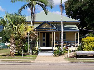
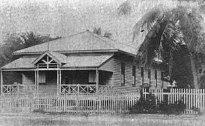
- The Cardwell Post Office (now the Cardwell Bush Telegraph heritage centre) at 53 Victoria Street.
There's also a special granite monument in Cardwell. It was sent from Great Britain for Walter Jervoise Scott, an early pioneer of the Valley of Lagoons. But when it arrived, it was too big to move to his grave, so it was set up in Cardwell instead!
Learning in Cardwell
Cardwell State School is a primary school for students from Prep (kindergarten) to Year 6. It's located at 43 Victoria Street. In 2018, the school had about 80 students.
There isn't a secondary school (high school) in Cardwell. The closest high school for students is Tully State High School in Tully, which is north of Cardwell.
Important Services in Cardwell
Cardwell has many important services to help its community:
- Cardwell Police Station is at 49 Victoria Street.
- Cardwell Fire Station is at 2 Panos Street.
- The Cardwell SES Facility, which helps during emergencies, is in Gregory Street.
- Cardwell Community Health Centre is at 226 Victoria Street.
- Cardwell Ambulance Station is right next to the health centre at 222–224 Victoria Street.
- Cardwell Cemetery is in Gregory Street and is managed by the Cassowary Coast Regional Council.
- Cardwell Coast Guard is at 1 Victoria Street. It's part of the Australian Volunteer Coast Guard, helping keep people safe on the water.
Places to Visit and Enjoy
- The Cassowary Coast Regional Council runs a public library at 4 Balliol Street.
- Cardwell Post Office is at 1 Brasenose Street.
- Our Lady Star of the Sea Catholic Church is at 121 Victoria Street.
- Cardwell Country Club is at 23 Gregory Street. It has an 18-hole golf course and a lawn bowls green for fun activities.
- Port Hinchinbrook (also called Cardwell Marina) is a large marina in Front Street.
- There's a boat ramp and floating walkway at Port Hinchinbrook in Foxtail Avenue, managed by the Cassowary Coast Regional Council.
- Another boat ramp is in Sheridan Street, also managed by the Cassowary Coast Regional Council.
- The Cardwell jetty is a popular spot at the north end of Hinchinbrook Channel, opposite 315A Victoria Street. It's also managed by the Cassowary Coast Regional Council.
Fun Things to Do
- The Cardwell Bush Telegraph Heritage Centre is one of the oldest buildings in North Queensland. It's now a museum at 53 Victoria Street, where you can learn about the town's history.
- Cardwell Lookout is at the end of Braenose Street. From here, you can enjoy amazing views of the town and the ocean!
 | Misty Copeland |
 | Raven Wilkinson |
 | Debra Austin |
 | Aesha Ash |


