Cavehill facts for kids
Quick facts for kids Cave Hill |
|
|---|---|
| Binn Uamha / Beann Mhadagáin | |
 |
|
| Highest point | |
| Elevation | 368 m (1,207 ft) |
| Geography | |
| Location | near Belfast, County Antrim, Northern Ireland |
| Climbing | |
| Easiest route | Hike |
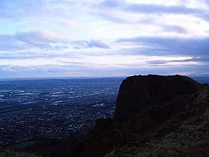
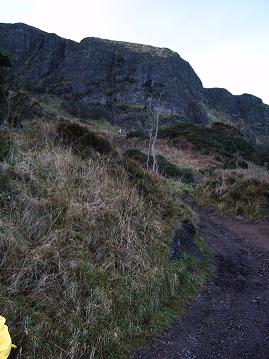
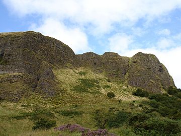
Cave Hill is a cool rocky hill that looks over the city of Belfast in Northern Ireland. It's about 368 metres (1,207 ft) tall! You'll see amazing cliffs and caves there. One famous part is 'Napoleon's Nose,' a tall cliff that looks just like the side profile of Emperor Napoleon. Right on top, there are old ruins of a fort called McArt's Fort. Long ago, people also called it 'Ben Madigan.' This name comes from an old Irish king named Madagán who lived around 856 AD.
Cave Hill is part of the Belfast Hills. It sits on the edge of the Antrim Plateau. From the top, you can see all of Belfast! On clear days, you might even spot the Isle of Man and Scotland. It's a bit like Arthur's Seat in Edinburgh, being so close to a big city center.
Many people think Cave Hill inspired Jonathan Swift's famous book, Gulliver's Travels. Swift imagined the hill looked like a giant sleeping to protect the city.
Contents
Exploring Cave Hill
Cave Hill rises 368 metres (1,207 ft) above the sea. Much of its lower side is part of the Belfast Castle estate. The main building there is a grand 19th-century castle. It was built in 1872 in what was once a deer park. The slopes of Cave Hill used to be farmland. But in the 1880s, many trees were planted. This created the beautiful woodlands you see today. In 1934, the Belfast Castle estate was given to the City of Belfast.
The Mysterious Caves
There are three main caves on Cave Hill. The lowest one is 21 feet (6.4 m) long and 18 feet (5.5 m) wide. It's about 7 to 10 feet (3.0 m) high. Above it is another cave, 10 feet (3.0 m) long and 7 feet (2.1 m) wide. It's about 6 feet (1.8 m) high. The third and highest cave is said to be the biggest. But it's very hard and dangerous to reach, so few people go there. These caves were made by people, probably for mining iron a long time ago.
Near the lowest cave is a spot called 'The Devil's Punchbowl.' Sometimes it's called 'The Devil's Cauldron.' Ancient Celtic farmers might have used this area to keep their cattle safe. It's a steep, rocky area and can be tricky for people who aren't experienced hikers.
McArt's Fort: An Ancient Stronghold
On top of the cliff, you'll find McArt's Fort. This is an example of an old ring fort. One side is protected by a steep drop. The other sides have a ditch about 10 feet (3.0 m) deep and 25 feet (7.6 m) wide. There's also a large wall of earth. The flat area inside the fort is about 150 feet (46 m) from north to south. It's 180 feet (55 m) from east to west.
People believe that those who lived in the fort used the caves. They might have stored food there for winter. The caves could also have been a safe place during attacks.
A Look at History
The hill's original Irish name was Beann Mhadagáin. This means "Madigan's hill." It was named after one of two kings of Ulaid. One king was Matudán mac Muiredaig, who ruled from 839 to 857 AD. Another was Matudán mac Áeda, who ruled from 937 to 950 AD. The grandson of the later king, Eochaid mac Ardgail, died in a battle in 1004. This battle was where the people of Ulster were beaten by their old enemies. McArt's Fort got its name from him.
The area at the bottom of Cave Hill is now called Ben Madigan. You'll find streets with similar names there. It's a nice area with homes and even a school. For example, Belfast Royal Academy has the Ben Madigan Preparatory School nearby.
In 1795, two important figures, Theobald Wolfe Tone and Henry Joy McCracken, are said to have met on Cave Hill. They took an oath there to start the rebellion of 1798. Sadly, McCracken was captured on Cave Hill in 1798.
A special stone called the Giant's Chair was once on Cave Hill's summit. It belonged to the O'Neill clan. This stone was there until 1896. It even gave its name to the nearby Throne Hospital.
During World War II, a German bomb fell early during a raid on Belfast. It exploded on Cave Hill, making a big hole near Belfast Castle. It's thought that the RAF Bomber Command was on Cave Hill early in the war. They later moved to Castle Archdale. So, the German bomb might have been aimed at them.
On June 1, 1944, an American Air Force B-17 bomber crashed into Cave Hill. This happened during thick fog. All ten crew members died instantly. This sad event inspired the film Closing the Ring. Some parts of the movie were even filmed on Cave Hill. You can easily visit the crash site through Carr's Glen Country Park. The field, known as 'The Bomb hole Field,' is open to everyone.
How Cave Hill Was Formed
The unique shape of Cave Hill comes from ancient lava flows. These happened about 65 million years ago. Below this lava are layers of limestone from 145 million years ago. Even deeper, there's a type of clay from 200 million years ago.
In Victorian times, limestone was mined from the southern side of Cave Hill. It was taken to Belfast docks using a railway pulled by horses. This railway was stopped in the 1890s. Two small villages, Daddystown and Mammystown, were built in the 1820s. They were homes for the quarry workers. Some streets in the area are named 'Waterloo,' which relates to these old rock layers.
Fun on Cave Hill
Cave Hill Country Park, Belfast Zoo, and Belfast Castle are popular places. Locals and tourists love to visit them. In the 18th century, people from Belfast would gather there for a festival on Easter Monday. It was held near a spring called the 'Volunteers' Well.'
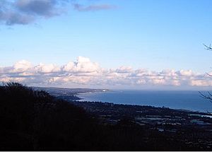
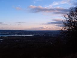
From the top of Cave Hill, you get amazing views. You can look south over Belfast City and the Lough. You can also see the Mourne Mountains, Scrabo Tower, and Slieve Croob. On a clear day, looking east, you can see Carrickfergus, the Mull of Galloway in Scotland, and the Isle of Man.
 | John T. Biggers |
 | Thomas Blackshear |
 | Mark Bradford |
 | Beverly Buchanan |


