Cerro Gordo County, Iowa facts for kids
Quick facts for kids
Cerro Gordo County
|
|
|---|---|

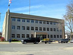
Cerro Gordo County Courthouse
|
|

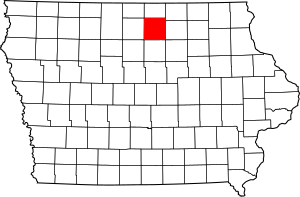
Location within the U.S. state of Iowa
|
|
 Iowa's location within the U.S. |
|
| Country | |
| State | |
| Founded | 1851 |
| Named for | Battle of Cerro Gordo |
| Seat | Mason City |
| Largest city | Mason City |
| Area | |
| • Total | 575 sq mi (1,490 km2) |
| • Land | 568 sq mi (1,470 km2) |
| • Water | 6.8 sq mi (18 km2) 1.2% |
| Population
(2020)
|
|
| • Total | 43,127 |
| • Density | 75.00/sq mi (28.959/km2) |
| Time zone | UTC−6 (Central) |
| • Summer (DST) | UTC−5 (CDT) |
| Congressional district | 4th |
Cerro Gordo County is a county in the state of Iowa, USA. A county is a part of a state, like a district. In 2020, about 43,127 people lived here. The main city and government center is Mason City. The county got its name from the Battle of Cerro Gordo, a famous battle during the Mexican–American War.
Cerro Gordo County is also part of the Mason City Micropolitan Statistical Area. This means it's connected to Mason City and nearby smaller towns.
Contents
History
Cerro Gordo County was officially created in 1851. Its name comes from the Battle of Cerro Gordo. This battle happened in 1847 during the Mexican–American War. In this battle, General Winfield Scott from the U.S. defeated General Santa Anna from Mexico.
The first white settlers arrived in the area in 1851, settling near Clear Lake. Four years later, in 1855, the first elections were held. The county's first legal actions took place in 1857. For a short time, Livonia was chosen as the county seat, which is where the county government is located. But in 1858, the county seat moved back to Mason City. The first courthouse was built in 1866. The courthouse used today opened in 1960.
Cerro Gordo County is also known for a sad event. On February 3, 1959, a small airplane crashed north of Clear Lake. This crash killed famous rock and roll musicians Buddy Holly, Ritchie Valens, and J.P. "The Big Bopper" Richardson. Their pilot, Roger A. Peterson, also died. This event is often called "The Day the Music Died." The crash site is in Grant Township.
Geography
Cerro Gordo County covers about 575 square miles. Most of this area, about 568 square miles, is land. The rest, about 6.8 square miles, is water, which is about 1.2% of the total area.
Major Roads
Several important roads pass through Cerro Gordo County:
Public Transport
- Mason City Transit provides bus services in the area.
Airport
The county has its own airport, the Mason City Municipal Airport (MCW).
Neighboring Counties
Cerro Gordo County shares borders with several other counties:
- Worth County (north)
- Mitchell County (northeast)
- Floyd County (east)
- Franklin County (south)
- Hancock County (west)
People and Population
| Historical population | |||
|---|---|---|---|
| Census | Pop. | %± | |
| 1860 | 940 | — | |
| 1870 | 4,722 | 402.3% | |
| 1880 | 11,461 | 142.7% | |
| 1890 | 14,864 | 29.7% | |
| 1900 | 20,672 | 39.1% | |
| 1910 | 25,011 | 21.0% | |
| 1920 | 34,675 | 38.6% | |
| 1930 | 38,476 | 11.0% | |
| 1940 | 43,845 | 14.0% | |
| 1950 | 46,053 | 5.0% | |
| 1960 | 49,894 | 8.3% | |
| 1970 | 49,223 | −1.3% | |
| 1980 | 48,458 | −1.6% | |
| 1990 | 46,733 | −3.6% | |
| 2000 | 46,447 | −0.6% | |
| 2010 | 44,151 | −4.9% | |
| 2020 | 43,127 | −2.3% | |
| 2023 (est.) | 42,406 | −4.0% | |
| U.S. Decennial Census 1790-1960 1900-1990 1990-2000 2010-2018 |
|||
What the 2020 Census Shows
In 2020, the census counted 43,127 people living in Cerro Gordo County. This means there were about 75 people for every square mile. There were 22,603 homes or housing units, and 19,224 of them were lived in.

Here's a look at the different groups of people living in Cerro Gordo County in 2020:
| Race | Number of People | Percentage |
|---|---|---|
| White | 37,819 | 87.7% |
| Black or African American | 848 | 2% |
| Native American | 96 | 0.22% |
| Asian | 535 | 1.24% |
| Pacific Islander | 137 | 0.32% |
| Other/Mixed Race | 1,449 | 3.4% |
| Hispanic or Latino | 2,243 | 5.2% |
Towns and Communities
Cerro Gordo County has several cities, towns, and smaller communities.
Cities
Townships
The county is also divided into sixteen smaller areas called townships:
- Bath
- Clear Lake
- Dougherty
- Falls
- Geneseo
- Grant
- Grimes
- Lake
- Lime Creek
- Lincoln
- Mason
- Mount Vernon
- Owen
- Pleasant Valley
- Portland
- Union
Smaller Communities
These are smaller places that are not officially cities:
- Burchinal
- Portland
- Cameron
- Cartersville
- Emery
- Freeman
- Hurley
City Sizes
Here are the cities and towns in Cerro Gordo County, listed by how many people lived there in 2020:
† county seat (main government city)
| Rank | City/Town/Community | Type | Population (2020 Census) |
|---|---|---|---|
| 1 | † Mason City | City | 27,338 |
| 2 | Clear Lake | City | 7,687 |
| 3 | Nora Springs (mostly in Floyd County) | City | 1,369 |
| 4 | Rockwell | City | 1,071 |
| 5 | Ventura | City | 711 |
| 6 | Thornton | City | 400 |
| 7 | Plymouth | City | 375 |
| 8 | Meservey | City | 222 |
| 9 | Swaledale | City | 144 |
| 10 | Rock Falls | City | 150 |
| 11 | Dougherty | City | 62 |
| 12 | Burchinal | Census-designated place | 33 |
| 13 | Portland | Census-designated place | 28 |
How the County Works
Law Enforcement
The Cerro Gordo County Sheriff's Office helps keep the county safe. Sheriff Kevin Pals leads this office. They are in charge of law enforcement, which means they investigate crimes and make sure laws are followed. They also handle legal papers and run the county jail. The Sheriff's Office is located at 17262 Lark Ave, Mason City, IA 50401.
See also
 In Spanish: Condado Cerro Gordo (Iowa) para niños


