
Districts of Redditch facts for kids
Quick facts for kids Redditch |
|
|---|---|

Redditch
|
|
| Population | 85,261 |
| District | |
| Shire county | |
| Region | |
| Country | England |
| Sovereign state | United Kingdom |
| Postcode district | B96, B97, B98 |
| Dialling code | 01527 |
| Police | West Mercia |
| Fire | Hereford and Worcester |
| Ambulance | West Midlands |
| EU Parliament | West Midlands |
| UK Parliament |
|
Redditch is a town and local government area in Worcestershire, England. The town is made up of many different areas, called districts.
In the newer parts of Redditch, street signs are blue with white letters. They also show the district name in black on a white background. Roads in these areas are often named in alphabetical order. House numbers in dead-end streets usually start with 1 and go up in order.
Contents
- Exploring Redditch Districts
- Abbeydale: Post-War Homes
- Batchley: A Growing Community
- Brockhill: Modern Living Areas
- Church Green: The Town's Heart
- Church Hill: A Large Planned Estate
- Enfield: Industrial and Essential Services
- Feckenham: A Village Connected to Redditch
- Greenlands: Parks and Community Life
- Headless Cross: History and Landmarks
- Ipsley: Private Homes and Businesses
- Lakeside: Industry and Nature
- Lodge Park: Early New Town Development
- Matchborough: A Large District with a Pond
- Moons Moat: Ancient History and Industry
- Oakenshaw: Shopping and Residential Areas
- Park Farm: Business and Politics
- Riverside: History and Recreation
- Smallwood: Shops and Factories
- Southcrest: Historic Homes
- St Georges: Churches and Schools
- Town Centre: The Kingfisher Shopping Centre
- Walkwood: Nature and Community
- Washford: Industry and Ancient History
- Webheath: A Former Village
- Winyates: A New Town Estate
- Wirehill: Houses and Woods
- Woodrow: Hospital and Farms
- Images for kids
Exploring Redditch Districts
Redditch has many unique districts, each with its own history and features. Let's explore some of them!
Abbeydale: Post-War Homes
Abbeydale, along with Batchley and Mayfields, is a housing area built in the 1950s. These homes were needed after World War II to help with a growing population.
Batchley: A Growing Community
Batchley is home to Redditch United F.C.'s Valley Stadium. This football stadium is located off Bromsgrove Road. Batchley started as a housing area before World War II. It has continued to grow to provide homes for people.
This area has a mix of privately owned homes, rented homes, and social housing. It has three local schools, a park, and a fishing lake. You can also find small shops and a Tesco Express here. Batchley is only a short walk from Redditch town centre.
Brockhill: Modern Living Areas
Brockhill is in the north-west part of Redditch. It is mostly a modern residential area. Many new housing estates are still being built here since 1996. The district is also where Brockhill (HM Prison), a Young Offenders Institution, is located.
Church Green: The Town's Heart

Church Green is a busy area and public space in the centre of Redditch. It is like a traditional village green or town square. You can find a bandstand and a fountain here. St Stephen's Church stands tall over the area. Many businesses, like banks and restaurants, are also located here.
Church Hill: A Large Planned Estate
Church Hill is the largest housing area in Redditch. It is in the north-east part of the town. Building started here in 1975. Church Hill has a special design, with main roads like Paper Mill Drive going around the outside. Most homes are built on cul-de-sacs (dead-end streets).
The area is divided into different parts:
- Church Hill North - Mostly private homes.
- Church Hill Centre - A small shopping area with a community centre, medical centre, and schools.
- Church Hill South - Mostly social housing.
The North and South parts are separated by a road just for buses. Children from both sides go to the same schools, like Church Hill Middle School. The estate is named after St Leonards church, which is nearby.
Enfield: Industrial and Essential Services
Enfield is named after the old Enfield Motorbike factory. It is mainly an industrial area. This area was important during the Industrial Revolution for making needles and fishing hooks. Mettis Aerospace, which made parts for Spitfire planes during World War Two, is also here.
You can find the local Fire Station in Enfield. It has three main fire engines. There is also a retail park with a Sainsburys supermarket and a Royal Mail delivery office. The DVLA test centre for North Worcestershire is also located here.
Feckenham: A Village Connected to Redditch
Feckenham is a village that is part of Redditch for local government. It grew up along an old salt trading route and a stream called Bow Brook.
Feckenham Forest used to cover a large part of Worcestershire. It was a royal hunting forest for kings long ago.
Greenlands: Parks and Community Life
Greenlands is located between Woodrow and Lodge Park. It is known for its three large football fields. There is also a walkway that leads to Tesco Extra and Oakenshaw, which is popular for dog walks.
Greenlands is home to the South Redditch social club and The Greenlands pub. Most of the houses here were built in the 1950s, 60s, and 70s. You can also find a shop, a Chinese takeaway, and a basketball court with a small skatepark.
Headless Cross: History and Landmarks


Headless Cross was once its own village. It might be named after an old farm. Like other parts of Redditch, Headless Cross was involved in making needles. There were three needle factories here in the past.
There are two schools in Headless Cross: The Vaynor First School and Walkwood CE Middle School. Redditch's two water towers are also in Headless Cross because it's a bit higher up. One old water tower has been turned into a home. The new water tower has a unique shape and can be seen from far away.
Ipsley: Private Homes and Businesses
Ipsley is where the main office of the engineering company GKN is located. It is one of the few areas in Redditch that does not have any council-owned housing. All the homes in Ipsley are privately owned.
Lakeside: Industry and Nature
Lakeside is mostly an industrial area. It is very close to the Arrow Valley Park, a large green space. There is also a small housing area in Lakeside.
Lodge Park: Early New Town Development
The first houses in Lodge Park were built in the late 1950s and finished in the mid-1960s. More homes were added in the 1980s. There is a social club with a view of Lodge Park and a small group of shops, including a Tesco Express. Lodge Park has a middle school and a first school.
Matchborough: A Large District with a Pond
Matchborough is a large district in Redditch. It is located between Winyates, Ipsley, and Washford. Arrow Vale High School and Matchborough First School are both in Matchborough. The area has two parts: Matchborough East and Matchborough West. It also has a small shopping centre called Matchborough Centre. Matchborough Pond, near Arrow Vale High School, is a well-known feature of the area.
Moons Moat: Ancient History and Industry
Moon's Moat is an industrial and business area in the north-east of Redditch. The name comes from an ancient homestead (an old farm or house) that was surrounded by a moat (a ditch filled with water). This homestead was founded by Monks and dates back to the 12th century. It is now a protected heritage site.
The Mohun family lived in the homestead, which is where the name "Moon's" comes from. The homestead was last used in the 1700s and is now a ruin. Some people believe the ghost of Lady Mohun appears near the site on January 21st.
Oakenshaw: Shopping and Residential Areas
Oakenshaw is mostly a residential area with a mix of privately owned and social housing. A large McDonald's is in the centre of Oakenshaw. The biggest retail store in Redditch, Tesco Extra, is also nearby.
This area is named after Oakenshaw Farm, which used to be where the underpass from Tesco to Greenlands is today.
Oakenshaw South: Newer Homes
Oakenshaw South was built in the 1980s. It has ten residential streets, all leading off Grangers Lane. This area was built on land that once belonged to Woodrow Farm.
Park Farm: Business and Politics
Park Farm is an area in south-east Redditch. It mainly has industrial and commercial buildings. Politically, Park Farm is part of the Greenlands ward. This ward is represented by councillors from the Labour Party and the Conservative Party.
Riverside: History and Recreation
The Riverside area of Redditch runs along the River Arrow. Here you can find the Forge Mill Needle Museum and the ruins of Bordesley Abbey. The Abbey Stadium Sports Complex is also in Riverside. It has a swimming pool built in 2011. The pool is partly heated using waste heat from the nearby Redditch Crematorium.
Smallwood: Shops and Factories
Smallwood is named after the Smallwood Brothers. This area has the Smallwood Alms Houses and old Victorian factories like Millsborough House. You can also find a B&Q store, an ASDA Superstore, and Matalan here. The Redditch Central Mosque is also located in Smallwood.
Southcrest: Historic Homes
Southcrest is a residential area south of the Town Centre. It is one of the oldest parts of Redditch. Most of the older buildings here are from the late Victorian era. This includes Southcrest Works, which have been turned into private apartments. The Southcrest Hotel and Plymouth Road Cemetery are also located here.
St Georges: Churches and Schools
St Georges is a residential area south-east of the Town Centre. It is home to St George the Martyr Church, Our Lady of Mount Carmel Church, and St Georges Church of England First School. The area is mainly built around Beoley Road West and St Georges Road.
Town Centre: The Kingfisher Shopping Centre

The main shopping area of Redditch is the indoor Kingfisher Shopping Centre. It is designed like a large mall with covered walkways and multi-storey car parks. The centre was built where several old Redditch streets used to be. The walkways inside are named after these old streets.
The Kingfisher Centre, along with Church Green and public buildings like the Town Hall and Redditch Central Library, are surrounded by the Redditch Ringway. This is a raised, one-way, three-lane road designed to help cars get to the car parks.
Walkwood: Nature and Community
Walkwood is a small suburb of Redditch. It is home to the Bramley Cottage Inn and Walkwood Coppice, which is a nature reserve. Nearby is Morton Stanley Park, a large open parkland area. This park hosts the annual Morton Stanley Festival. There is also a small shopping area on Mason Road, which includes a post office.
Washford: Industry and Ancient History
Washford is mainly a modern industrial area in south-east Redditch. It is home to the main offices of Halfords, a company that sells car and bicycle accessories. Gardner Denver, a large compressor manufacturer, also has its UK headquarters here.
The area is named after the Washford Mill, which is now a popular pub and restaurant. A mill has been on this site since 1066 and is even mentioned in the Domesday Book. Many areas of Redditch, like Ipsley and Batchley, also have very old origins, dating back to Saxon times.
Webheath: A Former Village
Webheath is a district of Redditch. It is next to Batchley and the village of Callow Hill. Webheath used to be its own village but is now part of the town of Redditch.
Webheath has two first schools, both on Downsell Road:
- Webheath Academy Primary School
- Mount Carmel Catholic First School
Webheath is part of the West Ward on Redditch Borough Council. It is represented by councillors from the Conservative and Green parties.
Winyates: A New Town Estate

Winyates is a new town housing area in eastern Redditch. It includes:
- Winyates West
- Winyates East
- Winyates Green, which is east of Winyates East
The West and East areas are separated by Winyates Way, which is mostly a bus lane. Winyates West is next to Arrow Valley Park, which you can reach by a footpath. Winyates is also home to the Ipsley Alders Marsh Nature Reserve, which is a special scientific interest area (SSSI).
Winyates elects three councillors to Redditch Borough Council. Tenacres First School is in Winyates East. Ipsley Middle School and Roman Way First School are in Winyates West.
Wirehill: Houses and Woods
Wire Hill is a small housing area that only contains houses. It is located on the same road as the Alexandra Hospital. You can only get to it by Nine Days Lane. The entrance to Wire Hill Woods, which is a special scientific interest area (SSSI), is also here.
Woodrow: Hospital and Farms
This area is named after Woodrow Farm, which was actually located where Oakenshaw South is today. Some roads in Woodrow North are remains of the old Woodrow Farm lane. Woodrow North has council housing, while Woodrow South has a mix of private and council homes.
The Alexandra Hospital is located in Woodrow.
Images for kids
-
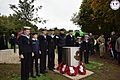
Bomford Hill Peace Memorial

