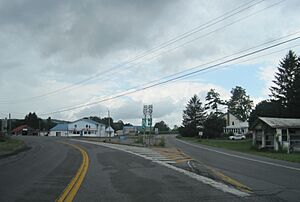
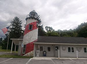
Eaton, New York facts for kids
Quick facts for kids
Eaton, New York
|
|
|---|---|

Hamlet of Pine Woods in Eaton
|
|
| Country | United States |
| State | New York |
| County | Madison |
| Government | |
| • Type | Town council |
| Area | |
| • Total | 45.57 sq mi (118.03 km2) |
| • Land | 44.63 sq mi (115.58 km2) |
| • Water | 0.94 sq mi (2.45 km2) |
| Elevation | 1,398 ft (426 m) |
| Population
(2020)
|
|
| • Total | 4,284 |
| • Density | 96.0/sq mi (37.1/km2) |
| Time zone | UTC-5 (Eastern (EST)) |
| • Summer (DST) | UTC-4 (EDT) |
| ZIP Codes |
13334 (Eaton)
13408 (Morrisville) 13484 (West Eaton) 13310 (Bouckville) 13409 (Munnsville) 13346 (Hamilton) |
| Area code(s) | 315 |
| FIPS code | 36-053-23305 |
| GNIS feature ID | 0978923 |
Eaton is a town located in Madison County, New York, in the United States. In 2020, about 4,284 people lived here. This number was a bit lower than in 2010.
Contents
Discovering Eaton's History
The land where Eaton is located was once home to the Oneida people. They were a group of the Iroquois who helped the colonial forces during the American Revolution. People from Europe began to settle here around 1792.
The town of Eaton was officially created in 1807. It was formed from a part of the town of Hamilton. Eaton is named after William Eaton. He was an officer during the American Revolution. He also led U.S. military forces in Tripoli.
Exploring Eaton's Geography
Eaton is in the south-central part of Madison County. US Route 20 runs through the northern part of the town. This road goes through Morrisville, which is the largest community in Eaton. Route 20 leads east to Madison and west to Cazenovia.
New York State Route 26 crosses the southern part of Eaton. It passes through the smaller areas of Eaton and West Eaton. Route 26 goes east into Madison and southwest to Georgetown. A part of the village of Hamilton is also in the southeast of Eaton.
Eaton is near the center of New York State. The Chenango River starts in Eaton and flows south. Blue Creek also starts here and flows north. It joins Oneida Creek, which is part of the Oswego River system. This system eventually flows into Lake Ontario.
The town covers about 45.57 square miles (118.03 square kilometers). Most of this area is land, with a small part being water.
People Living in Eaton
The number of people living in Eaton has changed over the years. In 2020, there were 4,284 residents. This was a decrease from 5,255 people in 2010.
| Historical population | |||
|---|---|---|---|
| Census | Pop. | %± | |
| 1820 | 3,021 | — | |
| 1830 | 3,558 | 17.8% | |
| 1840 | 3,409 | −4.2% | |
| 1850 | 3,944 | 15.7% | |
| 1860 | 3,871 | −1.9% | |
| 1870 | 3,690 | −4.7% | |
| 1880 | 3,799 | 3.0% | |
| 1890 | 3,121 | −17.8% | |
| 1900 | 2,705 | −13.3% | |
| 1910 | 2,417 | −10.6% | |
| 1920 | 2,223 | −8.0% | |
| 1930 | 2,168 | −2.5% | |
| 1940 | 2,245 | 3.6% | |
| 1950 | 2,854 | 27.1% | |
| 1960 | 3,196 | 12.0% | |
| 1970 | 4,458 | 39.5% | |
| 1980 | 5,182 | 16.2% | |
| 1990 | 5,362 | 3.5% | |
| 2000 | 4,826 | −10.0% | |
| 2010 | 5,255 | 8.9% | |
| 2020 | 4,284 | −18.5% | |
| U.S. Decennial Census | |||
In 2000, there were 4,826 people living in Eaton. About one-third of the homes had children under 18. Most homes were made up of married couples. The average household had about 2.58 people.
The age of people in Eaton varied. About 20% were under 18. Many residents were young adults, aged 18 to 24. The average age was 24 years old.
Communities and Places in Eaton
Eaton is home to several smaller communities and interesting spots:
- Davis Corners – A small area near the northern border of the town.
- Eagleville – A small community located south of Morrisville.
- Eaton – This is the main community, also called a hamlet, in the southern part of the town. It is on Route 26.
- Eaton Reservoir – A large body of water, partly in the southwest of the town.
- Leland Pond – Two ponds connected by a small channel. They are south of Pine Woods.
- Morrisville – This is the largest village in Eaton. It is home to Morrisville State College. You can also find the Morrisville Equine Center and a fish hatchery here.
- Morrisville Station – A small community east of Morrisville on Route 20.
- Pine Woods – A community on Route 20. It has historical ties to the Oneida people.
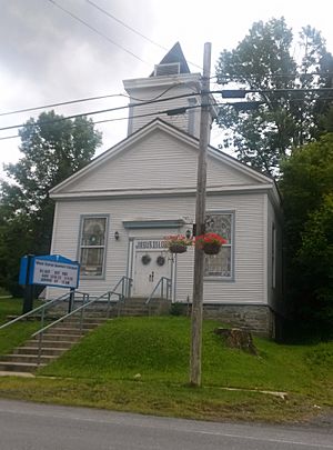
- Pratts Hollow – This area is special because it marks the geographic center of New York State. The Pratts Hollow United Methodist Church is located here.
- West Eaton – A community in the southwestern part of the town.
See also
 In Spanish: Eaton (Nueva York) para niños
 | Chris Smalls |
 | Fred Hampton |
 | Ralph Abernathy |


