Elk Township, New Jersey facts for kids
Quick facts for kids
Elk Township, New Jersey
|
||
|---|---|---|
|
Township
|
||
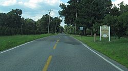
Entering Elk Township along County Route 609
|
||
|
||
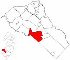
Location of Elk Township in Gloucester County highlighted in red (right). Inset map: Location of Gloucester County in New Jersey highlighted in red (left).
|
||
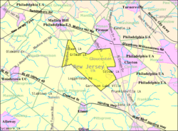
Census Bureau map of Elk Township, New Jersey
|
||
| Country | ||
| State | ||
| County | ||
| Incorporated | April 17, 1891 | |
| Government | ||
| • Type | Township | |
| • Body | Township Committee | |
| Area | ||
| • Total | 19.34 sq mi (50.08 km2) | |
| • Land | 19.16 sq mi (49.61 km2) | |
| • Water | 0.18 sq mi (0.47 km2) 0.93% | |
| Area rank | 145th of 565 in state 6th of 24 in county |
|
| Elevation | 144 ft (44 m) | |
| Population
(2020)
|
||
| • Total | 4,424 | |
| • Estimate
(2023)
|
4,473 | |
| • Rank | 398th of 565 in state 17th of 24 in county |
|
| • Density | 230.9/sq mi (89.2/km2) | |
| • Density rank | 494th of 565 in state 23rd of 24 in county |
|
| Time zone | UTC−05:00 (Eastern (EST)) | |
| • Summer (DST) | UTC−04:00 (Eastern (EDT)) | |
| ZIP Code |
08343 – Monroeville
|
|
| Area code(s) | 856 | |
| FIPS code | 3401521060 | |
| GNIS feature ID | 0882139 | |
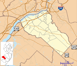
Elk Township is a community located in Gloucester County, in the U.S. state of New Jersey. It is known as a township. In 2020, about 4,424 people lived there. This was a small increase from the 2010 population.
Elk Township was officially created on April 17, 1891. It was formed from parts of other nearby townships: Clayton Township, Glassboro Township, and South Harrison Township. The name "Elk" comes from the elk that used to be hunted in this area.
Contents
Geography of Elk Township
Elk Township covers an area of about 19.34 square miles (50.08 square kilometers). Most of this area is land, with a small amount of water.
Communities and Neighbors
Several small communities are found within Elk Township. These include Aura, Ferrell, Harding, Hardingville, and Monroeville.
The township shares its borders with several other towns. In Gloucester County, it borders Clayton, Franklin Township, Glassboro, Harrison Township, and South Harrison Township. It also borders Upper Pittsgrove Township in Salem County.
Population and People
The number of people living in Elk Township has changed over the years.
- In 1900, there were 997 people.
- By 1950, the population had grown to 2,074.
- In 2000, 3,514 people lived in the township.
- The 2010 census counted 4,216 people.
- The most recent count in 2020 showed 4,424 residents.
Who Lives in Elk Township?
In 2010, there were 4,216 people living in Elk Township. Most residents were White (about 79.7%). About 14.8% were Black or African American. Other groups included Native American, Asian, and people of two or more races. About 5.1% of the population identified as Hispanic or Latino.
The average age of people in Elk Township in 2010 was about 39.6 years old. About 23.8% of the population was under 18 years old.
Education in Elk Township
Students in Elk Township attend public schools through two different school districts.
Elementary School
Younger students, from pre-kindergarten through sixth grade, go to the Aura School. This school is part of the Elk Township School District. In the 2022–23 school year, about 336 students attended Aura School. The school was first built in 1927. It was rebuilt in 1949 after a fire and had a new part added in 2002.
Middle and High School
For seventh through twelfth grade, students attend schools in the Delsea Regional School District. This district serves students from both Elk Township and Franklin Township. Students from Newfield also attend these schools.
The schools in this district are:
- Delsea Regional Middle School (for grades 7-8)
- Delsea Regional High School (for grades 9-12)
The school board for the Delsea Regional School District has nine members. Two of these members are from Elk Township.
Vocational Education
Students from anywhere in Gloucester County can apply to attend the Gloucester County Institute of Technology. This is a four-year high school in Deptford Township. It offers special technical and job-focused education. Students do not have to pay tuition to attend this public school.
Transportation in Elk Township
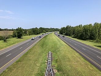
Elk Township has a good network of roads and highways.
Roads and Highways
As of 2010, Elk Township had about 66.75 miles of roads. Some roads are maintained by the township, others by Gloucester County, and some by the New Jersey Department of Transportation.
Important state routes that go through Elk Township include Route 77 and Route 55. Two main county roads are also accessible: County Route 538 and County Route 553. The New Jersey Turnpike is also nearby in Harrison Township.
Public Transportation
NJ Transit offers bus service in the area. The 410 bus route connects Bridgeton to Philadelphia, passing through Elk Township.
Notable People
People who have lived in or are connected to Elk Township include:
- Sean F. Dalton (born 1962), who was a member of the New Jersey General Assembly.
See also
 In Spanish: Municipio de Elk (Nueva Jersey) para niños


