Elthorne Hundred facts for kids
Elthorne was a hundred, which is a very old way of dividing land. It was part of the historic county of Middlesex, England.
Contents
What's in a Name? The Meaning of Elthorne
The name Elthorne comes from very old English words. It likely means "El's thorn."
Who was El?
"El" was probably a person, maybe an important leader or "earl." This is similar to how the nearby area, Spelthorne Hundred, got its name.
What does "Thorn" mean?
The "thorn" part refers to thorny plants. These include hawthorns, blackthorns, and brambles. These plants grew naturally in the area. Hawthorns, for example, have small white flowers in warm months. They are common in the gravelly soil found here. Blackthorns are also found in local woodlands.
A Meeting Place?
Some historians think that "Elthorne" might have been a place where people met. This would be like Ossulstone, another old meeting point. However, it's hard to know for sure if the name refers to one specific thorn tree.
Old Parishes of Elthorne Hundred
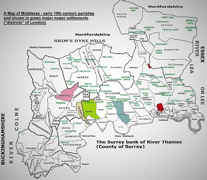
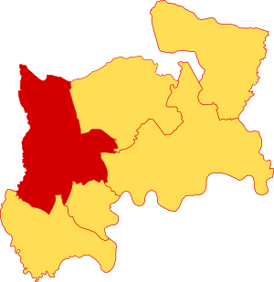
Elthorne Hundred covered the north-west part of Middlesex. It included several parishes, which are like small towns or districts.
List of Parishes
Here are some of the parishes that were part of Elthorne:
- Cranford, Harlington, and West Drayton were small parishes. They were located north of Harmondsworth.
- Harmondsworth was in the far south-west. Much of its land is now part of London Heathrow Airport.
- Greenford was located between Northolt and Perivale in the east.
- Hanwell was a long, narrow parish east of Norwood Green.
- Hayes had a south-east part called Norwood Green. This area had its own chapel since the 12th century. The Southall area within Hayes also grew significantly.
- Yeading developed later in the northern part of Hayes. Its first church was built in 1890.
- Hillingdon was a large, rectangular area. It was the westernmost parish.
- Ickenham was a small parish. It was north-east of Hillingdon and north-west of Hayes.
- Northolt was located between Ruislip and Hayes.
- Perivale was a small parish in the far east.
- Harefield and Ruislip were the northernmost parishes. Ruislip was the main parish for areas like Eastcote and Northwood.
Elthorne Today
Today, the area of Elthorne Hundred is very similar to the modern London Borough of Hillingdon. It also includes the western half of the London Borough of Ealing. The eastern part of Ealing, including Ealing and Acton, was in a different hundred called Ossulstone.
Making Borders Simpler
Over time, the borders of these old parishes became very complicated. New roads and housing estates helped to simplify them.
Modern Borders
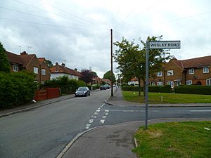
If you look at street signs in these areas, they often show the names of the local districts. These names are based on the old parishes and how they changed. Even the borders of local Church of England church areas have been made much simpler. For example, the borders of Ickenham parish have shifted quite a bit.
How Councils Use Borders
Local councils don't just use voting areas (called "wards") for street signs. Instead, they combine long history, wards, and postal codes. This helps people understand where they are.
See also
- UB postcode area: This area is similar to Elthorne but does not include Ruislip and its related areas like Eastcote and Northwood. Most of the UB postcode divisions are based on the original parishes, but they were redrawn for mail delivery.
- HA postcode area: This area includes Ruislip and its surrounding places.
- London Heathrow Airport: Much of the land for Heathrow Airport came from Harmondsworth parish. The airport is now in the TW postcode area.
 | Kyle Baker |
 | Joseph Yoakum |
 | Laura Wheeler Waring |
 | Henry Ossawa Tanner |


