
Falkner's Circle facts for kids

The sole surviving stone from Falkner's Circle
|
|

Location in Wiltshire
|
|
| Location | Avebury |
|---|---|
| Coordinates | 51°25′22″N 1°50′37″W / 51.42269°N 1.843477°W |
| Type | Stone circle |
| History | |
| Periods | Neolithic / Bronze Age |
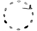
Falkner's Circle was an ancient stone circle located near the village of Avebury in Wiltshire, England. It was made from twelve huge stones called sarsens. The circle was about 37 metres (121 ft) wide, but today only one stone is still standing.
Stone circles like Falkner's Circle were built across Britain, Ireland, and Brittany during the Late Neolithic (New Stone Age) and Early Bronze Age. This was a long time ago, between 3300 and 900 BCE. We don't know exactly why these monuments were built. However, archaeologists think the stones might have represented special spirits or gods to the people who built them.
Falkner's Circle was built in a dry valley. It was placed at the southern end of a field that already had many natural sarsen stones. It's possible the builders simply stood up stones that were already there. This area was important to people even earlier, during the Mesolithic period (Middle Stone Age). The circle was also close to other big monuments from the Late Neolithic and Early Bronze Age, like the West Kennet Avenue and the famous Avebury stone circle.
Later, in the Iron Age, people used the site for a fireplace. Much later, in the 1600s and 1700s, many of the stones were pushed over and destroyed by fire. Most of the stones were already lying down by the 1600s. This might be why early explorers, called antiquarians, like John Aubrey and William Stukeley, didn't find it. The first known report of the circle came from a Mr. Falkner, who found it in 1840. Sadly, due to modern intensive farming, all the fallen stones were removed in the late 1800s or 1900s, destroying most of the circle. Archaeologists Mark Gillings and Joshua Pollard led an excavation at the site in 2002.
Contents
Where is Falkner's Circle?
Falkner's Circle is located about 750 meters south-east of Avebury. It sits at the bottom of a dry valley that stretches from Avebury to West Kennet. The archaeologist Aubrey Burl said it was "very close" to the large Avebury henge and stone circle.
Because of its location, Falkner's Circle is part of the "Stonehenge, Avebury and Associated Sites" UNESCO World Heritage Site. This means it's a very important historical place recognized around the world. The one stone that remains from the circle is also a Scheduled Ancient Monument. This gives it special protection under a law from 1979.
Why Were Stone Circles Built?
Around 3000 BCE, people in southern and eastern England started building different kinds of monuments. They stopped building older structures like long mounds and enclosures. Instead, they began creating circular monuments. These included earthen henges, wooden circles, and stone circles.
Stone circles are found in most parts of Britain where there are natural stones. They are most common in south-western Britain and north-eastern Scotland. People built these circles for a very long time, from about 3300 BCE to 900 BCE. The main period of building was between 3000 BCE and 1300 BCE.

Archaeologists have found very little evidence that people visited these stone circles often right after they were built. This suggests they weren't places for everyday rituals that would leave many traces. Instead, they might have been left as "silent and empty monuments." Some archaeologists, like Mike Parker Pearson, believe that in Neolithic Britain, stone was linked to the dead, while wood was linked to the living. Other experts think the stones might have represented gods or other supernatural beings.
In the area of modern Wiltshire, many stone circles were built. The most famous ones are Avebury and Stonehenge. All the other circles in Wiltshire are now ruined or have been destroyed. Falkner's Circle is one of four smaller stone circles known around Avebury. The others are The Sanctuary on Overton Hill, Winterbourne Bassett Stone Circle, and Clatford Stone Circle.
What Did Falkner's Circle Look Like?
Falkner's Circle originally had twelve stones. It was about 36.6 meters wide. Today, only one stone is left. The others were destroyed because of the growth of intensive farming in the 1900s. The single remaining stone is now part of a hedge line. It is about 250 meters east of the West Kennet Avenue.

The standing stone is 1.28 meters tall above the ground. It is about 2.10 meters wide at its base. It probably goes another 0.5 meters into the ground, making it about 2 meters long in total. The stone is covered in lichen (a type of moss-like growth) and has natural dips on top.
The grey sarsen stones used for Falkner's Circle were the same type as those used in the Avebury stone circle. They were also used in the two avenues connected to Avebury: West Kennet and Beckhampton. Falkner's Circle is at the southern edge of an area where many sarsen stones naturally lay. An early explorer, William Stukeley, recorded these natural stones in the 1700s, but farmers later removed them.
Archaeologists Mark Gillings and his team think that because the circle was built on the edge of this natural stone area, the builders might have seen it as a special, "in-between" place. They suggested that Falkner's Circle might have been "a monument to stones as opposed to one for people." It's possible the circle was made by simply standing up stones that were already there. If so, it would have been a mix of "nature" and "culture" working together.
During the 2002 excavations, archaeologists found several worked flints from the Mesolithic period (Middle Stone Age). These included a tiny stone tool called a microlith and a broken axe. Gillings and his team suggested that these Mesolithic flints are rare in the area. This might mean that this specific spot was important to people for a very long time, from the Mesolithic through the Neolithic.
Falkner's Circle is similar to the Clatford Stone Circle. Both had relatively few stones, were in valleys, and were about the same size as the outer ring of The Sanctuary. However, unlike The Sanctuary, Falkner's Circle did not start as a wooden circle that was later replaced by stone.
The exact connection between Falkner's Circle and other ancient structures around Avebury is not clear. You can see parts of the West Kennet Avenue from Falkner's Circle, but it doesn't directly connect to it. You cannot see the main Avebury henge and stone circles from Falkner's Circle because the land gently rises to the north. Compared to huge sites like Avebury henge, Silbury Hill, and West Kennet Avenue, Falkner's Circle is quite small. Gillings and his team thought that its importance to local people might have been only for a short time.
The Falkner's Circle may have served as a shrine for a single family or kin-group, marked a holy place within the landscape, or simply memorialised an important, even mythological, event that was deemed to have taken place there.
Later History and Discoveries
Based on his observations in the 1840s, Mr. Falkner believed there were once twelve stones in the circle. The 2002 excavation found five pits dug into the chalky ground. These pits were in an arc about 44 meters wide, spaced 13 to 17 meters apart. All of them had pieces of broken, burnt sarsen stone. If these pits formed a perfect circle with even spacing, it would suggest there were ten stones, not twelve as Falkner thought. However, stones in other circles are not always perfectly spaced, so twelve stones is still possible.
The excavation also found 1074 pieces of worked flint. Most of these were flakes from the Late Neolithic or Early Bronze Age. This shows that people were making flint tools at this spot. Three pieces of Grooved Ware pottery were also found. Archaeologists believe Falkner's Circle was probably built in the late 2000s BCE or early 1000s BCE.
Iron Age and Post-Medieval Activity
The 2002 excavation also found a pit at the site. This pit contained sarsen fragments that looked like they had broken from being exposed to heat. It also had carbonized (burnt) seeds. Scientists used radiocarbon dating to find out when these seeds were from. They dated to between 410-340 BCE and 310-200 BCE. This means the pit was used during the Middle Iron Age. It was likely a hearth, or fireplace.
Archaeologists also found a spread of fire-reddened clay and charcoal flakes, covering an area of about 10 meters by 4 meters. They think this was created in the period after the Middle Ages, when some of the stones were burned and destroyed. The excavation also found more recent animal burrows, one of which had the remains of at least two chickens.
How We Learned About Falkner's Circle
Early explorers of the Avebury area in the 1600s and 1700s, like John Aubrey, Stukeley, and Colt Hoare, did not describe Falkner's Circle. This was probably because most of the stones were lying down and hidden. The one standing stone was also hidden in a nearby hedge.
The first known record of the site came in 1840. A Mr. Falkner from Devizes wrote about finding the circle while riding his horse. His account was not published until 1858 by William Long. In that report, Falkner said he found one standing stone, two stones lying on the ground, and nine empty hollows where stones used to be. He also said there was no mound in the center of the circle, just flat ground.
Falkner's Circle was later included on an archaeological map in 1884 by Reverend A. C. Smith. This shows it was still known at that time. Smith said he found the site in the late 1870s. He probed the ground around the standing stone and dug up turf where he found buried stones. He found 22 small sarsen stones, which he believed were parts of the original circle stones. He noted that the northern, southern, and eastern parts of the circle were clear from these stones, but he found "scarcely a single stone" in the western part.
In August and September 2002, archaeologists Mark Gillings, Joshua Pollard, David Wheatley, and Rick Peterson led a four-week study of the circle. They used special equipment to scan the ground and also dug two trenches. They concluded that their findings supported Mr. Falkner's original claims of a stone circle at the site. However, they also noted that other interpretations of the evidence are possible.
Images for kids
-
Falkner's illustration of the circle, first published in 1858

