Fan Llia facts for kids
Quick facts for kids Fan Llia |
|
|---|---|

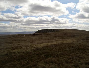
The summit of Fan Llia
|
|
| Highest point | |
| Elevation | 632 m (2,073 ft) |
| Prominence | 99 m (325 ft) |
| Parent peak | Fan Fawr |
| Listing | SubHuMP, Hewitt, Nuttall |
| Naming | |
| English translation | (the) peak near (the stream called) Llia |
| Language of name | Welsh |
| Geography | |
| Location | Powys, Wales |
| Parent range | Brecon Beacons |
| OS grid | SN937186 |
| Topo map | OS Landranger 160 |
Fan Llia is a cool mountain peak in the Brecon Beacons National Park in Wales. It's like a smaller helper peak next to a bigger one called Fan Fawr. You can find it in the Fforest Fawr area, which is part of the Brecon Beacons. This mountain is located in the county of Powys.
Fan Llia looks like a wide, long hill, stretching from the south-west to the north-east. Its highest point is 632 meters (about 2,073 feet) above sea level. To the north, there's another smaller peak called Fan Dringarth, which is 617 meters high. The northern part of the ridge ends sharply with cliffs known as Craig Cwm-du.
Contents
Ancient Discoveries on Fan Llia
You can find some interesting ancient sites on the sides of Fan Llia. These include several old house platforms, which are flat areas where people once built their homes long ago.
What Fan Llia is Made Of
Rocks and Landforms
Fan Llia is mostly made of sandstones from something called the Brownstones Formation. These rocks are part of the Old Red Sandstone and formed during the Devonian period, which was millions of years ago. The very bottom slopes of the mountain have sandstones from the Plateau Beds Formation. In the north-east, you'll find sandstones and mudstones from the Senni Beds Formation.
It's not easy to see the bare rocks because the hill is covered with dirt left behind by glaciers and layers of peat (decayed plant material). One cool feature is a huge landslip that happened after the last ice age. This landslip stretches from near the top of Fan Dringarth down its eastern side, almost to the Afon Dringarth river. This landslip might even be how Fan Dringarth got its name!
Ice Age History
During the Ice Age, a small glacier formed in the area called Craig Cwm-du, which is to the north of the mountain. This shows how cold and icy this region once was.
Water Around the Mountain
Water flows off Fan Llia in different directions. To the west, many small streams flow into the Afon Llia river. To the east, streams flow into the Afon Dringarth. Part of the Afon Dringarth has been dammed to create the Ystradfellte Reservoir, which is right next to the east side of the hill.
Fan Llia is also part of the Fforest Fawr Geopark. This area was given special recognition in 2005 because of its amazing geological history and features. It's like a natural museum of rocks and landforms!
How to Explore Fan Llia
Walking and Hiking
The entire area of Fan Llia is considered "open country." This means that walkers are allowed to explore freely across the land. Most people choose to start their walk from a car park run by Natural Resources Wales at a place called Blaen Llia. You can find it using the map reference SN 926165. This car park is just off a small road between the villages of Ystradfellte and Heol Senni.
The path that goes along the ridge of Fan Llia is also part of the Beacons Way, which is a long-distance walking trail. So, if you're looking for a great hike with amazing views, Fan Llia is a fantastic choice!
 | Chris Smalls |
 | Fred Hampton |
 | Ralph Abernathy |

