Florida State Road 44 facts for kids
Quick facts for kids
State Road 44 |
||||
|---|---|---|---|---|
|
SR 44 highlighted in red (eastern section signed as North Causeway)
|
||||
| Route information | ||||
| Maintained by FDOT | ||||
| Length | 102.786 mi (165.418 km) | |||
| Existed | 1945 renumbering (definition)–present | |||
| Western section | ||||
| Length | 49.155 mi (79.107 km) | |||
| West end | ||||
| Major junctions |
||||
| East end | ||||
| Central section | ||||
| Length | 52.198 mi (84.005 km) | |||
| West end | ||||
| Major junctions |
||||
| East end | ||||
| Eastern section (Signed as North Causeway) | ||||
| Length | 1.433 mi (2.306 km) | |||
| West end | North Riverside Drive in New Smyrna Beach | |||
| East end | Peninsula Avenue in New Smyrna Beach | |||
| Location | ||||
| Counties: | Citrus, Sumter, Lake, Volusia | |||
| Highway system | ||||
| Florida State and County Roads Interstate • US • SR (Pre-1945) • Toll • County
|
||||
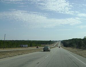
State Road 44 (often called SR 44) is a main road that goes from west to east across Florida. It starts in Crystal River on the Gulf of Mexico coast and stretches all the way to New Smyrna Beach on the Atlantic Ocean. Along its journey, it passes through several interesting towns like Inverness, Wildwood, Leesburg, and DeLand.
Part of SR 44 in Lake County shares its path with U.S. Highway 441. This means they run together for a bit, but you won't see signs for SR 44 there. Instead, signs on US 441 will say "TO SR 44." Also, an older part of SR 44 near Crystal River is now called County Road 44. Sometimes, it's even signed as County Road 44W.
Exploring State Road 44
SR 44 is a long road, stretching over 100 miles! Let's take a closer look at what you might see along the way.
From Crystal River to Inverness
SR 44 begins in Crystal River as NE 5TH ST, also known as Gulf to Lake Highway. It starts as a wide, four-lane road. As you leave Crystal River, the road turns slightly southeast. You'll pass by the new Suncoast Parkway Extension, which is a major toll road.
The road then becomes more divided, meaning there's a barrier or grassy area in the middle. It winds through hills and runs along the edge of the Withlacoochee State Forest. As you get closer to Inverness, the divider ends, and the road becomes a four-lane highway with a center lane for turns. When you enter Inverness, SR 44 becomes Main Street. Here, it briefly joins with US 41. The two roads curve around the historic Old Citrus County Courthouse before SR 44 splits off again, becoming Gulf-Atlantic Highway and a divided road once more.
From Inverness to Leesburg
After leaving Inverness, SR 44 crosses over the Withlacoochee State Trail, which is a popular path for bikes and walkers. It then follows the southern edge of Lake Henderson. The area around the road becomes very rural, with farms and parks, especially as it gets ready to cross the Withlacoochee River. This river marks the border between Citrus and Sumter counties.
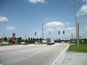
As SR 44 enters Wildwood, you'll see many truck stops, hotels, and places for travelers, especially around the interchange with Interstate 75 and Florida's Turnpike. These are major highways that connect different parts of Florida. The road then crosses over a CSX railroad line on a new bridge built in 2010, just before meeting US 301. After Wildwood, SR 44 continues its journey east, eventually crossing into Lake County.
Before reaching downtown Leesburg, SR 44 takes a turn onto a special bypass road called South Street. This helps trucks avoid the busy downtown area. South Street curves and then continues east, eventually meeting US 27. Here, SR 44 becomes West Dixie Avenue, turning northeast for a short bit before heading east again. It then becomes East Dixie Avenue and eventually joins with US 441.
From Leesburg to Mount Dora
The section where US 441 and SR 44 run together is a wide, six-lane road with special lanes for bikes. It passes by the Leesburg International Airport. This part of the road is quite scenic, as it goes between Lake Harris and Lake Eustis, crossing the Dead River on a bridge.
Further along, SR 44 briefly joins with State Road 19 as it passes through Tavares and Eustis. North of Mount Dora, SR 44 leaves US 441, which heads south towards Orlando. SR 44 then turns north and becomes a narrower, two-lane road. It winds between Lake Joanna and Loch Leven, passing by the Mid Florida Air Service Airport. Finally, it turns onto East Orange Avenue, continuing as a quiet, two-lane road through the countryside.
Through Seminole State Forest and DeLand
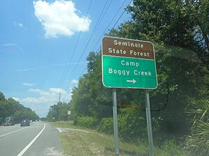
As SR 44 continues, it enters the beautiful Seminole State Forest. In a place called Crow's Bluff, SR 44 meets County Road 42 and then immediately crosses the St. Johns River on the Francis P. Whitehair Bridge. This bridge takes you into Volusia County. West of DeLand, SR 44 is called West New York Avenue. It goes over an Amtrak train line and then crosses another railroad track before reaching downtown DeLand.
When you get to downtown DeLand, SR 44 passes through the historic area and meets U.S. Route 17/92. Here, West New York Avenue becomes East New York Avenue. The road then curves southeast and becomes a four-lane divided highway again. It passes by a former section of SR 44 before reaching Interstate 4, another major highway.
Towards New Smyrna Beach
East of I-4, SR 44 remains a four-lane divided highway. You'll pass the New Smyrna Speedway on your way. The road then reaches Interstate 95, which is a very important highway connecting many states along the East Coast.
Finally, SR 44 enters New Smyrna Beach. Here, a business route, Florida State Road 44 Business, branches off as Canal Street. SR 44 itself becomes Lytle Avenue. The very last part of SR 44 goes over a bridge that crosses the Florida East Coast Railroad and U.S. Route 1. At this point, SR 44 becomes part of State Road A1A, which runs right along the coast!
History of State Road 44
SR 44 has changed a bit over the years. From 1945 until the mid-1960s, the section between US 17/92 in DeLand and US 1 in New Smyrna Beach was actually part of Florida State Road 40.
In Lake County, SR 44 used to go right through downtown Leesburg on Main Street. It would then join US 441 east of downtown. Later, it split off to the north on what is now County Road 44, passing north of Lake Eustis.
Around 1986, SR 44 was moved to its current path around the south side of Leesburg. This new path used to be parts of other state roads. Also, the section of SR 44 from US 441 east of Leesburg to State Road 19 north of Eustis was given to the county and became County Road 44. The route that goes through US 441 and SR 19 south of Lake Eustis became the new SR 44.
In 2005, SR 44 was rerouted again around downtown Eustis. It took over what was once County Road 44B. This made SR 44 a complete bypass around Eustis, helping traffic flow better.
Related Roads
SR 44 has a few "cousin" roads that are connected to it.
State Road 44 Business
| Location: | New Smyrna Beach |
|---|---|
State Road 44 Business is a special state road in New Smyrna Beach, Florida. Even though it's officially listed as SR 44 in some maps, you'll see signs that say "Business" on them. This road used to be the main SR 44 route that went through downtown New Smyrna Beach.
County Road 44W (Citrus County)
| West Fort Island Trail | |
|---|---|
| Location: | Fort Island-Crystal River |
County Road 44W is a small road that used to be the very western end of State Road 44, near Crystal River. The "W" in its name probably stands for "West," showing that it's west of US 19 and US 98. Like many roads near the coast in this part of Florida, it's now maintained by the county.
County Road 44A (Sumter County)
| County Road 44A | |
|---|---|
| Location: | Wildwood – Orange Home |
County Road 44A runs alongside State Road 44 in Wildwood and Orange Home. It starts southeast of the Interstate 75 interchange. This road winds through Wildwood, crossing a railroad track and US 301. For a while, it runs next to an old, unused railroad line before ending near a recreational vehicle park in Orange Home.
County Road 44 (Lake County)
|
|
|
|---|---|
| Location: | Leesburg – Mount Dora |
County Road 44 is a county road in Lake County. It goes from U.S. Route 441 near Leesburg in the west to State Road 44 near Mount Dora in the east.
This road starts where US 441 and SR 44 meet on the eastern side of Leesburg, close to Leesburg International Airport. From there, it heads northeast past Silver Lake and then east past Lake Eustis, eventually reaching the town of Eustis.
In Eustis, CR 44 meets State Road 19. Here, CR 44 actually splits into two parts. One part goes east to County Road 44A. The other part goes south with SR 19, then turns east on East Orange Avenue, passing Lake Joanna before ending at State Road 44 between Eustis and Mount Dora.
County Road 44A (Lake County)
|
|
|
|---|---|
| Location: | Umatilla – Mount Dora |
County Road 44A is another east-west county road in Lake County. It starts at State Road 19 in Umatilla. CR 44A heads east on Rose Street, then turns south. It passes County Road 450A before continuing south towards Eustis.
On the eastern side of Eustis, CR 44A meets one of the ends of County Road 44. It then turns east again onto DeLand Road. It continues on DeLand Road for about 9.4 miles (15.1 km), passing the Black Bear Golf Club, before reaching its end at State Road 44.
County Road 44B (Lake County)
|
|
|
|---|---|
| Location: | Mount Dora |
County Road 44B used to be a short north-south road near Mount Dora. In 2004, this road became part of State Road 44 when SR 44 was rerouted to go around downtown Eustis. The old part of SR 44 that went through Eustis then became County Road 44.
County Road 44C (Lake County)
|
|
|
|---|---|
| Location: | Mount Dora |
County Road 44C is also known as Eudora Road. It's a short north-south county road in the Mount Dora area. It connects Old County Road 441 and County Road 19A to US 441-SR 44, almost reaching the border between Mount Dora and Eustis.
 | Roy Wilkins |
 | John Lewis |
 | Linda Carol Brown |


