Folsom, New Jersey facts for kids
Quick facts for kids
Folsom, New Jersey
|
||
|---|---|---|
|
Borough
|
||
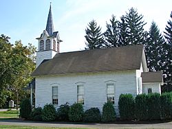
Jacobus Evangelical Lutheran Church
|
||
|
||
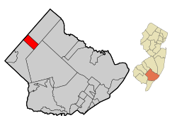
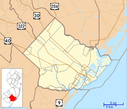
Location of Folsom in Atlantic County highlighted in red (left). Inset map: Location of Atlantic County in New Jersey highlighted in orange (right).
|
||
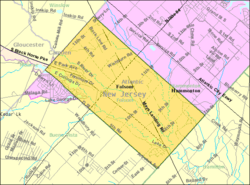
Census Bureau map of Folsom, New Jersey
|
||
| Country | ||
| State | ||
| County | Atlantic | |
| Incorporated | May 23, 1906 | |
| Named for | Frances Folsom | |
| Government | ||
| • Type | Borough | |
| • Body | Borough Council | |
| Area | ||
| • Total | 8.51 sq mi (22.04 km2) | |
| • Land | 8.26 sq mi (21.40 km2) | |
| • Water | 0.24 sq mi (0.63 km2) 2.88% | |
| Area rank | 226th of 565 in state 14th of 23 in county |
|
| Elevation | 56 ft (17 m) | |
| Population
(2020)
|
||
| • Total | 1,811 | |
| • Estimate
(2023)
|
1,813 | |
| • Rank | 494th of 565 in state 19th of 23 in county |
|
| • Density | 219.1/sq mi (84.6/km2) | |
| • Density rank | 499th of 565 in state 18th of 23 in county |
|
| Time zone | UTC−05:00 (Eastern (EST)) | |
| • Summer (DST) | UTC−04:00 (Eastern (EDT)) | |
| ZIP Code |
08037
|
|
| Area code(s) | 609 exchanges: 561, 567, 704 | |
| FIPS code | 3400123940 | |
| GNIS feature ID | 0885222 | |
| Website | ||
Folsom is a small town, or borough, located in Atlantic County, New Jersey. It's part of the South Jersey region. Folsom is also near bigger cities like Atlantic City and Philadelphia.
In 2020, about 1,811 people lived in Folsom. The number of people living here has changed a little over the years.
Folsom became an official borough on May 23, 1906. It was named after Frances Folsom, who was the wife of President Grover Cleveland. In 2008, New Jersey Monthly magazine even called Folsom one of the "Best Places To Live" in New Jersey!
Contents
Exploring Folsom's Geography
Folsom covers an area of about 8.51 square miles (22.04 square kilometers). Most of this area is land, but about 0.25 square miles (0.63 square kilometers) is water.
Nearby Towns and Communities
- Penny Pot is a small community found partly or fully within Folsom.
- Folsom shares its borders with several other towns. These include Buena Vista Township, Hamilton Township, and Hammonton in Atlantic County.
- It also borders Winslow Township in Camden County and Monroe Township in Gloucester County.
The Pinelands National Reserve
Folsom is special because it's located inside the New Jersey Pinelands National Reserve. This is a huge protected natural area, covering over 1.1 million acres. It's known for its unique plants and animals. The Pinelands was created by Congress in 1978 to protect this important environment.
People and Population in Folsom
| Historical population | |||
|---|---|---|---|
| Census | Pop. | %± | |
| 1910 | 232 | — | |
| 1920 | 217 | −6.5% | |
| 1930 | 219 | 0.9% | |
| 1940 | 229 | 4.6% | |
| 1950 | 292 | 27.5% | |
| 1960 | 482 | 65.1% | |
| 1970 | 1,767 | 266.6% | |
| 1980 | 1,892 | 7.1% | |
| 1990 | 2,181 | 15.3% | |
| 2000 | 1,972 | −9.6% | |
| 2010 | 1,885 | −4.4% | |
| 2020 | 1,811 | −3.9% | |
| 2023 (est.) | 1,813 | −3.8% | |
| Population sources: 1910–2000 1910–1920 1910 1910–1930 1940–2000 2000 2010 2020 |
|||
Folsom's Population in 2010
According to the 2010 United States census, there were 1,885 people living in Folsom. These people lived in 688 homes, and 526 of these were family homes. The population density was about 229.8 people per square mile.
Most of the people living in Folsom were White (90.93%). There were also Black or African American (4.19%), Asian (0.85%), and Native American (0.16%) residents. About 6.74% of the population identified as Hispanic or Latino.
The average age of people in Folsom was 41.8 years old. About 22.1% of the population was under 18 years old.
Education in Folsom
Folsom has its own school district, the Folsom Borough School District.
Folsom School District
- Students from pre-kindergarten through eighth grade attend the Folsom School.
- For the 2022–23 school year, there were 384 students and 41 teachers. This means there were about 9.4 students for every teacher.
High School Education
- After eighth grade, students go to Hammonton High School in Hammonton. This is part of a special agreement with the Hammonton Public Schools.
- In the 2022–23 school year, Hammonton High School had 1,357 students and 92.6 teachers.
Other School Options
- Students can also choose to attend special schools like the Atlantic County Institute of Technology. This school is in Mays Landing.
- Another option is the Charter-Tech High School for the Performing Arts, located in Somers Point.
Getting Around Folsom
Folsom has many roads for cars and trucks. As of 2010, there were about 27.69 miles of roads in the borough.
Major Roads and Highways
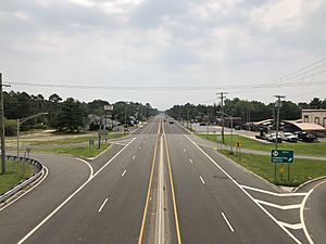
- U.S. Route 322 (also known as the Black Horse Pike) runs through Folsom. It connects Folsom to Monroe Township and Hamilton Township.
- New Jersey Route 54 goes from northeast to southwest. It links Folsom with Hammonton and Buena Vista Township.
- New Jersey Route 73 heads north from U.S. Route 322.
Public Transportation
- If you need to travel by bus, NJ Transit offers bus service on the 315 route. This route travels between Cape May and Philadelphia.
Famous People from Folsom
Many interesting people have connections to Folsom:
- Jimmy Horton (born 1956), a professional race car driver.
- Kenneth LeFevre (born 1945), who was a member of the New Jersey General Assembly from 1996 to 2002.
- E. B. Lewis (born 1956), a talented illustrator who won an award in 2006 for his work.
- Elizabeth Eckhardt May (1899–1996), an important home economist, educator, and college leader.
- G. R. Smith (born 1981), a professional Dirt Late Model driver and team owner. He also raced in NASCAR before.
See also
 In Spanish: Folsom (Nueva Jersey) para niños
 | Valerie Thomas |
 | Frederick McKinley Jones |
 | George Edward Alcorn Jr. |
 | Thomas Mensah |


