
Friuli Venezia Giulia facts for kids
Quick facts for kids
Friuli-Venezia Giulia
|
|||
|---|---|---|---|
|
|||
| Anthem: Incuintri al doman |
|||
 |
|||
| Country | Italy | ||
| Capital | Trieste | ||
| Government | |||
| • Body | Regional Council of Friuli-Venezia Giulia | ||
| Area | |||
| • Total | 7,924 km2 (3,059 sq mi) | ||
| Population
(31 August 2017)
|
|||
| • Total | 1,216,524 | ||
| • Density | 153.524/km2 (397.625/sq mi) | ||
| Demonym(s) | |||
| Time zone | UTC+1 (CET) | ||
| • Summer (DST) | UTC+2 (CEST) | ||
| ISO 3166 code | IT-36 | ||
| GDP (nominal) | €38 billion (2018) | ||
| GDP per capita | €31,200 (2018) | ||
| HDI (2021) | 0.905 very high · 7th of 21 |
||
| NUTS Region | ITD | ||
| Website | www.regione.fvg.it | ||


Friuli-Venezia Giulia is one of the 20 regions of Italy. It is a special autonomous region, meaning it has more control over its own laws. The capital city is Trieste, located on the Gulf of Trieste by the Adriatic Sea.
This region covers about 7,924 square kilometers and is home to around 1.2 million people. It's like a natural gateway to the sea for many countries in central Europe. Important transport routes between eastern and western Southern Europe pass through here. The region includes two main historical areas: Friuli and a part of Venezia Giulia. Each has its own unique history and traditions.
Contents
What's in a Name?
The region has different names because several languages are spoken there:
- Friûl Vignesie Julie in Friulian
- Furlanija Julijska krajina in Slovene
- Friaul Julisch Venetien in Austrian German
Even though "Venezia" (Venice) is in its name, the famous city of Venice is not part of this region.
Where the Names Come From
The name Friuli comes from the Latin term "Forum Julii". This was a busy trading center in Ancient Rome, which is now the city of Cividale. The name "Venezia Giulia" was suggested by an Italian linguist named Graziadio Isaia Ascoli. He wanted to highlight the Italian culture of that area.
A Look Back in Time

In Ancient Rome, the area of Friuli-Venezia Giulia was part of Roman Italy. You can still see signs of its Roman past everywhere. For example, the city of Aquileia, founded in 181 BC, was an important regional capital during the time of Emperor Augustus.
After the Lombards settled here in the 6th century, the histories of Friuli and Venezia Giulia started to become different. In 568, Cividale del Friuli became the capital of the first Lombard dukedom in Italy. Later, in 1077, the Holy Roman Emperor gave power to the Patriarchate of Aquileia, which ruled over eastern areas for a while. By the 12th century, Gorizia became independent, and Trieste became a free city-state.
Around the 6th century, Alpine Slavs, who are the ancestors of today's Slovenes, settled in the eastern parts of the region. They lived in the mountains of Friuli and near Gorizia and Trieste.

Friuli became part of the Republic of Venice in 1420. However, Trieste and Gorizia remained under the Holy Roman Empire. In 1797, Friuli was given to Austria. After a period under Napoleon, it became part of the Austrian Empire again. Trieste grew a lot during the 18th and 19th centuries, becoming a major port for the Habsburg empire. Later, Friuli joined the Kingdom of Italy.
During the First World War, this region was a major battleground. It suffered a lot of damage and many lives were lost. After the war, these borderlands became part of the Kingdom of Italy.
The Second World War led to a special administration in Trieste by the Americans and British. The final border was set in 1954. After Trieste returned to Italy, the special Autonomous Region of Friuli Venezia Giulia was finally created. The region's name was officially changed in 2001 to Friuli Venezia Giulia (without a hyphen).
Exploring the Geography
Friuli Venezia Giulia is Italy's most northeastern region. It covers about 7,858 square kilometers, making it the fifth smallest region in the country. It shares borders with Austria to the north and Slovenia to the east. To the south, it meets the Adriatic Sea, and to the west, it borders the Veneto region.
The region has many different climates and landscapes. It ranges from mild weather near the coast to cold, Alpine conditions in the north. About 42.5% of the region is mountainous, 19.3% is hilly, and 38.2% is made up of central and coastal plains.

The region has four main geographical areas:
- The mountainous north: This area includes the Carnic Alps and Julian Alps, with peaks over 2,700 meters high. You'll find large pine forests, pastures, mountain lakes, and many small rivers here. It's also a popular spot for winter sports.
- The hilly area: Located south of the mountains, this area is famous for its wine, especially white wines. The eastern part of this area is called Slavia Friulana, where many ethnic Slovenes live.
- The central plains: This flat area has been made fertile with irrigation and modern farming. Most of the region's farming happens here.
- The coastal area: This part is divided by the Isonzo river. To the west, the coast is sandy with tourist resorts and lagoons like Grado. To the east, the coastline has cliffs where the Karst Plateau meets the Adriatic Sea, leading to Trieste. The Karst area has interesting underground caves and rivers.

Rivers in the region flow from the north and Slovenia into the Adriatic Sea. The two main rivers are the Tagliamento and the Isonzo. The Timavo is a unique underground river that flows from Slovenia and reappears near the sea.
The region has a temperate climate, but it changes a lot depending on the area. The Alps protect the north, but the region is open to air from the east and west. The warm Sirocco wind from the Adriatic Sea brings heavy rain. Along the coast, the climate is mild. In the mountains, it's an Alpine-continental climate, with some of Italy's coldest winter temperatures. The Karst plateau has its own weather, often influenced by the strong, cold north-easterly wind called Bora, which can reach speeds over 150 km/h.
Economy and Transport

The economy of Friuli Venezia Giulia is very strong. It's built on many small and medium-sized businesses, special farming, and high-quality tourism. The region also exports many products.
Farming is still very important. Products like fruits, vegetables, cheese, cured ham, and wines are exported worldwide. The region is also a big producer of soy and timber.
Many specialized businesses are grouped into industrial districts. For example, Manzano is known for chairs, San Daniele del Friuli for cured ham, Maniago for knives, and Brugnera for furniture. There are also large companies here that are world leaders, such as Fincantieri (shipbuilding), Zanussi-Electrolux (appliances), and major insurance companies like Allianz Italia and Assicurazioni Generali.

The city of Trieste is a major center for services, including regional government, banking, and insurance. The unemployment rate in the region was 5.7% in 2020.
Getting Around
Trieste's commercial Free Port is very important for trade. It has special rules that help businesses. It's a key center for coffee trade and connects northern and eastern Europe.
Even though the region is small, it's a vital link between Italy and Central and Eastern Europe. Its transport network is excellent. There are over 200 km of highways connecting the region to Austria and Slovenia. The railway network has about 500 km of tracks, linking Venice, Trieste, Udine, and Austria. These networks connect to the ports of Trieste, Monfalcone, and Porto Nogaro, which are the northernmost ports in the Mediterranean. Trieste's free port has been active since 1719 and has a huge storage capacity.
The regional airport at Ronchi dei Legionari is close to Trieste and Udine, and it's well-connected to highways and railways. It offers flights to many national and international destinations. The region hopes to build a high-speed European Transport Corridor to improve trade with new EU partners.
Population and People
| Historical population | ||
|---|---|---|
| Year | Pop. | ±% |
| 1871 | 508,000 | — |
| 1881 | 530,000 | +4.3% |
| 1901 | 615,000 | +16.0% |
| 1911 | 728,000 | +18.4% |
| 1921 | 1,178,000 | +61.8% |
| 1931 | 1,176,000 | −0.2% |
| 1936 | 1,108,000 | −5.8% |
| 1951 | 1,226,000 | +10.6% |
| 1961 | 1,204,000 | −1.8% |
| 1971 | 1,214,000 | +0.8% |
| 1981 | 1,234,000 | +1.6% |
| 1991 | 1,198,000 | −2.9% |
| 2001 | 1,184,000 | −1.2% |
| 2011 | 1,235,000 | +4.3% |
| 2017 | 1,217,872 | −1.4% |
| Source: ISTAT 2001 | ||
The number of people living in Friuli-Venezia Giulia per square kilometer is lower than the average for Italy. In 2008, there were about 157.5 people per square kilometer. However, this number changes a lot depending on the area. For example, Trieste has a much higher population density than Udine.
While fewer babies are being born, more people are moving into the region. This helps keep the population from decreasing too much. In 2008, about 6.7% of the total population were foreign residents.
Government and How it Works
.jpg)
Friuli Venezia Giulia became an autonomous region within Italy on February 16, 1963. This means it has special powers to make its own laws.
The President of the Regional Government is the head of the region. The Regional Government of Friuli Venezia Giulia handles the daily running of the region, and the Regional Council makes the laws. In the 2018 election, Massimiliano Fedriga was elected president.
Local Divisions
Like other parts of Italy, Friuli Venezia Giulia used to be divided into four provinces: Gorizia, Pordenone, Trieste, and Udine. These provinces were officially ended between 2017 and 2018.
To replace the provinces, the Regional Council created 18 "Intermunicipal Territorial Unions" (called Unioni Territoriali Intercomunali, or UTI). These UTIs now handle local services that towns used to manage. They also take on some responsibilities that the provinces used to have. This new system helps with planning and budgeting for the 215 towns in the region.


Culture and Languages

The official languages of the region are Italian, Friulian, Slovene, and German.
Italian is the main national language. Friulian language is spoken in most of the region. However, in places like Trieste and around Monfalcone and Grado, a version of the Venetian language is spoken instead. Venetian is also common in the western part of the Province of Pordenone. Friulian and Venetian are more common in the countryside, while standard Italian is used more in bigger towns like Udine, Pordenone, and Gorizia. The region is also home to Italy's Slovene-speaking minority.

Regional Flag
A popular symbol for the Friulian people is the Friulian Historical Flag. The official flag of Friuli-Venezia Giulia, adopted in 2001, is inspired by this older flag. The historical symbol of the eagle has been used since at least the 13th century, from the time of the Patriarchate of Aquileia.
Images for kids
-
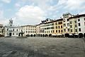
Piazza San Giacomo in Udine
-
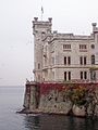
The Miramare Castle in Trieste
-
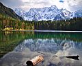
The lake of Fusine in Valromana
-
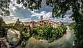
The Devil's Bridge in Cividale del Friuli
-
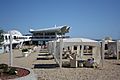
Terrazza Mare in Lignano Sabbiadoro
-
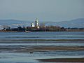
The Grado lagoon
-
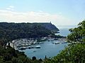
The bay of Sistiana
-
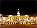
Piazza Unità d'Italia in Trieste
-
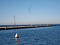
The sea in Trieste
-
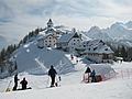
Sanctuary in Mount Lussari, Tarvisio
-
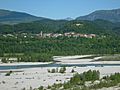
The Tagliamento river near Pinzano
-
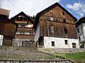
Typical houses in Carnia


.jpeg)
.jpg)


See also
 In Spanish: Friul-Venecia Julia para niños
