Fort Stockton, Texas facts for kids
Quick facts for kids
Fort Stockton, Texas
|
|
|---|---|
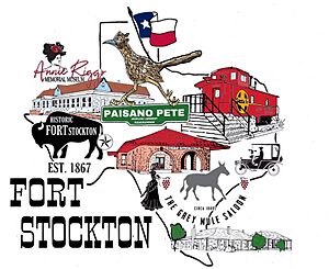
Historical places in Fort Stockton
|
|
| Nickname(s):
"Stockton; Stakitas"
|
|
| Motto(s):
The Heart of Pecos County
|
|
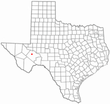
Location of Fort Stockton, Texas
|
|
 |
|
| Country | United States |
| State | Texas |
| County | Pecos |
| Area | |
| • Total | 5.55 sq mi (14.37 km2) |
| • Land | 5.55 sq mi (14.37 km2) |
| • Water | 0.00 sq mi (0.00 km2) |
| Elevation | 2,972 ft (906 m) |
| Population
(2020)
|
|
| • Total | 8,466 |
| • Density | 1,422.3/sq mi (549.14/km2) |
| Time zone | UTC-6 (Central (CST)) |
| • Summer (DST) | UTC-5 (CDT) |
| ZIP code |
79735
|
| Area code(s) | 432 |
| FIPS code | 48-26808 |
| GNIS feature ID | 1357597 |
Fort Stockton is a city in Pecos County, Texas, United States. It is also the county seat, which means it's where the county government is located. The city is found along major roads like Interstate 10 and several U.S. Highways. It's about 329 miles (529 km) northwest of San Antonio and 240 miles (386 km) southeast of El Paso. In 2020, about 8,466 people lived there.
Contents
History
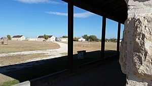
Fort Stockton began as a military post in 1859. It was first called Camp Stockton. The fort was built near Comanche Springs, which was a huge source of fresh water in Texas. The fort was named after Robert F. Stockton.
Comanche Springs was a popular resting spot for travelers. People used it on the Great Comanche Trail to Chihuahua, the San Antonio-El Paso Road, and the Butterfield Overland Mail route. A journalist named Albert D. Richardson visited in 1859. He described Camp Stockton as a military post with a few buildings and misty mountains nearby.
During the American Civil War, the fort was taken over by Confederate soldiers in 1861. However, they soon left West Texas in 1862.
In 1867, the U.S. Army rebuilt Fort Stockton. They made it larger and more permanent. This fort was part of a system of frontier forts. These forts helped protect settlers and control the area.
On July 21, 1867, the fort was reoccupied by soldiers. These included the 9th U.S. Cavalry Regiment, known as buffalo soldiers. A new fort was built nearby. The Army finally left Fort Stockton on June 27, 1886.
After the Army left, people from San Antonio saw a chance to use the spring water for farming. They bought large areas of land. In 1868, Peter Gallagher bought the land around the fort and Comanche Springs. He planned a town called Saint Gaul and opened two stores.
By 1870, Saint Gaul had about 420 people. Many were Irish, German, and Mexican Catholics. The first church in Saint Gaul was Catholic. When Pecos County was officially formed in 1875, Saint Gaul became the county seat. However, people didn't like the name Saint Gaul. So, on August 13, 1881, the town was officially renamed Fort Stockton.
By 1870, some settlers started using water from the Pecos River for farming. By 1945, about 12,900 acres (5,220 ha) were irrigated. In the 1950s, new wells were drilled that took water from the same underground source that fed Comanche Springs. This led to a lawsuit.
The court case was about who owned the groundwater. The court decided that groundwater was "too mysterious to regulate." This meant that landowners could pump as much water as they wanted from beneath their land. This decision is called "the rule of capture." By the late 1950s, Comanche Springs dried up because of all the pumping. This event is often called a sad example of how humans can harm nature.
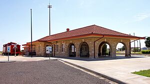
After the military fort closed in 1886, and major railroads bypassed the town, Fort Stockton faced a tough time. But it soon became a center for sheep and cattle ranching. In 1926, the discovery of the nearby Yates Oil Field brought a big economic boost. Later, the Kansas City, Mexico and Orient Railway also came to Fort Stockton.
Fort Stockton is about 100 miles (161 km) southwest of Midland International Airport. It's also close to the Big Bend area. This includes Big Bend National Park, about 137 miles (220 km) away, and Big Bend Ranch State Park, about 171 miles (275 km) away. These places offer beautiful scenery for day trips.
Geography
Fort Stockton covers a total area of about 5.1 square miles (13.2 square kilometers). All of this area is land.
Demographics
| Historical population | |||
|---|---|---|---|
| Census | Pop. | %± | |
| 1920 | 1,297 | — | |
| 1930 | 2,695 | 107.8% | |
| 1940 | 3,294 | 22.2% | |
| 1950 | 4,444 | 34.9% | |
| 1960 | 6,373 | 43.4% | |
| 1970 | 8,283 | 30.0% | |
| 1980 | 8,688 | 4.9% | |
| 1990 | 8,524 | −1.9% | |
| 2000 | 7,846 | −8.0% | |
| 2010 | 8,283 | 5.6% | |
| 2020 | 8,466 | 2.2% | |
Demographics tell us about the people who live in a place. This includes their age, race, and how many households there are.
2020 census
| Race | Number | Percentage |
|---|---|---|
| White (NH) | 1,531 | 18.08% |
| Black or African American (NH) | 253 | 2.99% |
| Native American or Alaska Native (NH) | 8 | 0.09% |
| Asian (NH) | 91 | 1.07% |
| Some Other Race (NH) | 20 | 0.24% |
| Mixed/multiracial (NH) | 87 | 1.03% |
| Hispanic or Latino | 6,476 | 76.49% |
| Total | 8,466 |
In 2020, Fort Stockton had 8,466 residents. There were 3,030 households and 2,014 families living in the city.
2010 census
In 2010, the city had 8,535 people. Most of the population, about 71%, was Hispanic or Latino.
Education
The Fort Stockton Independent School District serves the city of Fort Stockton.
Fort Stockton has two elementary schools: Alamo Elementary and Apache Elementary. Apache Elementary is for kindergarten and 1st grade. Alamo Elementary is for 2nd and 3rd grade. Fort Stockton Intermediate School teaches grades 4–5. Fort Stockton Middle School is for grades 6–8. Fort Stockton High School serves grades 9–12.
The city also uses the old Alamo school building for its Recreation Department. They host Little League games there. Butz High School is now used for alternative education programs. There are also preschool and childcare options in town.
Higher education
Fort Stockton has a Texas A&M Agrilife Extension Office. This office offers courses on managing environmental systems.
The city is also home to the Midland College Williams Regional Technical Training Center. This center was built in 1996. It helps provide higher education and job training for people in West Texas. The center was named after Clayton Williams Jr., who was from Fort Stockton and helped fund it.
Climate
Fort Stockton has a hot semi-arid climate. This means it's generally hot and dry. The hottest temperature ever recorded in Fort Stockton was 117 °F (47 °C) on June 29, 1974. The coldest temperature recorded was -6 °F (-21 °C) on February 2, 1985.
| Climate data for Fort Stockton, Texas, 1991–2020 normals, extremes 1940–present | |||||||||||||
|---|---|---|---|---|---|---|---|---|---|---|---|---|---|
| Month | Jan | Feb | Mar | Apr | May | Jun | Jul | Aug | Sep | Oct | Nov | Dec | Year |
| Record high °F (°C) | 88 (31) |
93 (34) |
98 (37) |
103 (39) |
108 (42) |
117 (47) |
112 (44) |
109 (43) |
106 (41) |
105 (41) |
92 (33) |
94 (34) |
117 (47) |
| Mean maximum °F (°C) | 80.0 (26.7) |
84.0 (28.9) |
89.5 (31.9) |
95.1 (35.1) |
101.1 (38.4) |
104.5 (40.3) |
102.9 (39.4) |
101.7 (38.7) |
98.2 (36.8) |
94.2 (34.6) |
85.2 (29.6) |
80.2 (26.8) |
106.4 (41.3) |
| Mean daily maximum °F (°C) | 60.7 (15.9) |
65.3 (18.5) |
72.9 (22.7) |
81.2 (27.3) |
88.7 (31.5) |
94.3 (34.6) |
94.4 (34.7) |
94.5 (34.7) |
87.8 (31.0) |
81.0 (27.2) |
68.9 (20.5) |
61.2 (16.2) |
79.2 (26.2) |
| Daily mean °F (°C) | 48.3 (9.1) |
52.2 (11.2) |
59.4 (15.2) |
66.9 (19.4) |
75.2 (24.0) |
81.6 (27.6) |
82.7 (28.2) |
82.4 (28.0) |
76.0 (24.4) |
67.9 (19.9) |
56.0 (13.3) |
49.1 (9.5) |
66.5 (19.2) |
| Mean daily minimum °F (°C) | 35.8 (2.1) |
39.0 (3.9) |
45.9 (7.7) |
52.7 (11.5) |
61.7 (16.5) |
68.9 (20.5) |
71.0 (21.7) |
70.3 (21.3) |
64.2 (17.9) |
54.9 (12.7) |
43.1 (6.2) |
37.0 (2.8) |
53.7 (12.1) |
| Mean minimum °F (°C) | 21.3 (−5.9) |
23.8 (−4.6) |
29.2 (−1.6) |
36.6 (2.6) |
47.6 (8.7) |
60.7 (15.9) |
64.6 (18.1) |
63.6 (17.6) |
51.7 (10.9) |
38.2 (3.4) |
28.4 (−2.0) |
22.2 (−5.4) |
17.3 (−8.2) |
| Record low °F (°C) | 4 (−16) |
−6 (−21) |
1 (−17) |
24 (−4) |
32 (0) |
41 (5) |
55 (13) |
51 (11) |
34 (1) |
22 (−6) |
13 (−11) |
1 (−17) |
−6 (−21) |
| Average precipitation inches (mm) | 0.65 (17) |
0.46 (12) |
0.58 (15) |
0.79 (20) |
1.41 (36) |
1.85 (47) |
1.79 (45) |
1.76 (45) |
1.97 (50) |
1.29 (33) |
0.62 (16) |
0.49 (12) |
13.66 (348) |
| Average snowfall inches (cm) | 0.5 (1.3) |
0.1 (0.25) |
0.0 (0.0) |
0.0 (0.0) |
0.0 (0.0) |
0.0 (0.0) |
0.0 (0.0) |
0.0 (0.0) |
0.0 (0.0) |
0.0 (0.0) |
0.0 (0.0) |
0.8 (2.0) |
1.4 (3.55) |
| Average precipitation days (≥ 0.01 in) | 3.1 | 2.2 | 2.4 | 2.2 | 4.7 | 4.4 | 4.7 | 4.4 | 5.0 | 3.9 | 2.4 | 2.7 | 42.1 |
| Average snowy days (≥ 0.1 in) | 0.2 | 0.2 | 0.0 | 0.0 | 0.0 | 0.0 | 0.0 | 0.0 | 0.0 | 0.0 | 0.0 | 0.2 | 0.6 |
| Source 1: NOAA | |||||||||||||
| Source 2: National Weather Service | |||||||||||||
Area ranches
La Escalera Ranch is a very large ranch near Fort Stockton. It covers about 257,000 acres (104,000 ha). The Fort Stockton part of the ranch is 223,000 acres (90,245 ha) and is located in Pecos and Brewster Counties.
For over 100 years, this land was known as the Elsinore Ranch. In 1992, Gerald Lyda bought it, made it bigger, and changed its name to La Escalera Ranch. "La Escalera" means "the ladder" in Spanish.
The Fort Stockton part of the ranch is known for its wildlife. You can find desert mule deer, pronghorns, elk, and Barbary sheep (also called aoudad). There are also coyotes, bobcats, Rio Grande turkeys, and quail.
The historic Comanche War Trail runs through the Fort Stockton ranch. Also, the famous Sierra Madera crater is located on the ranch. La Escalera Ranch is known as one of the largest ranches in Texas.
Notable people
- Walter L. Buenger (born 1951), a historian who grew up in Fort Stockton. He studies Texas and the American South at Texas A&M University.
- Gerald Lyda, a building contractor from Texas who owned La Escalera Ranch.
- Blaine McCallister, a professional golfer.
- Annie F. Riggs, a pioneer woman and hotel owner.
See also
 In Spanish: Fort Stockton para niños


