Gainesville, Virginia facts for kids
Quick facts for kids
Gainesville, Virginia
|
|
|---|---|
|
Census-designated place (CDP)
|
|

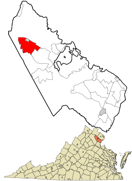
Location in Prince William County and Virginia
|
|
| Country | United States |
| State | Virginia |
| County | Prince William |
| Area | |
| • Total | 10.3 sq mi (26.6 km2) |
| • Land | 9.7 sq mi (25.2 km2) |
| • Water | 0.6 sq mi (1.5 km2) |
| Elevation | 354 ft (108 m) |
| Population
(2020)
|
|
| • Total | 17,287 |
| • Density | 1,150.2/sq mi (174.1/km2) |
| Time zone | UTC−5 (Eastern (EST)) |
| • Summer (DST) | UTC−4 (EDT) |
| ZIP Codes |
20155-20156
|
| Area code(s) | 703, 571 |
| FIPS code | 51-30176 |
| GNIS feature ID | 1494951 |
Gainesville is a community located in western Prince William County, Virginia, in the United States. It is called a "census-designated place" (CDP) because it's a special area the government uses for counting people. In 2020, about 17,287 people lived there.
Contents
History
Gainesville was once a busy stop for stagecoaches. These were like old-time buses pulled by horses. Drivers would stop here to switch to fresh horses. Before it was called Gainesville, the area had two other names. During the colonial era, it was known as the "Middle Grounds." This was because it was located between two streams, Broad Run and Bull Run.
The 1800s
In the early 1800s, a man named Samuel Love started building a major road. This road was called the Warrenton-Alexandria Turnpike. Where this road crossed the "Middle Grounds," a new stable was built. This stable was for stagecoach drivers to change horses. Soon, other businesses opened nearby. Because of the new stable, the settlement became known as New Stable.
In 1846, a post office opened in New Stable. It was inside Richard Graham's hotel and store. Mr. Graham also ran a large stable for travelers. The person who helped bring the railroad to the village was Thomas Brawner Gaines (1814-1856). He started buying land in the area as early as 1835. He later became a very important landowner.
In 1850, Thomas Brawner Gaines sold some of his land to the Manassas Gap Railroad. This land was for the railroad tracks to go through his property. The tracks followed the Warrenton Turnpike. The railroad was finished in 1854, reaching Strasburg, Virginia. Gaines then gave more land for a train station. He had one condition: the train stop had to be named after him. By 1856, a small community grew around the Gainesville train station. It even had its own post office.
The 1900s
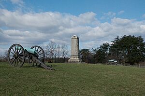
Gainesville became an important place for shipping goods. Farmers sent grain, timber, and cattle from here. It remained a major cattle shipping point until the early 1960s. During the American Civil War, both Confederate and Union armies used Gainesville. A nearby mountain pass, Thoroughfare Gap, was a path for soldiers. They used it to reach the First and Second battles of Bull Run.
Until the early 1940s, the Southern Railway ran passenger trains through Gainesville. These trains connected places like Harrisonburg and Strasburg Junction to Manassas and Washington's Union Station. In 1994, construction began on Gainesville's first townhome community. It was called Crossroads. This was the start of a lot of new building in Gainesville.
The 2000s
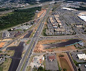
In 2006, the VDOT started planning a big road project. It was called the Gainesville Interchange improvement project. Construction officially began in July 2011. The goal was to make traffic flow better in the fast-growing Gainesville-Haymarket area. The project was finished on July 9, 2015.
Geography
Gainesville is located at 38°47′41″N 77°37′14″W / 38.79472°N 77.62056°W. According to the U.S. Census Bureau, the community covers about 10.3 square miles (26.6 square kilometers). Most of this area, 9.7 square miles (25.2 square kilometers), is land. The rest, 0.6 square miles (1.5 square kilometers), is water.
Climate
Gainesville has a humid subtropical climate. This means it has mild winters, but sometimes it gets very cold for a short time. Summers are hot and humid, with many thunderstorms. Spring and autumn are usually warm and pleasant. January is the coldest month. High temperatures are around 45°F (7°C), and lows are around 25°F (-4°C). July is the warmest month. Highs are around 90°F (32°C), and lows are around 65°F (18°C).
| Climate data for Gainesville, Virginia | |||||||||||||
|---|---|---|---|---|---|---|---|---|---|---|---|---|---|
| Month | Jan | Feb | Mar | Apr | May | Jun | Jul | Aug | Sep | Oct | Nov | Dec | Year |
| Mean daily maximum °F (°C) | 44.1 (6.7) |
50.5 (10.3) |
58.0 (14.4) |
68.7 (20.4) |
75.3 (24.1) |
86.2 (30.1) |
90.0 (32.2) |
87.8 (31.0) |
83.3 (28.5) |
72.4 (22.4) |
58.6 (14.8) |
49.1 (9.5) |
68.7 (20.4) |
| Mean daily minimum °F (°C) | 25.6 (−3.6) |
29.1 (−1.6) |
36.6 (2.6) |
42.4 (5.8) |
52.3 (11.3) |
60.8 (16.0) |
67.1 (19.5) |
64.8 (18.2) |
58.7 (14.8) |
46.3 (7.9) |
36.2 (2.3) |
28.3 (−2.1) |
45.7 (7.6) |
| Average precipitation inches (mm) | 2.6 (66) |
2.5 (64) |
2.8 (71) |
2.9 (74) |
3.7 (94) |
3.2 (81) |
3.1 (79) |
3.2 (81) |
3.3 (84) |
3.1 (79) |
3.1 (79) |
2.7 (69) |
36.2 (920) |
| Source: Weatherbase | |||||||||||||
People and Population

In 2010, Gainesville was the third-largest community in Prince William County. There were 11,481 people living in about 3,959 homes. About 3,100 of these were families.
In 2000, there were 4,383 people living in Gainesville. Most people, about 88.77%, were White. About 6.80% were African American. Other groups included Native American, Asian, and Pacific Islander people. About 3.77% of the population was Hispanic or Latino.
About 32.8% of homes had children under 18 living there. Most homes, 67.2%, were married couples living together. The average home had 2.55 people. The average family had 2.91 people.
About 24.4% of the people were under 18 years old. About 36.7% were between 25 and 44 years old. The average age in Gainesville was 36 years.
Modern Development
Since the year 2000, Gainesville has grown a lot. Many new homes and businesses have been built. There are now six large shopping centers in Gainesville. The biggest shopping area is where I-66 and Lee Highway (Route 29) meet. It has many large stores.
There were plans to build a new train station for the VRE (Virginia Railway Express) in Gainesville. This station would have connected the area to Fairfax County, Manassas, and Washington, D.C. by commuter rail. It was supposed to open in 2022. However, the VRE Operations Board decided not to build the new station. Instead, they chose to improve the existing train station in Broad Run.
See also
 In Spanish: Gainesville (Virginia) para niños
 | Precious Adams |
 | Lauren Anderson |
 | Janet Collins |


