Garibaldi Lake volcanic field facts for kids
Quick facts for kids Garibaldi Lake volcanic field |
|
|---|---|

|
|
| Highest point | |
| Elevation | 2,316 m (7,598 ft) |
| Geography | |
| Location | British Columbia, Canada |
| Parent range | Garibaldi Ranges |
| Geology | |
| Age of rock | Holocene |
| Mountain type | Volcanic field |
| Volcanic arc/belt | Canadian Cascade Arc Garibaldi Volcanic Belt |
| Last eruption | Holocene |
The Garibaldi Lake volcanic field is a special area in British Columbia, Canada. It's not just one volcano, but a group of nine smaller volcanoes and vents. These volcanoes were formed a very long time ago, during the late Pleistocene and early Holocene periods. That's between 1.3 million years ago and about 9,000 years ago!
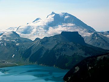
This volcanic field is found near the beautiful Garibaldi Lake, just north of Mount Garibaldi. The volcanoes here are mostly a type called stratovolcanoes. These are cone-shaped volcanoes built up by many layers of hardened lava and ash.
Contents
What is the Garibaldi Lake Volcanic Field?
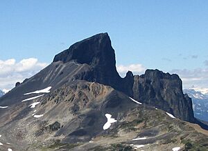
The Garibaldi Lake volcanic field is a place where many volcanoes have erupted over a long time. It's like a neighborhood of volcanoes! The oldest volcano here is called The Black Tusk. It started forming about 1.3 million years ago. After a long time, glaciers carved away parts of it. Then, new lava flows created its top part.
Other volcanoes in this area are located near the Cheakamus River. One of them, called Cinder Cone, created a very long lava flow, about 9 kilometers (5.6 miles) long. This happened during the late Pleistocene or early Holocene.
Volcanoes of the Field
The Black Tusk

The Black Tusk is the oldest volcano in this field. It formed between 1.3 and 1.1 million years ago. Imagine how much has changed since then! After glaciers shaped it, new lava flows built up its peak.
Mount Price
Mount Price is located west of Garibaldi Lake. It's about 5 kilometers (3 miles) south of The Black Tusk. This volcano was formed in three main stages, starting 1.1 million years ago. Its most recent activity created two huge lava flows from a spot called Clinker Peak. These lava flows happened about 9,000 years ago. They flowed against a giant sheet of ice that was melting. This created a natural dam called The Barrier, which holds back Garibaldi Lake.
The Table
The Table is a unique, flat-topped volcano. It's about 3 kilometers (1.9 miles) southwest of Mount Price. It looks like a giant table rising 305 meters (1,000 feet) above the ground. This type of volcano is called a tuya. A tuya forms when lava erupts under a thick glacier or ice sheet. Scientists believe The Table also formed during the early Holocene period.
Clinker Peak
Clinker Peak is a part of Mount Price. It's located on the west side of Garibaldi Lake. About 9,000 years ago, Clinker Peak produced two very large lava flows. These flows were important because they helped create The Barrier, which keeps Garibaldi Lake in place.
Mount Brew
Mount Brew is another interesting volcano in the area. It's known as a subglacial mound. This means it formed under a glacier or ice sheet. Its last eruption happened during the Pleistocene period.
Dangers and Safety

Even though these volcanoes haven't erupted recently, there are still some things to be aware of.
Volcanic Eruptions
If future eruptions happen in this area, they could affect nearby towns like Whistler and Squamish. Even smaller eruptions could create a lot of volcanic ash. This ash could cause problems for people living nearby and for airplanes flying in the sky. Ash clouds can rise very high, making air travel dangerous.
The Barrier and Garibaldi Lake
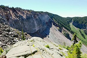
One of the biggest concerns is The Barrier. This natural dam is made of old lava and rock. It holds back the huge amount of water in Garibaldi Lake. In the past, parts of The Barrier have collapsed, causing large debris flows. These are like fast-moving rivers of mud and rocks. One such event happened in 1855-56, creating the rocky area known as Rubble Creek.
Because of worries about The Barrier becoming unstable, the government declared the area below it unsafe in 1981. This led to the town of Garibaldi being moved to a safer place. If The Barrier were to completely collapse, all the water from Garibaldi Lake would rush out. This would cause huge damage to the Cheakamus River and Squamish River areas, including the town of Squamish. It could even create a large wave in Howe Sound that might reach Vancouver Island.
 | James B. Knighten |
 | Azellia White |
 | Willa Brown |

