Georgetown, Guyana facts for kids
Quick facts for kids
Georgetown
|
|||
|---|---|---|---|
|
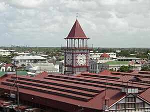
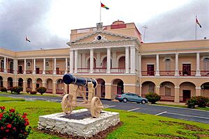
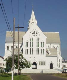
Stabroek Market Clock, View of St George's Cathedral, Guyana Parliament Building
|
|||
|
|||
| Nickname(s):
Garden City of the Caribbean
|
|||
| Country | |||
| Region | Demerara-Mahaica | ||
| Established | 1781 | ||
| Named | 29 April 1812 | ||
| Government | |||
| • Type | Mayor-Council | ||
| Area | |||
| • Total | 70 km2 (30 sq mi) | ||
| Elevation | 0 m (0 ft) | ||
| Population
(2012)
|
|||
| • Total | 118,363 | ||
| • Density | 1,690/km2 (4,380/sq mi) | ||
| Time zone | UTC-04:00 (Guyana Time) | ||
| • Summer (DST) | (Not Observed) | ||
| Climate | Af | ||
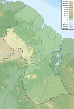
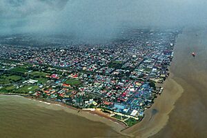
Georgetown is the capital and largest city in Guyana. It is located on the Atlantic Ocean coast, where the Demerara River meets the sea. Georgetown is often called the "Garden City of the Caribbean" because of its many green spaces.
This city is the main place for shopping, government, and money services in Guyana. A big part of Guyana's economy comes from Georgetown. In 2012, about 118,363 people lived here.
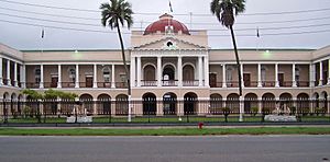
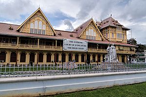
All the main government offices of Guyana are in Georgetown. This includes the Parliament Building and the Court of Appeals, which is Guyana's highest court. The State House, where the president lives, is also in the city. Georgetown is also home to the Caribbean Community (CARICOM), a group of 15 countries that work together.
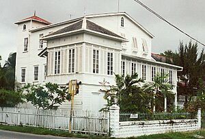
The city is famous for its old British colonial buildings. These include the tall, wooden St. George's Cathedral and the well-known Stabroek Market.
Contents
History of Georgetown
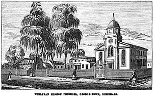
Georgetown started as a small town in the 1700s. The first capital of the Demerara-Essequibo colony was on Borsselen Island, controlled by the Dutch. In 1781, the British took over. Lieutenant-Colonel Robert Kingston chose the mouth of the Demerara River for a new town. This town was built between two plantations called Werk-en-Rust and Vlissingen.
How the City Got Its Name
In 1782, the French took control and made it their capital, calling it Longchamps. When the Dutch got it back in 1784, they renamed it Stabroek. This name honored Nicolaas Geelvinck, a leader of the Dutch West India Company. The town grew, covering more areas like Vlissingen, La Bourgade, Eve Leary, Werk-en-Rust, and La Repentir.
On April 29, 1812, the city was renamed Georgetown. This was to honor King George III. An official rule was made on May 5, 1812, stating that the town formerly known as Stabroek would now be called Georgetown.
Early City Management
The city was first managed by a group called the Board of Police. This board was chosen by the governor. People chosen for the board had to serve for two years or pay a fine. Later, the Board of Police was replaced by a mayor and a town council.
Georgetown officially became a city on August 24, 1842, during the time of Queen Victoria.
Street Names and Their Meanings
The names of Georgetown's neighborhoods and streets show the history of Dutch, French, and English rule.
- Cummingsburg was first called Plantation La Bourgade by its owner. It was later developed by Thomas Cuming, a Scotsman, who gave it its current name. He also gave the city the Militia Parade Ground and Promenade Gardens.
- Carmichael Street is named after General Hugh Lyle Carmichael, who was governor from 1812 to 1813.
- Water Street got its name because it ran along the river.
- High Street was a main road connecting different areas.
- Camp Street led to the military camp.
- Kingston was named after King George of Great Britain. Its streets have military names because a military base was once there.
- Lacytown was named after George Lacy.
- Bourda Street and the Bourda area were named after Joseph Bourda, a member of the Court of Policy. The Bourda Cemetery is where many people from Georgetown are buried.
In 1945, a huge fire, known as The Great Fire, caused a lot of damage in the city.
Geography and Climate
Georgetown is on Guyana's Atlantic coast, on the east side of the Demerara River. The land here is flat coastal plain. The city is surrounded by sugarcane fields, swamps, and open grasslands. The city is actually one meter (about 3 feet) below the high tide level. To protect it from the ocean, there's a strong wall called the seawall. There's also a clever system of canals and special gates called "kokers" to drain extra water from the city.
What is Georgetown's Climate Like?
Georgetown has a hot, tropical rainforest climate all year round. This means it's always warm and gets a lot of rain. The air is very humid, especially in May, June, August, and from December to January. These are usually the rainiest months. From September to November, the air is less humid, and it's a drier time of year.
Georgetown doesn't really have a dry season because it rains more than 60 millimeters (about 2.4 inches) every month. The city's temperatures are kept mild by cool winds from the North Atlantic Ocean. Because of this, temperatures rarely go above 31 degrees Celsius (88 degrees Fahrenheit).
| Climate data for Cheddi Jagan Airport (1991-2020) | |||||||||||||
|---|---|---|---|---|---|---|---|---|---|---|---|---|---|
| Month | Jan | Feb | Mar | Apr | May | Jun | Jul | Aug | Sep | Oct | Nov | Dec | Year |
| Mean daily maximum °C (°F) | 30.2 (86.4) |
30.5 (86.9) |
31.2 (88.2) |
31.5 (88.7) |
30.9 (87.6) |
30.8 (87.4) |
31.3 (88.3) |
32.2 (90.0) |
33.0 (91.4) |
33.0 (91.4) |
32.1 (89.8) |
30.8 (87.4) |
31.5 (88.6) |
| Daily mean °C (°F) | 25.8 (78.4) |
25.8 (78.4) |
26.4 (79.5) |
26.9 (80.4) |
26.9 (80.4) |
26.7 (80.1) |
26.8 (80.2) |
27.3 (81.1) |
27.7 (81.9) |
27.7 (81.9) |
27.2 (81.0) |
26.4 (79.5) |
26.8 (80.2) |
| Mean daily minimum °C (°F) | 21.3 (70.3) |
21.1 (70.0) |
21.4 (70.5) |
22.2 (72.0) |
22.8 (73.0) |
22.6 (72.7) |
22.4 (72.3) |
22.4 (72.3) |
22.4 (72.3) |
22.4 (72.3) |
22.3 (72.1) |
22.0 (71.6) |
22.1 (71.8) |
| Average precipitation mm (inches) | 227.2 (8.94) |
138.1 (5.44) |
113.7 (4.48) |
189.9 (7.48) |
341.1 (13.43) |
357.5 (14.07) |
297.8 (11.72) |
228.8 (9.01) |
149.5 (5.89) |
135 (5.3) |
193.2 (7.61) |
267.4 (10.53) |
2,639.2 (103.9) |
| Average precipitation days (≥ 1.0 mm) | 17 | 13 | 11 | 12 | 21 | 21 | 23 | 17 | 11 | 10 | 14 | 20 | 190 |
| Mean monthly sunshine hours | 174.6 | 170.8 | 197.1 | 184.7 | 155 | 139.2 | 186.3 | 218.7 | 216.7 | 214.9 | 186.3 | 156.1 | 2,200.4 |
| Source: NOAA NCEI | |||||||||||||
| Climate data for Georgetown (Guyana Botanical Gardens) (1991–2020) | |||||||||||||
|---|---|---|---|---|---|---|---|---|---|---|---|---|---|
| Month | Jan | Feb | Mar | Apr | May | Jun | Jul | Aug | Sep | Oct | Nov | Dec | Year |
| Record high °C (°F) | 32.2 (90.0) |
32.5 (90.5) |
34.4 (93.9) |
33.0 (91.4) |
33.4 (92.1) |
32.7 (90.9) |
32.5 (90.5) |
33.8 (92.8) |
34.4 (93.9) |
34.0 (93.2) |
33.3 (91.9) |
33.4 (92.1) |
34.4 (93.9) |
| Mean daily maximum °C (°F) | 29.6 (85.3) |
29.9 (85.8) |
30.9 (87.6) |
30.5 (86.9) |
30.2 (86.4) |
30.2 (86.4) |
30.2 (86.4) |
31.0 (87.8) |
31.3 (88.3) |
31.6 (88.9) |
31.1 (88.0) |
30.0 (86.0) |
30.5 (86.9) |
| Daily mean °C (°F) | 26.6 (79.9) |
26.8 (80.2) |
27.2 (81.0) |
27.5 (81.5) |
27.3 (81.1) |
27.0 (80.6) |
27.1 (80.8) |
27.6 (81.7) |
28.1 (82.6) |
28.2 (82.8) |
27.7 (81.9) |
27.0 (80.6) |
27.3 (81.1) |
| Mean daily minimum °C (°F) | 22.9 (73.2) |
22.9 (73.2) |
21.8 (71.2) |
23.4 (74.1) |
23.6 (74.5) |
22.9 (73.2) |
22.4 (72.3) |
23.2 (73.8) |
23.0 (73.4) |
21.8 (71.2) |
23.2 (73.8) |
23.3 (73.9) |
22.9 (73.2) |
| Record low °C (°F) | 20.3 (68.5) |
20.6 (69.1) |
20.2 (68.4) |
18.5 (65.3) |
19.9 (67.8) |
20.2 (68.4) |
19.5 (67.1) |
20.1 (68.2) |
19.5 (67.1) |
19.4 (66.9) |
20.0 (68.0) |
20.5 (68.9) |
18.5 (65.3) |
| Average precipitation mm (inches) | 238.9 (9.41) |
126.7 (4.99) |
100.2 (3.94) |
142.0 (5.59) |
287.0 (11.30) |
303.1 (11.93) |
281.8 (11.09) |
166.9 (6.57) |
92.2 (3.63) |
69.2 (2.72) |
196.8 (7.75) |
276.3 (10.88) |
2,281.1 (89.81) |
| Average precipitation days (≥ 1.0 mm) | 15 | 12 | 10 | 11 | 19 | 22 | 21 | 14 | 7 | 8 | 12 | 19 | 169.0 |
| Mean monthly sunshine hours | 206.8 | 201.4 | 233.8 | 209.4 | 173.9 | 165.8 | 198.7 | 242.0 | 247.0 | 247.4 | 209.5 | 195.7 | 2,531.4 |
| Source: NOAA | |||||||||||||
Getting Around Georgetown
By Air
The main airport for Georgetown is Cheddi Jagan International Airport. It's about 41 kilometers (25 miles) south of the city. Closer to the city is Eugene F. Correia International Airport. This airport handles flights within the Caribbean region and supports offshore oil and gas work.
By Land
Georgetown has a four-lane East Coast Highway that was finished in 2005. You can get around the city using private buses. There's also a regular bus service that connects Georgetown to Boa Vista in Brazil. The Demerara Harbour Bridge is a very important bridge for crossing the river. Taxis are also widely available.
By Water
Georgetown has a seaport. The Demerara River is deep enough for large ships to travel about 100 kilometers (62 miles) upriver.
People of Georgetown
In 2012, Georgetown had a population of 118,363 people. This was a decrease from 134,497 people in 2002. In 2002, most people identified as Black/African (53%). About 24% were mixed, and 20% were East Indian. There were also smaller groups of Amerindian, Portuguese, Chinese, and white people.
Fun Places to Visit in Georgetown
Georgetown is designed in a grid pattern, with streets running north-south and east-west. It has many canals and special gates called "kokers" that help drain water from the city. A long seawall protects the city from floods. The city is known for its wide boulevards and many old wooden colonial buildings and markets.
Most of the important buildings are in the western part of the city. In the central-western area, you'll find:
- Independence Square and Promenade Gardens
- The Walter Roth Museum of Anthropology
- The National Library
- The Bank of Guyana
- The National Museum of Guyana
- State House, where the president lives
- St. George's Anglican Cathedral
- The Red House
The Georgetown Cenotaph is a monument built in 1923. It's where people gather every November for Remembrance Day services.
South of this area, you can see:
- The Gothic-style City Hall (built in 1889)
- The Victoria Law Courts (1887)
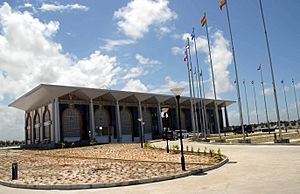
- The Parliament Building (1829–1834)
- The large Stabroek Market (1792), famous for its tall clock tower
- The Roman Catholic Brickdam Cathedral
- St. Andrew's Kirk (1818)
- Independence Arch
In the northern part of the city, near the Atlantic coast, you'll find:
- Splashmins Fun Park
- Fort William Frederick
- The Umana Yana, a unique cone-shaped building with a thatched roof. It was built by Wai-Wai Amerindians using traditional methods for a conference in 1972. It burned down in 2010 but was rebuilt in 2016.
- The Georgetown Lighthouse, a well-known landmark.
The Guyana National Park is a city park. Further inland, you can visit the Guyana Zoo, the Botanical Gardens, and Castellani House. The Botanical Gardens have many different plants, a manatee pond, and enclosures for animals like jaguars. The Museum of African Heritage is in the Bel Air Park area.
Sports in Georgetown
Georgetown has hosted the CaribeBasket, a major international basketball tournament for Caribbean countries, in 1981, 1988, and 1994.
Performing Arts in Georgetown
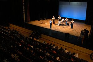
Georgetown's theater shows mostly happen at the National Cultural Centre. Plays are also performed at the Theatre Guild of Guyana, which is the oldest theater in Guyana. It opened in 1957 and was fixed up in 2007.
Neighbourhoods of Georgetown
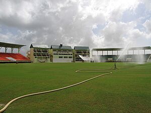
Central Georgetown
The central part of the city includes the main business area and where the national government is located.
Greater Georgetown
Northeastern Georgetown has many important business offices. These include the University of Guyana, the Guyana Sugar Corporation, and the CARICOM Secretariat. You'll also find The Cyril Potter College of Education, the Guyana International Conference Centre, and Eugene F. Correia International Airport here.
This area also has fancy gated communities like Bel Air Park and Lamaha Gardens. These are known as places where wealthy people live.
North of Georgetown is Main Street, where the president's official home and the Ministry of Finance are located. East of Georgetown, towards the Avenue of the Republic, is where Georgetown's city hall building and St. George's Cathedral are. Brickdam, also on the east side, has many government departments like the Ministries of Health, Education, and Home Affairs.
West of Stabroek Market is the Port of Georgetown, which is Guyana's busiest shipping point. Stabroek Market itself houses the Ministry of Labour and the Ministry of Human Services and Social Security. Regent Street is the main shopping area, and Sheriff Street is where most of the city's clubs, bars, and restaurants are found.
South Georgetown
The southern part of the city includes neighborhoods along the eastern bank of the Demerara River. Some areas like Sophia and Albouystown are known as poorer parts of the city. However, some areas like Houston Estates and Ruimvelt are still very wealthy.
City Services
Electricity in Georgetown is provided by a government-owned company called Guyana Power and Light. Water supply and sanitation are managed by another government company, Guyana Water Incorporated.
Famous People from Georgetown
- John Agard (born 1949), a poet
- Joy Ford Austin, a non-profit leader
- David A. Granger (born 1945), a former President of Guyana
- R. B. Greaves (1943–2012), an American singer
- Saint Jhn (born 1986), a singer and rapper
- Wilson Harris (1921–2018), a Guyanese writer
- Grace Nichols (born 1950), a Guyanese poet
- CCH Pounder (born 1952), a Guyanese-American actress
- Walter Rodney (1942–1980), a historian
- Oneeka Williams (born 1966), a Guyanese writer and surgeon
- Letitia Wright (born 1993), a Guyanese actress
Sports Stars
- Lance Gibbs (born 1934), a former member of the West Indies cricket team
- Roger Harper (born 1963), a former member of the West Indies cricket team
- Carl Hooper (born 1966), a former member of the West Indies cricket team
- Clive Lloyd (born 1944), a captain of the West Indies cricket team
Sister Cities
Georgetown has several sister cities:
See also
 In Spanish: Georgetown para niños
 | Selma Burke |
 | Pauline Powell Burns |
 | Frederick J. Brown |
 | Robert Blackburn |


