
Grundy County, Tennessee facts for kids
Quick facts for kids
Grundy County
|
||
|---|---|---|

Grundy County Courthouse in Altamont
|
||
|
||

Location within the U.S. state of Tennessee
|
||
 Tennessee's location within the U.S. |
||
| Country | ||
| State | ||
| Founded | 1844 | |
| Named for | Felix Grundy | |
| Seat | Altamont | |
| Largest city | Gruetli-Laager | |
| Area | ||
| • Total | 361 sq mi (930 km2) | |
| • Land | 361 sq mi (930 km2) | |
| • Water | 0.6 sq mi (2 km2) 0.2%% | |
| Population
(2020)
|
||
| • Total | 13,529 |
|
| • Density | 38/sq mi (15/km2) | |
| Time zone | UTC−6 (Central) | |
| • Summer (DST) | UTC−5 (CDT) | |
| Congressional district | 4th | |

Grundy County is a county in the state of Tennessee. It's located in the middle part of Tennessee, right next to East Tennessee. In 2021, about 13,622 people lived there. The main town, or county seat, is Altamont. The county is named after a person named Felix Grundy.
Contents
History of Grundy County
Grundy County has a long and interesting history. Today, it's famous for the huge South Cumberland State Park. This park is a great place for hiking, camping, and rock climbing. Most of Grundy County is on top of the Cumberland Plateau, which is about 1,800 feet above sea level. Many spots in the county offer amazing views and beautiful waterfalls. The county seat, Altamont, was started in the 1840s.
About 30 years before the American Civil War, a resort town called Beersheba Springs was founded. It was built around natural mineral springs. This area is now close to a popular wilderness spot called Savage Gulf. Visitors to Savage Gulf love the pretty views and many hiking trails.
In the mid-1860s, the town of Gruetli-Laager was settled by people who came from Switzerland. Even today, you can find many of the original family names among the people living there. Many visitors pass through the friendly town of Tracy City on their way to Fiery Gizzard and Foster Falls. Tracy City is home to the Grundy County Historical Society. This group helps visitors learn about the area's past and research their family history.
Near Tracy City, you can find Grundy Lakes. This park has several mountain lakes and streams. It's a nice place for swimming and picnics. There's also a paved road for running and walking. Around the lake, you can see old coke ovens. These were used long ago when coal was mined in the area.
The county also has several old saltpeter mines. Saltpeter was a key ingredient for making gunpowder. It was found by digging up earth from local caves. Fultz Saltpeter Cave and Hubbard Saltpeter Cave were both important mining spots. Woodlee Cave was also used for saltpeter. These caves might have been mined during the War of 1812 or the Civil War.
Geography of Grundy County


Grundy County covers about 361 square miles. Most of this area is land, with only a small part (0.2%) being water.
Natural Features in Grundy County
Grundy County includes a large part of the Fiery Gizzard Trail. This trail is famous for its beautiful scenery and different types of plants and animals.
Wonder Cave is located at the base of the Cumberland Plateau. It was found in 1897 by Robert A. Nelson, Melville Anderson, and Will Fitzgerald. They crawled into a small opening near a large spring. In 1898, R. M. Payne bought the cave. He made the entrance bigger, built paths, and opened it to the public. Wonder Cave was a popular tourist spot for almost 80 years. However, when new highways were built, fewer tourists came, and the cave eventually closed.
Counties Next to Grundy County
- Warren County (north)
- Sequatchie County (east)
- Marion County (south)
- Franklin County (southwest)
- Coffee County (west)
State Protected Areas in Grundy County
- Grundy Forest State Natural Area
- Savage Gulf State Park (part)
- South Cumberland State Park (part)
Population in Grundy County
| Historical population | |||
|---|---|---|---|
| Census | Pop. | %± | |
| 1850 | 2,773 | — | |
| 1860 | 3,093 | 11.5% | |
| 1870 | 3,250 | 5.1% | |
| 1880 | 4,592 | 41.3% | |
| 1890 | 6,345 | 38.2% | |
| 1900 | 7,802 | 23.0% | |
| 1910 | 8,322 | 6.7% | |
| 1920 | 9,753 | 17.2% | |
| 1930 | 9,717 | −0.4% | |
| 1940 | 11,552 | 18.9% | |
| 1950 | 12,558 | 8.7% | |
| 1960 | 11,512 | −8.3% | |
| 1970 | 10,631 | −7.7% | |
| 1980 | 13,787 | 29.7% | |
| 1990 | 13,362 | −3.1% | |
| 2000 | 14,332 | 7.3% | |
| 2010 | 13,703 | −4.4% | |
| 2020 | 13,529 | −1.3% | |
| U.S. Decennial Census 1790-1960 1900-1990 1990-2000 2010-2014 |
|||

2020 Census Information
| Race | Number | Percentage |
|---|---|---|
| White (non-Hispanic) | 12,620 | 93.28% |
| Black or African American (non-Hispanic) | 38 | 0.28% |
| Native American | 33 | 0.24% |
| Asian | 44 | 0.33% |
| Other/Mixed | 619 | 4.58% |
| Hispanic or Latino | 175 | 1.29% |
In 2020, there were 13,529 people living in Grundy County. These people lived in 4,820 households, and 3,320 of these were families.
Communities in Grundy County
Cities
Towns
- Altamont (county seat)
- Beersheba Springs
- Monteagle (also in Franklin and Marion Counties)
- Palmer
- Tracy City
Census-designated place
Notable People from Grundy County
- Right Rev. William Millsaps was a religious leader. He was the presiding bishop of the Episcopal Missionary Church. He also served as a chaplain at the University of the South.
- P.R. Olgiati was the 55th mayor of Chattanooga. He was also a Democratic candidate for Governor of Tennessee in 1970.
Images for kids
-
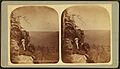
A stereo card from around 1900 showing an overlook at Beersheba Springs.
-
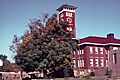
James K. Shook School, an old building in Grundy County.


See also
 In Spanish: Condado de Grundy (Tennessee) para niños
