
Henderson County, Illinois facts for kids
Quick facts for kids
Henderson County
|
|
|---|---|

Henderson County Courthouse, Oquawka
|
|

Location within the U.S. state of Illinois
|
|
 Illinois's location within the U.S. |
|
| Country | |
| State | |
| Founded | 1841 |
| Named for | Richard Henderson |
| Seat | Oquawka |
| Largest village | Oquawka |
| Area | |
| • Total | 395 sq mi (1,020 km2) |
| • Land | 379 sq mi (980 km2) |
| • Water | 16 sq mi (40 km2) 4.1% |
| Population
(2020)
|
|
| • Total | 6,387 |
| • Estimate
(2023)
|
6,088 |
| • Density | 16.170/sq mi (6.243/km2) |
| Time zone | UTC−6 (Central) |
| • Summer (DST) | UTC−5 (CDT) |
| Congressional district | 15th |
Henderson County is a place in the state of Illinois, USA. It is a type of local government area called a county. In 2020, about 6,387 people lived here. The main town and government center is Oquawka. Henderson County is also part of a larger area around Burlington, Iowa, which includes parts of Iowa and Illinois.
Contents
History of Henderson County
Henderson County was created in 1841. It was formed from a part of Warren County. The county was named after Henderson County, Kentucky. That Kentucky county was named for Richard Henderson. He was a judge who tried to start a new colony in 1775. This area later became the state of Kentucky.
-
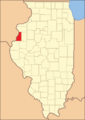
Henderson County when it was first created in 1841.

Geography of Henderson County
Henderson County covers a total area of about 395 square miles (1,023 square kilometers). Most of this area, about 379 square miles (982 square kilometers), is land. The rest, about 16 square miles (41 square kilometers), is water. Water makes up about 4.1% of the county's total area.
Climate and Weather in Henderson County
| Weather chart for Oquawka, Illinois | |||||||||||||||||||||||||||||||||||||||||||||||
|---|---|---|---|---|---|---|---|---|---|---|---|---|---|---|---|---|---|---|---|---|---|---|---|---|---|---|---|---|---|---|---|---|---|---|---|---|---|---|---|---|---|---|---|---|---|---|---|
| J | F | M | A | M | J | J | A | S | O | N | D | ||||||||||||||||||||||||||||||||||||
|
1.3
30
15
|
1.5
36
21
|
3
49
31
|
3.6
62
43
|
4.4
72
54
|
4.5
82
63
|
4.5
85
67
|
3.9
83
65
|
3.6
76
57
|
2.9
65
46
|
2.7
49
33
|
2.1
35
21
|
||||||||||||||||||||||||||||||||||||
| temperatures in °F precipitation totals in inches source: The Weather Channel |
|||||||||||||||||||||||||||||||||||||||||||||||
|
Metric conversion
|
|||||||||||||||||||||||||||||||||||||||||||||||
In Oquawka, the county seat, temperatures change a lot throughout the year. In January, the average low temperature is about 15°F (–9°C). In July, the average high temperature is about 85°F (29°C). The coldest temperature ever recorded was –26°F (–32°C) in February 1996. The hottest was 105°F (41°C) in August 1983.
The amount of rain and snow also changes by month. January usually gets about 1.31 inches (3.3 cm) of precipitation. July gets the most, with about 4.48 inches (11.4 cm).
Major Roads in Henderson County
 U.S. Highway 34
 Illinois Route 94
 Illinois Route 96
 Illinois Route 116
 Illinois Route 164
Counties Next to Henderson County
- Mercer County - to the north
- Warren County - to the east
- McDonough County - to the southeast
- Hancock County - to the south
- Lee County, Iowa - to the southwest
- Des Moines County, Iowa - to the west
People of Henderson County
| Historical population | |||
|---|---|---|---|
| Census | Pop. | %± | |
| 1850 | 4,612 | — | |
| 1860 | 9,501 | 106.0% | |
| 1870 | 12,582 | 32.4% | |
| 1880 | 10,722 | −14.8% | |
| 1890 | 9,876 | −7.9% | |
| 1900 | 10,836 | 9.7% | |
| 1910 | 9,724 | −10.3% | |
| 1920 | 9,770 | 0.5% | |
| 1930 | 8,778 | −10.2% | |
| 1940 | 8,949 | 1.9% | |
| 1950 | 8,416 | −6.0% | |
| 1960 | 8,237 | −2.1% | |
| 1970 | 8,451 | 2.6% | |
| 1980 | 9,114 | 7.8% | |
| 1990 | 8,096 | −11.2% | |
| 2000 | 8,213 | 1.4% | |
| 2010 | 7,331 | −10.7% | |
| 2020 | 6,387 | −12.9% | |
| 2023 (est.) | 6,088 | −17.0% | |
| US Decennial Census 1790-1960 1900-1990 1990-2000 2010 |
|||

In 2010, there were 7,331 people living in Henderson County. They lived in 3,149 homes. Most people were white (98.2%). Small groups of Asian, American Indian, and Black people also lived there. About 1.1% of the people were of Hispanic or Latino background.
Many people in the county have German (24.4%), Irish (14.5%), or English (11.9%) family roots. The average age of people in the county was 47.2 years old. About 26.9% of homes had children under 18 living in them. The average home had 2.31 people.
The average income for a family in the county was about $55,154 per year. About 11.4% of all people in the county lived below the poverty line. This included 13.3% of children under 18.
Towns and Villages in Henderson County
City
- Dallas City (partly in Hancock County)
Villages
Unincorporated Communities
These are smaller places that are not officially cities or villages.
- Bald Bluff
- Carman
- Carthage Lake
- Decorra
- Hopper
- Olena
- Shokonon
- Terre Haute
Townships
Henderson County is divided into eleven smaller areas called townships. These help manage local services.
- Bald Bluff
- Biggsville
- Carman
- Gladstone
- Lomax
- Media
- Oquawka
- Raritan
- Rozetta
- Stronghurst
- Terre Haute
State and Federal Parks and Facilities
- Big River State Forest - This is a large forest area of 2,900 acres. It is next to the Mississippi River and was created in 1925.
- Delabar State Park - This park is 89 acres and is also next to the Mississippi River. It opened in 1960.
- Oquawka State Wildlife Refuge - A special area to protect wildlife.
See also
 In Spanish: Condado de Henderson (Illinois) para niños
