
Hereford, Texas facts for kids
Quick facts for kids
Hereford
|
|
|---|---|

Hereford welcome sign on U.S. Highway 385
|
|
| Nickname(s):
Beef Capital of the World;
The Town Without a Toothache |
|

Location of Hereford, Texas
|
|
 |
|
| Country | United States of America |
| State | Texas |
| County | Deaf Smith |
| Area | |
| • Total | 6.30 sq mi (16.32 km2) |
| • Land | 6.30 sq mi (16.32 km2) |
| • Water | 0.00 sq mi (0.00 km2) |
| Elevation | 3,819 ft (1,164 m) |
| Population
(2020)
|
|
| • Total | 14,972 |
| • Density | 2,376.51/sq mi (917.40/km2) |
| Time zone | UTC-6 (Central (CST)) |
| • Summer (DST) | UTC-5 (CDT) |
| ZIP code |
79045
|
| Area code(s) | 806 |
| FIPS code | 48-33320 |
| GNIS feature ID | 2410747 |
Hereford is a city in Texas, United States. It is the main city and county seat of Deaf Smith County, Texas. About 15,000 people live there. Hereford is located southwest of Amarillo. It is the only place in the U.S. named "Hereford."
The area around Hereford has a semiarid climate, which means it's quite dry. Farmers and ranchers use water from underground sources like the Ogallala Aquifer to grow crops and raise animals.
Hereford's water supply has a lot of natural fluoride. Fluoride helps protect teeth from cavities. Because of this, Hereford is sometimes called "The Town Without a Toothache."
The city is also known as the "Beef Capital of the World." This is because many cattle feedlots are in the area. The city got its name from the Hereford breed of cattle. The local economy also gets a boost from the dairy and ethanol industries.
Hereford is home to the main office of the Deaf Smith Electric Cooperative. This company provides electricity to several nearby counties.
Contents
History of Hereford
.jpg)
Hereford started as a town called "Blue Water" in 1899. This happened after a railway line connected Amarillo to Farwell. When people found out there was already another town named Blue Water, they changed the name. They chose "Hereford" to honor the local cattle ranchers and a city in the United Kingdom also called Hereford.
During World War II, there was a camp in Hereford for Italian prisoners of war. This camp was taken down in 1947.
In 1975, a high school teacher named Wayne Woodward was fired. He had tried to start a local group to protect people's rights. Mr. Woodward later won a lawsuit against the school district. This case became well-known across the country.
Hereford has a rich Western history. The Las Escarbadas ranch house, which belonged to the famous XIT Ranch, was once near Hereford. Today, you can see this restored old house at the National Ranching Heritage Center in Lubbock. The Deaf Smith County Historical Museum in Hereford also shows exhibits about how West Texas was settled.
Hereford was once called the "Windmill City." This was because many windmills pumped fresh water from the Ogallala Aquifer.
Geography of Hereford
Hereford is located in the southeastern part of Deaf Smith County. It sits on a flat area called the Llano Estacado. The city covers about 6.3 square miles (16.3 square kilometers) of land.
U.S. Highway 60 runs through Hereford as 1st Street. It goes northeast to Amarillo and southwest to Clovis, New Mexico. U.S. Highway 385 (25 Mile Avenue) goes north and south through the city. It leads north to Interstate 40 at Vega and south to Dimmitt.
Climate in Hereford
Hereford has a steppe climate, which means it's a semiarid region. It's known as one of the "coolest" cities in Texas. The average summer temperature is around 73 degrees Fahrenheit (23 degrees Celsius).
| Climate data for Hereford, Texas (1991–2020 normals, extremes 1905–1912, 1936–present) | |||||||||||||
|---|---|---|---|---|---|---|---|---|---|---|---|---|---|
| Month | Jan | Feb | Mar | Apr | May | Jun | Jul | Aug | Sep | Oct | Nov | Dec | Year |
| Record high °F (°C) | 84 (29) |
85 (29) |
98 (37) |
99 (37) |
103 (39) |
111 (44) |
109 (43) |
107 (42) |
102 (39) |
97 (36) |
87 (31) |
80 (27) |
111 (44) |
| Mean maximum °F (°C) | 71.0 (21.7) |
76.2 (24.6) |
84.3 (29.1) |
89.5 (31.9) |
96.0 (35.6) |
102.1 (38.9) |
101.4 (38.6) |
99.2 (37.3) |
95.8 (35.4) |
89.3 (31.8) |
79.7 (26.5) |
71.4 (21.9) |
104.1 (40.1) |
| Mean daily maximum °F (°C) | 51.1 (10.6) |
55.5 (13.1) |
64.3 (17.9) |
72.4 (22.4) |
81.1 (27.3) |
90.2 (32.3) |
92.4 (33.6) |
90.7 (32.6) |
83.5 (28.6) |
72.6 (22.6) |
60.3 (15.7) |
51.1 (10.6) |
72.1 (22.3) |
| Daily mean °F (°C) | 36.8 (2.7) |
40.4 (4.7) |
48.3 (9.1) |
56.1 (13.4) |
65.7 (18.7) |
75.4 (24.1) |
78.6 (25.9) |
77.1 (25.1) |
69.7 (20.9) |
57.9 (14.4) |
45.8 (7.7) |
37.4 (3.0) |
57.4 (14.1) |
| Mean daily minimum °F (°C) | 22.5 (−5.3) |
25.3 (−3.7) |
32.4 (0.2) |
39.7 (4.3) |
50.3 (10.2) |
60.6 (15.9) |
64.8 (18.2) |
63.5 (17.5) |
55.8 (13.2) |
43.3 (6.3) |
31.3 (−0.4) |
23.8 (−4.6) |
42.8 (6.0) |
| Mean minimum °F (°C) | 9.3 (−12.6) |
11.1 (−11.6) |
18.4 (−7.6) |
26.5 (−3.1) |
36.9 (2.7) |
51.4 (10.8) |
59.0 (15.0) |
56.9 (13.8) |
43.7 (6.5) |
28.2 (−2.1) |
16.6 (−8.6) |
8.9 (−12.8) |
4.2 (−15.4) |
| Record low °F (°C) | −15 (−26) |
−17 (−27) |
1 (−17) |
14 (−10) |
16 (−9) |
40 (4) |
51 (11) |
44 (7) |
31 (−1) |
15 (−9) |
0 (−18) |
−12 (−24) |
−17 (−27) |
| Average precipitation inches (mm) | 0.64 (16) |
0.45 (11) |
1.22 (31) |
1.09 (28) |
2.09 (53) |
3.34 (85) |
2.34 (59) |
3.04 (77) |
1.86 (47) |
1.85 (47) |
0.69 (18) |
0.72 (18) |
19.33 (491) |
| Average snowfall inches (cm) | 3.2 (8.1) |
1.7 (4.3) |
1.9 (4.8) |
0.7 (1.8) |
0.1 (0.25) |
0.0 (0.0) |
0.0 (0.0) |
0.0 (0.0) |
0.0 (0.0) |
0.6 (1.5) |
2.5 (6.4) |
3.6 (9.1) |
14.3 (36) |
| Average precipitation days (≥ 0.01 in) | 2.8 | 3.2 | 4.3 | 4.8 | 6.4 | 7.6 | 6.9 | 8.3 | 5.7 | 5.2 | 3.7 | 3.6 | 62.5 |
| Average snowy days (≥ 0.1 in) | 1.7 | 1.2 | 1.0 | 0.3 | 0.1 | 0.0 | 0.0 | 0.0 | 0.0 | 0.2 | 0.9 | 1.8 | 7.2 |
| Source: NOAA | |||||||||||||
People of Hereford
| Historical population | |||
|---|---|---|---|
| Census | Pop. | %± | |
| 1900 | 532 | — | |
| 1910 | 1,750 | 228.9% | |
| 1920 | 1,696 | −3.1% | |
| 1930 | 2,458 | 44.9% | |
| 1940 | 2,584 | 5.1% | |
| 1950 | 5,207 | 101.5% | |
| 1960 | 6,752 | 29.7% | |
| 1970 | 13,414 | 98.7% | |
| 1980 | 15,853 | 18.2% | |
| 1990 | 14,745 | −7.0% | |
| 2000 | 14,597 | −1.0% | |
| 2010 | 15,370 | 5.3% | |
| 2020 | 14,972 | −2.6% | |
| U.S. Decennial Census | |||
2020 Population Data
| Race | Number | Percentage |
|---|---|---|
| White (NH) | 2,757 | 18.41% |
| Black or African American (NH) | 98 | 0.65% |
| Native American or Alaska Native (NH) | 39 | 0.26% |
| Asian (NH) | 32 | 0.21% |
| Some Other Race (NH) | 39 | 0.26% |
| Mixed/Multi-Racial (NH) | 129 | 0.86% |
| Hispanic or Latino | 11,878 | 79.33% |
| Total | 14,972 |
In 2020, there were 14,972 people living in Hereford. There were 4,776 households and 3,593 families.
2010 Population Data
In 2010, Hereford had 15,370 residents. Most of the people (71.7%) were of Hispanic or Latino background. About 26.3% were White, and smaller groups included Black, Native American, and Asian people.
Education in Hereford
The first public school in Hereford opened in 1900. Today, Hereford has seven public schools. These schools serve about 4,000 students. They are managed by the Hereford Independent School District.
Notable People from Hereford
- Parker Bridwell: A baseball pitcher who played for the New York Yankees.
- Ron Ely: An actor famous for playing Tarzan in a TV show in the 1960s.
- Lon L. Fuller: A legal philosopher known for his ideas about natural law.
- Rip Hawk: A professional wrestler who lived in Hereford after he retired.
- Edgar Mitchell: An astronaut who walked on the Moon during the Apollo 14 mission in 1971.
- Skeeter Skelton: A lawman and writer known for his articles about firearms.
Gallery
-
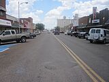
Downtown Hereford, with the grain elevator to the rear
-
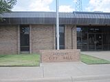
Hereford City Hall
-
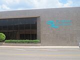
First Bank Southwest in Hereford
-
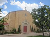
St. Anthony's Roman Catholic Church in Hereford is located off U.S. Highway 385.
-
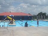
Swimming in Hereford
-
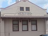
Hereford train depot
-
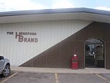
Hereford Brand newspaper office
-
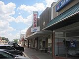
The former Mills Ranch Western Store, once a fixture of downtown Hereford


See also
 In Spanish: Hereford (Texas) para niños
