Hindscarth facts for kids
Quick facts for kids Hindscarth |
|
|---|---|

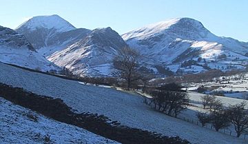
Hindscarth and Robinson from Catbells
|
|
| Highest point | |
| Elevation | 727 m (2,385 ft) |
| Prominence | 71 m (233 ft) |
| Parent peak | Dale Head |
| Listing | Hewitt, Wainwright, Nuttall |
| Naming | |
| English translation | pass used by the red deer |
| Language of name | Norse |
| Geography | |
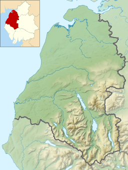
| Location | Cumbria, England |
| Parent range | Lake District, North Western Fells |
| OS grid | NY215165 |
| Topo map | OS Landrangers 89, 90, Explorer OL4 |
Hindscarth is a mountain located in the beautiful Lake District in England. It sits between two valleys, Buttermere and Newlands. This mountain is part of the north-western fells, which are a group of hills in this famous national park.
The name Hindscarth comes from the Old Norse language. It combines the words Hind (meaning a female red deer) and Skarth (meaning a pass). So, its name means "the pass used by the red deer."
Contents
Exploring Hindscarth's Landscape
The North Western Fells are a collection of hills found between the Derwent and Cocker rivers. They form a long, oval-shaped area of high ground. Two main roads cut across these fells, dividing them into three sections. Hindscarth is located in the southern part of this area.
A main ridge in these fells starts from Buttermere. It rises over Robinson, then Hindscarth, and finally Dale Head. From Dale Head, the ridge turns north and slowly goes down towards Derwentwater. Along this northern path, you'll find other peaks like High Spy, Maiden Moor, and Catbells.
The ridge connecting Robinson to Dale Head goes around Hindscarth. Hindscarth itself stands a bit to the north, acting as a natural wall between the Little Dale and Newlands valleys. Its long north-west side slopes down in stages, with rocky areas leading to where its streams meet. The southern face of Hindscarth looks down onto Honister Pass.
Climbing to the Top
Many people enjoy hiking up Hindscarth. A popular way to start is from a parking spot near Newlands Church. From there, you walk along the Scope End ridge before climbing up the rocky parts to reach the summit.
Because Hindscarth and Robinson are close, hikers often combine them into one longer walk. This usually starts from Newlands. Hindscarth is also part of an even longer and more challenging hike known as the "Newlands horseshoe." This route includes Catbells, High Spy, Dale Head, and then follows the Littledale Edge ridge to Robinson.
Hindscarth's Rocky Secrets
The rocks that make up Hindscarth are part of something called the Buttermere Formation. This is a special type of rock layer made up of mixed and folded mudstone, siltstone, and sandstone. It shows how the Earth's crust moved and changed a long, long time ago.
History of Mining
At the foot of Hindscarth's northern ridge, where it slopes down into the Newlands valley, you'll find a very famous old mine. This is the Goldscope mine, located at Scope End. English Heritage has said this mine is very important nationally and needs to be protected.
The Goldscope mine first opened in 1564. German miners helped develop it in its early days. They dug for rich veins of lead and copper. This mine was so important that Elizabeth I herself took control of it from its owner, the Earl of Northumberland.
You can still see large piles of waste rock, called spoil heaps, on the Newlands Beck side of Scope End. The mine shafts went very deep into the hillside. Eventually, it became too expensive to pump out all the water that filled the shafts. This led to the mine closing down at the end of the 19th century.
Reaching the Summit
At the very top of Hindscarth, you'll find a small, somewhat messy cairn (a pile of stones) among some rocks. There are also patches of grass and gravel. About a hundred yards to the south, there's a bigger cairn. This one is marked as a "Shelter" on Ordnance Survey maps.
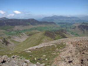
The view from the summit is amazing, especially looking north into the Newlands Valley with Skiddaw in the background. You can see almost all the major groups of fells in the Lake District from here, except for High Street.
 | William Lucy |
 | Charles Hayes |
 | Cleveland Robinson |


