
Hutchinson County, South Dakota facts for kids
Quick facts for kids
Hutchinson County
|
|
|---|---|

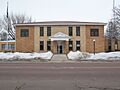
Former Hutchinson County Courthouse in Olivet
|
|

Location within the U.S. state of South Dakota
|
|
 South Dakota's location within the U.S. |
|
| Country | |
| State | |
| Founded | 1862 (created) 1871 (organized) |
| Named for | John Hutchinson |
| Seat | Olivet |
| Largest city | Parkston |
| Area | |
| • Total | 814 sq mi (2,110 km2) |
| • Land | 813 sq mi (2,110 km2) |
| • Water | 1.5 sq mi (4 km2) 0.2% |
| Population
(2020)
|
|
| • Total | 7,427 |
| • Estimate
(2023)
|
7,394 |
| • Density | 9.124/sq mi (3.5228/km2) |
| Time zone | UTC−6 (Central) |
| • Summer (DST) | UTC−5 (CDT) |
| Congressional district | At-large |
Hutchinson County is a county located in the state of South Dakota in the United States. In 2020, about 7,427 people lived here. The main town, or county seat, is Olivet. The county was officially started in 1862 and fully set up in 1871. It was named after John Hutchinson, who was the first secretary of the territory.
Contents
History of Hutchinson County
Hutchinson County was created by a special law on May 8, 1862. At first, its borders were a bit different. They included parts of what are now Davison and Hanson Counties. The first county seat was Maxwell City. But in October 1873, people voted to move the county seat to Olivet.
On January 13, 1871, the government set the county's current borders. They also finished setting up how the county would be governed. In 1873, the county was actually split into two parts. The northern half became Armstrong County, with Milltown as its main town. However, Armstrong County was later dissolved in 1879. Its land was then added back to Hutchinson County.
Geography and Nature
The James River flows through the middle of Hutchinson County, heading south. The land here has gentle, rolling hills. Most of the area is used for farming. The land slopes down towards the river valley from both sides. The highest point in the county is in its southwest corner. It is about 1,880 feet (573 meters) above sea level.
Hutchinson County covers a total area of about 814 square miles. Of this, 813 square miles is land. Only about 1.5 square miles (0.2%) is water.
Main Roads in Hutchinson County
 U.S. Highway 18
 U.S. Highway 81
 South Dakota Highway 25
 South Dakota Highway 37
 South Dakota Highway 44
Neighboring Counties
- Hanson County - north
- McCook County - northeast
- Turner County - east
- Yankton County - southeast
- Bon Homme County - south
- Charles Mix County - southwest
- Douglas County - west
- Davison County - northwest
Protected Natural Areas
- Mogck Slough State Public Shooting Area
- Weigher Slough State Public Shooting Area
Lakes in Hutchinson County
- Lake Dimock
- Lake Menno
- Silver Lake
- Tripp Lake
People of Hutchinson County
| Historical population | |||
|---|---|---|---|
| Census | Pop. | %± | |
| 1870 | 37 | — | |
| 1880 | 5,573 | 14,962.2% | |
| 1890 | 10,469 | 87.9% | |
| 1900 | 11,897 | 13.6% | |
| 1910 | 12,319 | 3.5% | |
| 1920 | 13,475 | 9.4% | |
| 1930 | 13,904 | 3.2% | |
| 1940 | 12,668 | −8.9% | |
| 1950 | 11,423 | −9.8% | |
| 1960 | 11,085 | −3.0% | |
| 1970 | 10,379 | −6.4% | |
| 1980 | 9,350 | −9.9% | |
| 1990 | 8,262 | −11.6% | |
| 2000 | 8,075 | −2.3% | |
| 2010 | 7,343 | −9.1% | |
| 2020 | 7,427 | 1.1% | |
| 2023 (est.) | 7,394 | 0.7% | |
| U.S. Decennial Census 1790-1960 1900-1990 1990-2000 2010-2020 |
|||
In 2020, the census counted 7,427 people living in Hutchinson County. There were 2,797 households and 1,802 families. This means there were about 9.1 people per square mile. There were also 3,212 homes or housing units.
In 2010, there were 7,343 people living in the county. Most people (97.4%) were white. About 0.7% were American Indian. People of Hispanic or Latino background made up 1.6% of the population. Many people in the county have German roots (67.7%). Other common backgrounds include Russian, Norwegian, and Irish.
The average age of people in the county was 46.8 years. The average income for a household was $39,310. For families, it was $52,390. About 10.4% of all people lived below the poverty line. This included 11.5% of those under 18.
Mennonites and Hutterites in Hutchinson County
Hutchinson County has the largest number of Mennonite people in South Dakota. German-speaking Mennonites from Russia started settling here in 1874. They continued to arrive until the early 1880s.
South Dakota also has the largest population of Hutterites in the country. Hutterites are a group that lives in communities. They also came from Russia around the same time as the Mennonites. Both groups share the Anabaptist faith. Hutterites live in special communities, usually with about 150 people.
One Hutterite community is Wolf Creek Colony. It is located where the Wolf Creek meets the James River. This colony is west of Freeman and north of Olivet and Menno. Other Hutterite communities in the county include Maxwell Colony, New Elm Spring Colony, Old Elm Spring Colony, and Tschetter Colony.
Communities in Hutchinson County
Cities
Towns
Census-Designated Places
These are areas that are like towns but are not officially incorporated.
- Kaylor
- Maxwell Colony
- Milltown
- New Elm Spring Colony
- Old Elm Spring Colony
- Tschetter Colony
- Wolf Creek Colony
Unincorporated Communities
These are small settlements that are not officially part of a city or town.
- Clayton
- Lake Tripp
- Wolf Creek
Townships
Townships are smaller areas within a county, often used for local government.
- Capital
- Clayton
- Cross Plains
- Fair
- Foster
- German
- Grandview
- Kassel
- Kaylor
- Kulm
- Liberty
- Mittown
- Molan
- Oak Hollow
- Pleasant
- Sharon
- Silver Lake
- Starr
- Susquehanna
- Sweet
- Valley
- Wittenberg
- Wolf Creek
Images for kids
-
Former Hutchinson County Courthouse in Olivet
See also
 In Spanish: Condado de Hutchinson (Dakota del Sur) para niños
