Iron Mountain (Pierce County, Washington) facts for kids
Quick facts for kids Iron Mountain |
|
|---|---|

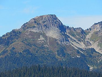
Iron Mountain seen from the southeast
|
|
| Highest point | |
| Elevation | 6,286 ft (1,916 m) |
| Prominence | 303 ft (92 m) |
| Geography | |
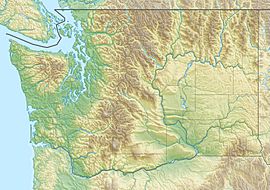
| Location | Mount Rainier National Park, Pierce County, Washington, U.S. |
| Parent range | Cascades |
| Topo map | USGS Mount Rainier West |
| Climbing | |
| Easiest route | Scrambling |
Iron Mountain is a mountain peak located in Mount Rainier National Park in Washington state. It stands about 6,286-foot (1,916-metre) (1,916 meters) tall. This mountain is part of the Cascade Range, a long chain of mountains in western North America.
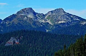
Iron Mountain is found near a spot called Success Cleaver. It also looks over a beautiful area known as Indian Henry's Hunting Ground. The closest taller mountain is Copper Mountain, which is just 0.3 miles (0.48 km) to the north.
From the top of Iron Mountain, you can see amazing views. These include Mount Rainier, Mount Adams, Mount St. Helens, and Mount Wow. You can also spot other peaks in the Tatoosh Range. Water from rain and snow on Iron Mountain flows into several creeks. These creeks, like Tahoma Creek and Devils Dream Creek, eventually join the Nisqually River.
The mountain got its name because of the rocks found there. In the late 1800s, people hoped to find valuable metals like copper, silver, and gold in mines around Mount Rainier. Dark reddish rocks on Iron Mountain looked like iron or iron oxide. Because of this, the mountain was named Iron Mountain. The name was officially recognized in 1932 by the United States Board on Geographic Names.
Contents
Understanding the Climate Around Iron Mountain
Iron Mountain is located in a special climate zone called the marine west coast climate. This type of climate is found in areas along the western coasts of continents, like western North America.
How Weather Forms in the Cascades
Most of the weather in this region starts over the Pacific Ocean. Large weather systems, called weather fronts, travel northeast towards the Cascade Mountains. When these fronts reach the tall peaks of the Cascades, they are forced to rise. This process is called Orographic lift. As the air rises, it cools down.
Rain and Snowfall
When the air cools, it can't hold as much moisture. This causes the moisture to fall as rain or snowfall onto the mountains. Because of this, the western side of the Cascades gets a lot of rain and snow, especially during the winter months. In winter, the sky is often cloudy.
Summer Weather
However, during the summer, large high-pressure systems often form over the Pacific Ocean. These systems become stronger in summer. This usually means that during the summer months, there are very few clouds, and the weather is often sunny and clear.
 | Kyle Baker |
 | Joseph Yoakum |
 | Laura Wheeler Waring |
 | Henry Ossawa Tanner |


