Isles of Shoals facts for kids
Isles of Shoals
|
|
| Geography | |
|---|---|
| Location | Gulf of Maine, Atlantic Ocean |
| Coordinates | 42°58′53″N 70°36′41″W / 42.98139°N 70.61139°W |
| Total islands | 9 (Maine – 5, New Hampshire – 4) |
| Major islands | Appledore, Star, Smuttynose |
| Administration | |
|
United States
|
|
| States | Maine and New Hampshire |
| Counties | York County, Maine / Rockingham County, New Hampshire |
| Towns | Kittery, Maine / Rye, New Hampshire |
|
Isles of Shoals
|
|
| Lua error in Module:Location_map at line 420: attempt to index field 'wikibase' (a nil value). | |
| Nearest city | Portsmouth, New Hampshire |
| Area | 145.6 acre |
| Built | 1614 |
| NRHP reference No. | 74000325 |
| Added to NRHP | May 16, 1974 |
The Isles of Shoals are a group of small islands and rocky ledges. They are located about 6 miles (10 km) off the east coast of the United States. These islands are special because they sit right on the border of the states of Maine and New Hampshire.
People have lived on these islands for over 400 years. First, they were home to fishing communities. More recently, they have private homes, a large summer hotel, and a marine science lab.
History of the Isles of Shoals
Some of these islands were used by indigenous peoples for seasonal fishing camps. Europeans first settled here in the early 1600s. The islands became important fishing spots for the young British and French colonies. This was one of the northernmost fishing ports.
Early European Exploration
English explorer Captain John Smith saw the islands in 1614. He named them the "Smith Iles." However, this name did not last once the British started settling New England. In 1623, another English explorer, Captain Christopher Levett, found the islands mostly empty. He wrote that the islands were good for fishing but didn't have much land for farming or good trees.
In 1628, the Plymouth Pilgrims sent Thomas Morton to one of the islands.
Town Life and Changes
The first town on the islands was called "Apledoore." It was officially created by the Massachusetts Bay Colony on May 22, 1661. At that time, both New Hampshire and Maine were part of Massachusetts. By 1665, the town's name changed to "Iles of Shoales."
Starting around 1680, many people moved from Hog Island (now Appledore) in Maine to Star Island in New Hampshire. In 1696, the town became part of Kittery. Then, in 1715, New Hampshire created the town of Gosport on Star Island.
War and Revival
The Gosport community was quite successful until about 1778. During the Revolutionary War, the islanders had to leave and go to Rye, New Hampshire. A small number of people stayed, but the islands were mostly empty until the mid-1800s.
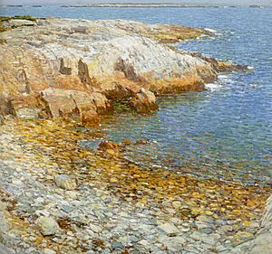
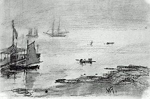
Then, Thomas Laighton and Levi Thaxter opened a popular summer hotel on Appledore Island. Thomas's daughter, Celia, married Levi. As Celia Thaxter, she became a very famous American poet. She created an arts community on the island. Many famous writers visited, including Nathaniel Hawthorne, John Greenleaf Whittier, Oliver Wendell Holmes, and Sarah Orne Jewett. The Impressionist painter Childe Hassam also spent time there.
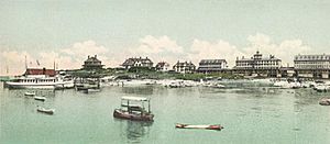
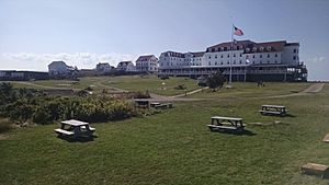
The success of Laighton's Appledore House led to other hotels. The Mid-Ocean House opened on Smuttynose Island. The Oceanic Hotel, which is still used today, opened on Star Island.
Exploring the Islands Today
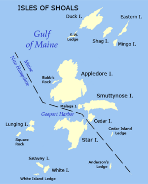
The Isles of Shoals are made up of nine main islands. Five are in Maine, and four are in New Hampshire. Each island has its own unique story and purpose today.
Appledore Island: A Hub of Learning
Appledore Island, located in Maine, is the largest of the Isles of Shoals. It is about 95 acres (38 hectares) in size. It used to be called Hog Island and before that, Farm Island. The island is about 0.5 miles (0.8 km) from east to west and 0.6 miles (1 km) from north to south.
In the 1800s, Appledore Island was home to a large hotel called The Appledore House. It was built in 1847 and opened the next year. Sadly, the hotel was destroyed by a fire in 1914.
Today, Appledore Island is home to the Shoals Marine Laboratory. This is a science center run by Cornell University and the University of New Hampshire. Students and researchers come here to study marine life and the ocean. Most of the island is owned by the Star Island Corporation.
Star Island: A Place for Gatherings
Star Island is the second largest island, at 46 acres (19 hectares). It is in New Hampshire, within the town of Rye. It is the only island that has a commercial boat service from the mainland.
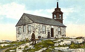
Star Island is a religious and educational conference center. It is owned by the Star Island Corporation, which works with the Unitarian Universalist Association and the United Church of Christ. During the summer, the island hosts many week-long and shorter conferences. Visitors stay at the Oceanic Hotel, Gosport House, and use the 150-year-old chapel. Some buildings even date back to the original village. Day visitors are also welcome, depending on the boat schedule. It's also a popular spot for sailboats to anchor overnight in Gosport harbor.
Smuttynose and Malaga Islands: Connected by History
Smuttynose Island is the third-largest island, at 25 acres (10 hectares). There are two small houses on the island. One of them, the Samuel Haley house, was once thought to be the oldest building in Maine. Smuttynose is not populated today.
Malaga Island is a very small island just west of Smuttynose. It is connected to Smuttynose by a breakwater, which is a wall built to protect a harbor. The first breakwater was built around 1820 by Captain Samuel Haley. People say he paid for it with money from four bars of silver he found under a rock on the island.
White and Seavey Islands: Home to a Lighthouse
White Island and Seavey Island are at the southern end of the Isles of Shoals. They are located in the town of Rye, New Hampshire. When the tide is low, these two islands are connected by a land bridge.
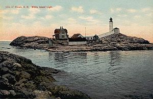
White Island is dominated by the Isles of Shoals Light, which is a lighthouse. The lighthouse is now automated, meaning it runs by itself. The keeper's house is also on the island. This lighthouse is one of two on the New Hampshire coast. The state of New Hampshire now owns the lighthouse and its buildings.
The island also has a weather station. This station often records very strong, hurricane-force winds during winter storms called Nor'easters. This happens because the island is very exposed to the ocean. The lighthouse tower was repaired in 2005. This was thanks to a group of seventh graders from nearby North Hampton, who called themselves the Lighthouse Kids. The poet Celia Thaxter grew up on White Island before moving to Smuttynose Island and then Appledore Island.
Seavey Island has been used for a tern bird restoration project. This project is run by the Audubon Society of New Hampshire.
Other Islands of the Shoals
Lunging, Duck, and Cedar islands are also part of the Isles of Shoals.
Lunging Island, on the New Hampshire side, used to be called Londoner's Island. It was once a place where people traded codfish. Today, it is privately owned.
Duck and Cedar islands are on the Maine side. Duck Island is about 1 mile (1.6 km) to the north. It was once used as a bombing range by the US Navy. In 2002, it was sold to the Maine Coast Heritage Trust. In 2003, it was given to the U.S. Fish and Wildlife Service. It is now a wildlife sanctuary. It is home to a seal colony and has never had people living on it.
Cedar Island is connected by breakwaters to both Smuttynose Island and Star Island. It is privately owned.
 | Anna J. Cooper |
 | Mary McLeod Bethune |
 | Lillie Mae Bradford |


