
Khulna Division facts for kids
Quick facts for kids
Khulna Division
|
|
|---|---|

Map of Khulna Division
|
|
| Country | |
| Area | |
| • Total | 22,285 km2 (8,604 sq mi) |
| Population
(2011 census)
|
|
| • Total | 15,563,000 |
| • Density | 698.36/km2 (1,808.75/sq mi) |
| Time zone | UTC+6 (BST) |
Khulna Division is one of the eight main areas, called divisions, in Bangladesh. It is located in the southwest part of the country. About 15.5 million people live here. The main city and capital of the division is Khulna city, which is in Khulna District.
Contents
Where is Khulna Division?
The Khulna Division shares its borders with several other areas. To the north, it meets the Rajshahi Division. The Dhaka Division is to its northeast, and the Barisal Division is to the east. To the south, it touches the Bay of Bengal, which is a large sea. On its western side, it borders the state of West Bengal in India. The Barisal Division used to be a part of Khulna Division a long time ago.
Districts of Khulna Division
Khulna Division is made up of ten smaller areas called districts. Each district has its own local government and unique features. These districts are:
- Bagerhat District
- Chuadanga District
- Jessore District
- Jhenaidah District
- Khulna District
- Kushtia District
- Magura District
- Meherpur District
- Narail District
- Satkhira District
Economy and Natural Wonders
Khulna Division plays a big role in Bangladesh's economy. In the past, when Bangladesh was known as East Pakistan, the jute industry in Khulna brought in a lot of money from other countries. Jute is a natural fiber used to make things like ropes and bags.
Today, Khulna Division is home to Mongla Port, which is the second-largest seaport in Bangladesh. This port is very important for trade. The country's only shipbuilding yard, where ships are built and repaired, is also located here.
One of the most amazing natural features in Khulna Division is the Sundarbans. This is the largest mangrove forest in the world! Mangrove forests are special forests that grow in salty water along coastlines. The Sundarbans spreads across three districts in the division: Satkhira, Khulna, and Bagerhat. It is famous for its unique wildlife, including the Royal Bengal Tiger.
Related Places
Images for kids
-
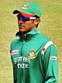
Shakib Al Hasan, a famous cricketer.
-
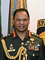
General SM Shafiuddin Ahmed, a leader of the Bangladesh Army.
-
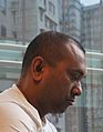
Firoz Mahmud, a visual artist and educator.
-
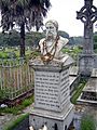
Michael Madhusudan Dutt, a well-known poet and writer from the 1800s.


See also
 In Spanish: División de Khulna para niños
