
Khulna facts for kids
Quick facts for kids
Khulna
খুলনা
|
|
|---|---|
|
A monument at the Khulna University of Engineering & Technology
Khan Jahan Ali Bridge
Khulna Medical College
Khulna Railway Station
Gollamari Martyrs' Memorial
Khulna University lake
|
|
| Nickname(s):
City of Tigers, Industrial City, Gateway to the Sundarbans
|
|
| Lua error in Module:Location_map at line 416: Malformed coordinates value. | |
| Country | |
| Division | Khulna Division |
| District | Khulna District |
| Municipal Council: | 8 September 1884 |
| Municipal Corporation: | 12 December 1984 |
| City Corporation: | 6 August 1990 |
| Government | |
| • Type | Mayor-council |
| • Body | Khulna City Corporation |
| Area | |
| • Urban | 45.65 km2 (17.63 sq mi) |
| • Metro | 150.57 km2 (58.14 sq mi) |
| Area rank | 3rd |
| Elevation | 9.0 m (29.5 ft) |
| Population | |
| • Rank | 3rd |
| • Urban | 884,445 |
| • Urban density | 19,374.5/km2 (50,180/sq mi) |
| • Metro | 1,556,300 |
| • Metro density | 10,336.1/km2 (26,770.3/sq mi) |
| • City rank | 3rd in Bangladesh |
| • Metro rank | 3rd in Bangladesh |
| Demonym(s) | Khulnaiya |
| Languages | |
| • Official | Bengali • English |
| Time zone | UTC+6 (BST) |
| Postal codes |
9000, 9100, 92xx
|
| IDD : Calling Code | +880 (0)41 |
| UN/LOCODE | BD KHI |
| Police | Khulna Metropolitan Police |
| Airport | Jessore Airport & Khan Jahan Ali Airport (Planned) |
| Metropolitan Planning Authority | Khulna Development Authority |
| Water Supply and Sewerage Authority | Khulna WASA |
| Literacy rate | 71.5% |

.jpg)


Khulna (Bengali: খুলনা) is the third-largest city in Bangladesh. It is located after Dhaka and Chittagong. Khulna is the main administrative center for the Khulna District and the Khulna Division. Its economy is the third-largest in Bangladesh. In 2020, it contributed $53 billion to the region's economy.
Khulna is found on the Rupsha and Bhairab River. This makes it an important spot in southwestern Bangladesh. It is also a big center for industries in Bangladesh. Many of the country's largest companies are located here. The city uses the Port of Mongla, which is Bangladesh's second-largest seaport.
An old steamboat service still runs on the river to the city. Khulna is known as the gateway to the Sundarbans. This is the world's largest mangrove forest and home to the famous Bengal tiger. Khulna is also north of the Mosque City of Bagerhat, which is a UNESCO World Heritage Site.
Contents
History of Khulna
Khulna was once part of ancient kingdoms like Vanga. It was also part of Gangaridai and Samatata. In the 12th century, the Sena dynasty ruled the area.
Early Muslim Rulers
In the 14th century, Shamsuddin Firoz Shah was the first Muslim ruler to arrive. More Muslim settlements grew during Shamsuddin Ilyas Shah's time. Many mosques and shrines were built then. A Muslim saint named Khan Jahan Ali received land in the 15th century. He renamed the area Jahanabad and ruled until 1459.
After Ali's death, the city became part of the Bengal Sultanate. Later, in the 16th century, Vikramaditya gained control of southern Bengal, including Khulna. He created his own kingdom. His son, Pratapaditya, became a powerful ruler. However, he was defeated by Raja Man Singh I in 1611. Man Singh was a general for the Mughal emperor Akbar.
British Rule and Independence
Khulna was ruled by local leaders until 1793. Then, the British East India Company took control. In 1842, it became part of Jessore District. Khulna became the main city of Khulna District in 1882. It got a municipal council in 1884. This council became a municipal corporation in 1984.
Before 1947, Khulna was part of undivided Bengal. On August 15, 1947, Khulna first declared itself part of India. However, officials requested its inclusion in Pakistan. The boundary commission then decided that Khulna would be part of East Bengal.
_%E0%A6%AA%E0%A6%B0%E0%A6%BF%E0%A6%95%E0%A6%B2%E0%A7%8D%E0%A6%AA%E0%A6%A8%E0%A6%BE.png)
During the Bangladesh Liberation War, Khulna was an important area. Fighters from Khulna were part of sector 8.
Geography and Climate
Khulna is Bangladesh's third-largest city. It is located in the southwestern part of the country. The city sits on the Rupsha and Bhairab Rivers. The city area is about 45.65 square kilometers. The wider metropolitan area covers 150.57 square kilometers.
Surrounding Areas
Khulna is south of Jessore and Narail District. It is east of Satkhira District and west of Bagerhat. To the north is the Bay of Bengal. Khulna is part of the Ganges Delta. This is the world's largest river delta. The Sundarbans, the world's largest mangrove forest, is in the southern part of this delta.
Weather in Khulna
Khulna has a tropical wet and dry climate. Summers are hot and humid. Winters are pleasantly warm. The city is greatly affected by the Monsoon of South Asia. Khulna gets less rain than other parts of Bangladesh. This is because of its location and the Sundarbans forest. Most rain falls between May and October.
Khulna also gets heavy rain from cyclones. These storms form in the Bay of Bengal. The average yearly temperature in Khulna is 26.3°C. Monthly averages range from 11.4°C in January to 34.6°C in April.
| Climate data for Khulna (1991–2020) | |||||||||||||
|---|---|---|---|---|---|---|---|---|---|---|---|---|---|
| Month | Jan | Feb | Mar | Apr | May | Jun | Jul | Aug | Sep | Oct | Nov | Dec | Year |
| Record high °C (°F) | 31.2 (88.2) |
36.2 (97.2) |
38.7 (101.7) |
40.7 (105.3) |
40.7 (105.3) |
39.0 (102.2) |
37.4 (99.3) |
36.5 (97.7) |
37.2 (99.0) |
36.5 (97.7) |
38.4 (101.1) |
30.7 (87.3) |
40.7 (105.3) |
| Mean daily maximum °C (°F) | 25.1 (77.2) |
28.9 (84.0) |
32.9 (91.2) |
34.9 (94.8) |
35.0 (95.0) |
33.5 (92.3) |
32.3 (90.1) |
32.4 (90.3) |
32.7 (90.9) |
32.3 (90.1) |
30.1 (86.2) |
26.4 (79.5) |
31.4 (88.5) |
| Daily mean °C (°F) | 18.1 (64.6) |
22.0 (71.6) |
26.5 (79.7) |
29.2 (84.6) |
29.8 (85.6) |
29.5 (85.1) |
28.9 (84.0) |
29.0 (84.2) |
28.8 (83.8) |
27.7 (81.9) |
24.1 (75.4) |
19.6 (67.3) |
26.1 (79.0) |
| Mean daily minimum °C (°F) | 12.4 (54.3) |
16.0 (60.8) |
20.9 (69.6) |
24.3 (75.7) |
25.5 (77.9) |
26.4 (79.5) |
26.4 (79.5) |
26.4 (79.5) |
26.1 (79.0) |
24.3 (75.7) |
19.5 (67.1) |
14.4 (57.9) |
21.9 (71.4) |
| Record low °C (°F) | 6.4 (43.5) |
9.0 (48.2) |
12.5 (54.5) |
16.0 (60.8) |
19.4 (66.9) |
19.2 (66.6) |
22.2 (72.0) |
22.2 (72.0) |
21.5 (70.7) |
18.3 (64.9) |
13.0 (55.4) |
8.0 (46.4) |
6.4 (43.5) |
| Average precipitation mm (inches) | 14 (0.6) |
37 (1.5) |
39 (1.5) |
62 (2.4) |
179 (7.0) |
311 (12.2) |
369 (14.5) |
320 (12.6) |
285 (11.2) |
151 (5.9) |
35 (1.4) |
6 (0.2) |
1,808 (71.2) |
| Average precipitation days (≥ 1 mm) | 1 | 3 | 3 | 6 | 11 | 17 | 23 | 21 | 17 | 9 | 2 | 1 | 114 |
| Average relative humidity (%) | 78 | 74 | 73 | 76 | 79 | 85 | 87 | 86 | 87 | 84 | 80 | 79 | 81 |
| Mean monthly sunshine hours | 220.1 | 229.7 | 254.2 | 249.6 | 237.2 | 157.5 | 137.7 | 146.9 | 160.0 | 216.6 | 234.5 | 217.8 | 2,461.8 |
| Source 1: NOAA | |||||||||||||
| Source 2: Bangladesh Meteorological Department (humidity 1981–2010) | |||||||||||||
City Government and Safety
The Khulna Municipal Council started on December 12, 1884. It became a municipal corporation in 1984. Then, it became a city corporation in 1990. The Khulna City Corporation (KCC) runs the city. It is led by an elected mayor. The mayor governs the city's 31 wards. Talukder Abdul Khaled is the current mayor of KCC.
Police and Development
The Khulna Metropolitan Police (KMP) keeps law and order. They also manage traffic in the city. The KMP has eight police stations. The Metropolitan Magistrate Court handles legal matters. The Khulna Development Authority (KDA) plans the city's growth. The Khulna Water Supply & Sewerage Authority (KWASA) manages water and sewage.
Military Presence
Khulna is one of two main naval centers for the Bangladesh Navy. The BNS Titumir naval base is in the city. The Jahanabad Cantonment is 15 kilometers from Khulna. It houses the Army Service Corps Center and School.
People and Culture
In the 2011 census, Khulna City Corporation had 751,237 people. Most of the city's population are Bengali. People who are native to Khulna are called Khulnaiya. The city also has people from nearby districts.
Languages Spoken
Most residents speak Bengali. This is the national language of Bangladesh. Many people also understand English, especially in business. There is also a group of Urdu-speaking people. They are descendants of Muslims who moved from Bihar in 1947.
| Religions in Khulna city (2011) | ||||
|---|---|---|---|---|
| Religion | Percent | |||
| Islam | 90.04% | |||
| Hinduism | 8.71% | |||
| Christianity | 1.23% | |||
| Other or not stated | 0.02% | |||
Religions in Khulna
Islam is the main religion in Khulna. About 90.04% of the people practice Islam. Other religions include Hinduism (8.71%) and Christianity (1.23%).
Economy and Industries
Khulna is Bangladesh's third-largest economic hub. It is located north of the Port of Mongla. The city has many different industries. Important industries include jute, chemicals, and seafood packaging. Other sectors are food processing, sugar milling, power generation, and shipbuilding.
Business and Investment
The Khulna Chamber of Commerce and Industry (KCCI) helps regulate business. The region has an Export Processing Zone. This zone helps attract money from other countries. Many national companies have offices in Khulna. These include M. M. Ispahani Limited and BEXIMCO. Some of Khulna's largest companies are Khulna Shipyard and Bangladesh Cable Shilpa Limited.
Getting Around Khulna

Rickshaws are very popular for short trips in Khulna. Auto rickshaws are also common. Nagar Paribahan buses offer frequent service. They travel between Rupsha and Phultala. Motorcycles are popular with the middle class. People with more money often prefer private cars.
Road Travel
The N7 highway connects Khulna to the rest of Bangladesh. The Khulna City Bypass is another important road. The R760 connects Satkhira and western Khulna Districts. Many private bus services operate in Khulna. The Bangladesh Road Transport Corporation also runs inter-district buses. Sonadanga Bus Terminal is the main bus terminal.
Train Travel

Khulna Railway Station is the city's main train station. Bangladesh Railway runs six intercity trains. These include the Sundarban and Chitra Expresses to Dhaka. There are also trains to Rajshahi and Chilahati. Two commuter trains go to Benapole. The international Bandhan Express travels to Kolkata. More railway stations are being built.
Air Travel
.jpg)
Jessore Airport is 50 kilometers north of Khulna. It has flights to Dhaka. Airlines like Biman Bangladesh Airlines use this airport. Air-conditioned buses take passengers from the airport to Khulna. The Khan Jahan Ali Airport was planned but is no longer a top priority.
Waterways and Local Transport
Several passenger boats and cargo services operate from the Bangladesh Inland Water Transport Authority terminal. Besides urban buses, Cycle rickshaws and auto rickshaws are vital for transport within Khulna. Ride-sharing services like Uber are also available.
Education in Khulna


Khulna has many educational institutions. These include the Khulna University of Engineering & Technology (KUET). This is the only engineering university in Khulna. It was listed in the 2019 QS Asian University Rankings.
Brajalal College, founded in 1902, is the city's oldest higher-education institution. Khulna University is a public university where student politics is not allowed. There is also an agriculture university, Khulna Agricultural University (KAU), founded in 2019. Sheikh Hasina Medical University and Khulna Medical College (KMC) are public medical schools. Private universities include North Western University, Bangladesh (NWU).
Sports and Recreation
Cricket and football are the most popular sports in Khulna. The Khulna Division cricket team plays its home games in the city. Khulna's cricket team in the Bangladesh Premier League is called the Khulna Titans.
Stadiums and Venues
Sheikh Abu Naser Stadium is the city's international sports venue. It hosts test cricket, One Day International, and Twenty20 International matches. It became Bangladesh's seventh test-cricket venue in 2012. It also hosts many Bangladesh Premier League matches. Khulna District Stadium hosts other local sports and cultural events.
Media and News
Print newspapers in Khulna include the Daily Purbanchal and Daily Janmabhumi. The Daily Tribune is the only English-language newspaper. Electronic media includes the Khulna Gazette. Radio stations are Bangladesh Betar Khulna, Radio Today (89.6 MHz), and Radio Foorti (88.0).
Television Broadcasting
State-owned Bangladesh Television has a relay station in Khulna. It was set up in 1977. There have been efforts to make it a full television station. Privately-owned Ekushey Television also had a station in Khulna.
Tourism and Attractions
The Sundarbans forest is in Khulna District. It is home to the Bengal tiger. It is the world's largest natural mangrove forest. The Sundarbans is a UNESCO World Heritage Site. The Mosque City of Bagerhat is about 15 miles southeast of Khulna. It is also a World Heritage Site.
Cultural Sites
Rabindra Complex is in Dakkhindihi village. It is 19 kilometers from Khulna. This was the home of Rabindranath Tagore's father-in-law. Tagore visited this home many times. The museum has been updated. The Khulna Divisional Museum, founded in 1998, was set up by the Department of Archaeology.
Notable People from Khulna
- Khan Jahan Ali – A Sufi saint
- Prafulla Chandra Ray – A famous chemist
- Sheikh Razzak Ali – A lawyer and politician
- Tanvir Mokammel – A filmmaker and writer
- Nilima Ibrahim – An educationist and social worker
- Prafulla Chandra Sen – A former chief minister
- Sheikh Abu Naser – A politician
- Rudra Mohammad Shahidullah – A poet
- Humayun Kabir Balu – A renowned journalist
- SM Shafiuddin Ahmed – A former Chief of Army Staff
- Abdur Razzak – A cricketer
- Popy – An actress and model
- Moushumi – An actress and model
- Salma Khatun – A cricketer
- Mehedi Hasan – A cricketer
- Nurul Hasan Sohan – A cricketer
- Afif Hossain – A cricketer
- Shakil Ahmed – A sports shooter
Images for kids
-
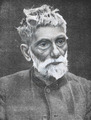
Prafulla Chandra Ray
-
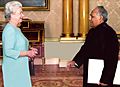
Sheikh Razzak Ali meeting with Queen Elizabeth II
-
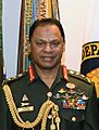
General SM Shafiuddin Ahmed
-
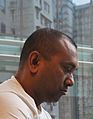
Firoz Mahmud
-
Tanvir Mokammel


See also
 In Spanish: Khulna para niños
