Kwagunt Butte facts for kids
Quick facts for kids Kwagunt Butte |
|
|---|---|

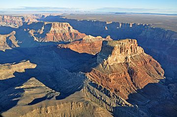
Nankoweap Mesa-(northwest), Malgosa Crest, Kwagunt Butte-(southeast)
|
|
| Highest point | |
| Elevation | 6,377 ft (1,944 m) |
| Prominence | 1,317 ft (401 m) |
| Isolation | 2.15 mi (3.46 km) |
| Parent peak | Chuar Butte (6,500 ft) |
| Geography | |
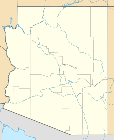
| Location | Grand Canyon National Park Coconino County, Arizona, US |
| Parent range | Kaibab Plateau-(at East Rim, East Grand Canyon) Colorado Plateau |
| Topo map | USGS Cape Solitude |
| Geology | |
| Type of rock | (Kaibab Limestone prominence), Kaibab Limestone, Toroweap Formation, Coconino Sandstone, Hermit Shale, Supai Group, Redwall Limestone, Muav Limestone-(seen along east flank, with Colorado River) Bright Angel Shale |
Kwagunt Butte is a tall, flat-topped mountain in the eastern part of the Grand Canyon. It's located in Coconino County, Arizona, USA. This impressive rock formation stands 6,377 feet (about 1,944 meters) high. It's like a giant natural landmark in the beautiful Grand Canyon National Park.
Kwagunt Butte is one of several important peaks found along the Butte Fault. It sits between Chuar Butte to the south and Malgosa Crest and Nankoweap Mesa to the north. These formations are all close to the Colorado River, which flows nearby. Kwagunt Butte has a long, narrow top that doesn't have much plant life. Its highest point is at the southwest end.
Geology of Kwagunt Butte
Kwagunt Butte is made of different layers of sedimentary rock. These rocks formed over millions of years from sand, mud, and tiny bits of sea creatures. These layers were pressed together and hardened.
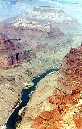
At the bottom of Kwagunt Butte, you can see a large, red cliff made of Redwall Limestone. Below this, there's a shorter cliff of Muav Limestone. Then, there are gentle slopes of soft, greenish rock called Bright Angel Shale. These slopes lead down to the Colorado River.
The Bright Angel Shale slopes often have shelves and rock pieces covering them. Strong winds blow through the Grand Canyon. These winds can sometimes clear away the loose rock, showing the different layers of rock underneath.


