Malgosa Crest facts for kids
Quick facts for kids Malgosa Crest |
|
|---|---|

|
|
| Highest point | |
| Elevation | 5,446 ft (1,660 m) |
| Prominence | 850 ft (260 m) |
| Isolation | 1.2 mi (1.9 km) |
| Parent peak | Kwagunt Butte (6,377 ft) |
| Geography | |
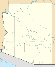
| Location | Grand Canyon National Park Coconino County, Arizona, US |
| Parent range | Kaibab Plateau-(at East Rim, East Grand Canyon) Colorado Plateau |
| Topo map | USGS Cape Solitude |
| Geology | |
| Type of rock | (Coconino Sandstone prominence), (eroded Coconino cliffs, on Hermit Shale, on platform of Esplanade Sandstone) and Coconino Sandstone, Hermit Shale, Supai Group-(4 units) _(unit-4, Esplanade Sandstone), Redwall Limestone, Muav Limestone-(seen along east flank, with Colorado River) Bright Angel Shale |
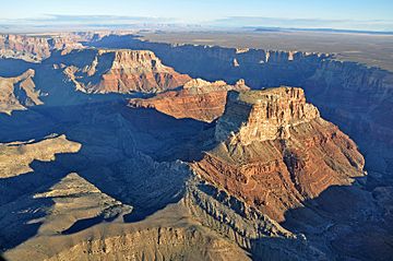
Malgosa Crest is a tall, narrow mountain ridge in the eastern Grand Canyon in Arizona, USA. It stands 5,446 feet (about 1,660 meters) high. This ridge is located right next to the East Rim of the Grand Canyon. It's one of several important landforms found along the Butte Fault.
If you look from south to north, along the west side of the Colorado River, you'll see several interesting peaks. These include Chuar Butte, Awatubi Crest, Kwagunt Butte, Malgosa Crest, and Nankoweap Mesa. All these features are close to where Marble Canyon ends and the main part of the Grand Canyon begins.
Malgosa Crest is very narrow and long. Its top part is made of tough rock layers that have been worn down over time. These layers include Coconino Sandstone and Hermit Shale. They sit on a strong base of Esplanade Sandstone. This Esplanade Sandstone is the same type of rock that forms a famous flat hiking area in the western Grand Canyon called The Esplanade.
The highest point of Malgosa Crest is right in the middle of the ridge. There's also a lower, but very noticeable, peak at the northeast end of the ridge.
How Malgosa Crest Formed
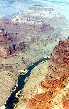
The rocks that make up Malgosa Crest and Kwagunt Butte tell an amazing story. You can see some of these rock layers in the picture above.
At the bottom of the large, red cliffs of Redwall Limestone, there's a shorter cliff of Muav Limestone. Below that, you'll find the soft, greenish Bright Angel Shale. This shale forms gentle slopes that go all the way down to the Colorado River.
These slopes often have shelves and piles of loose rock. However, strong winds blow through the canyon. These winds can sometimes sweep the slopes clean, showing off the different rock layers. For example, at a place called Tanner Graben downstream, the winds keep a very dark, vertical cliff of basalt rock almost completely free of debris.


