Nankoweap Mesa facts for kids
Quick facts for kids Nankoweap Mesa |
|
|---|---|

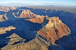
Malgosa Crest-(center), (south-flank)-Nankoweap Mesa-(north)
(part of Kwagunt Butte is at photo left) |
|
| Highest point | |
| Elevation | 6,316 ft (1,925 m) |
| Prominence | 1,636 ft (499 m) |
| Isolation | 2.63 mi (4.23 km) |
| Parent peak | Kwagunt Butte (6,377 ft) |
| Geography | |
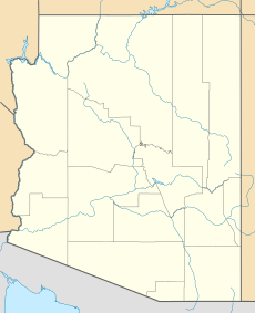
| Location | Grand Canyon National Park Coconino County, Arizona, US |
| Parent range | Kaibab Plateau Colorado Plateau |
| Topo map | USGS Cape Solitude |
| Geology | |
| Type of rock | (Kaibab Limestone prominence), Kaibab Limestone-Toroweap Formation-Coconino Sandstone-(mostly uneroded vertical cliffs) and Kaibab Limestone, Toroweap Formation, Coconino Sandstone, Hermit Shale, Supai Group, Redwall Limestone, Muav Limestone-(seen along east flank, with Colorado River) Bright Angel Shale |
Nankoweap Mesa is a tall, flat-topped mountain in the eastern part of the Grand Canyon. It stands 6,316 feet (about 1,925 meters) high. This impressive landform is located in Coconino County, in northern Arizona, USA.
Nankoweap Mesa is found near the East Rim of the Grand Canyon. It's one of several important peaks along the Butte Fault, a long crack in the Earth's crust. If you look from south to north, you'll see Chuar Butte, Awatubi Crest, Kwagunt Butte, Malgosa Crest, and then Nankoweap Mesa. These peaks are all close to the end of Marble Canyon, which is where the Grand Canyon officially begins. The Colorado River flows along the west side of these peaks.
The northern part of Nankoweap Mesa is a bit lower, at 6,073 feet. In the middle of the mesa, there's a slight dip, like a saddle. One very old and famous site on the mesa is the Nankoweap Granaries. These are storage buildings built by ancient native tribes on the northeast side of the mesa, looking out over the Colorado River.
Understanding the Geology of Nankoweap Mesa

(south-flank)-Nankoweap Mesa, Malgosa Crest, Kwagunt Butte
(the Coconino Sandstone cliff-remainder can be seen on the lower elevation Malgosa Crest) |
The mountains and mesas in this part of the Grand Canyon, like Nankoweap Mesa and Chuar Butte, are quite similar in how they were formed. They are mostly made of different types of sedimentary rock. This means they were created from layers of sand, mud, and other materials that piled up over millions of years and then hardened into rock.
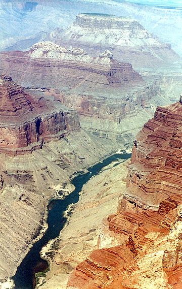
If you look at the photo, you can see these peaks sitting on slopes of reddish rock. These red layers are part of the Supai Group. Below that, you can often see the red cliffs of the Redwall Limestone. The very bottom layers, which form the base of these landforms, are slopes of dull greenish rock called the Bright Angel Shale. These different rock layers tell a long story about Earth's history in the Grand Canyon.


