Lae facts for kids
Quick facts for kids
Lae
|
|
|---|---|
|
City
|
|

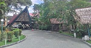
Welcome signs on approach from Nadzab airport
|
|
| Country | |
| Province | Morobe |
| District | Lae |
| LLG | Lae Urban LLG |
| Elevation | 8 m (26 ft) |
| Population
(2012)
|
|
| • City | 100,677 |
| • Rank | 2nd |
| • Urban | 193,000~ |
| Time zone | UTC+10 (PGT) |
| Climate | Af |
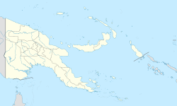
Lae is the second-largest city in Papua New Guinea and the capital of Morobe Province. It's located near the Markham River delta. Lae is also the starting point of the Highlands Highway. This highway is a very important road. It connects the Highlands Region to the coast.
Lae is Papua New Guinea's biggest cargo port. It is also a major industrial center. People often call Lae the Garden City. It is also home to the University of Technology.
Contents
Discovering Lae's Past
Lae's history can be divided into four main parts. First, there was the mission phase from 1886 to 1920. Then came the gold phase, lasting until World War II. After that, the timber and farming phase continued until 1965. Finally, an industrial boom began in 1965. This boom happened when the Highlands Highway opened.
Between 1884 and 1918, a German company set up trading posts. On July 12, 1886, a German missionary named Johann Flierl arrived. He was a pioneer for the Lutheran Church. He sailed to Simbang and then came to Lae.
After World War I, Eastern New Guinea became controlled by Australia. Many German names were changed to English or local names. For example, Adolf Haven became Morobe Harbour. In 1921, a gold prospector named Cecil John Levien became a local official.
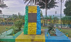
In 1923, Levien got permission to mine for gold. He then started a company called Guinea Gold. This company later formed Guinea Airways Limited in 1927. Levien also helped build an airstrip in Lae. This airstrip was important for transporting gold from mines near Wau.
Lae officially became a town on March 31, 1931. This was during the time of the gold rush. Lae became a model for other towns in New Guinea. These towns were built around airstrips. Europeans lived on the east side of the Lae Airfield. New Guineans lived on the west side. Goods arrived in Lae and were then flown to the goldfields.
In July 1937, Lae was in the news worldwide. The famous American pilot Amelia Earhart was last seen flying from Lae's airport. She was on her way back to the United States. Sadly, she was never seen again.
When volcanoes erupted in Rabaul in 1937, it was decided to move the capital of New Guinea to Lae. But World War II stopped this plan. The Japanese army took over Lae on March 8, 1942. Lae, Rabaul, and Salamaua became major Japanese bases.
The naval Battle of the Bismarck Sea happened in March 1943. This battle was fought when the Japanese tried to send more troops to Lae by sea. The Allies attacked their ships and stopped them. In mid-1943, after some defeats, the Japanese moved back to Lae and Salamaua. However, the Salamaua–Lae campaign involved many weeks of tough fighting. The Allies finally took control of Lae on September 16.

In 1971, the Australian government set up the first local government for Lae. In 1972, Lae was officially named a city. Lae grew a lot after the war. This growth was linked to the development of the highlands. Farmers started growing Coffee and tea, and a port was needed. Later, roads became a priority, leading to the Highlands Highway. The mining industry also grew in the 1980s and 1990s.
Understanding Lae's Geology
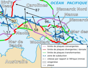
Lae is located in an area called the Pacific Ring of Fire. This means there are many faults and earthquakes.
Lae sits between two large land plates: the Indo-Australian Plate and the Pacific Plate. It's on the South Bismarck Plate in a special area called the Ramu-Markham Fault Zone. Here, the plates are pushing together very quickly. This makes the risk of earthquakes quite high. Scientists have studied Lae for over 15 years. Their measurements show how much the city and its land are changing.
The Ramu-Markham Fault Zone is an active boundary between plates. It has caused large earthquakes in the past. For example, a strong earthquake happened in 1999 near Lae. Another big one occurred in 2007. Experts believe that major earthquakes have happened in this area before. There is a chance for another large earthquake to happen in the future.
Mount Lunaman: A Local Landmark
Mount Lunaman is a hill that is 96 meters (about 315 feet) high. It has a radio tower at its top. This tower has red lights to help planes navigate. At the bottom of the hill, you'll find the neighborhoods of Voco Point and Chinatown.
Locals call Mount Lunaman Lo' Wamung, which means "first hill." It's also known as Hospital Hill and was called Fortress Hill by German settlers.
Mount Lunaman and the Lae area have been studied by scientists. They want to understand how the land plates are moving.
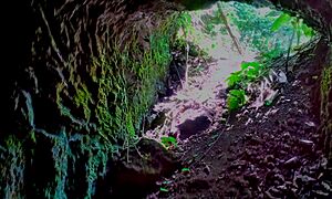
Mount Lunaman was important during World War II for both sides. Soldiers used tunnels inside the hill for storage.
How Lae is Governed
The Lae City Council is also known as the Lae Urban Local-Level Government. It is in charge of making decisions for the city. It also manages and provides services to the people living in Lae.
The city's goal is to become a "Garden City" in the Asia Pacific region. This means creating a modern, safe, and lively city. They want a strong economy and to protect their cultural heritage. They also aim for a healthy, well-educated, and friendly community.
The Lae Urban Local-Level Government is a local government. The Lord Mayor leads it and is chosen by the people. There are also five elected councilors and three nominated ones. The elected councilors represent different parts of the city. The nominated councilors represent groups like businesses, workers, women, youth, and churches.
Roads in Lae
Lae City has 137 kilometers of roads. The national government takes care of some main roads. These include Independence Drive, Markham Road, and Milford Haven Road. The Lae City Council maintains the rest of the roads. Because of a lack of money, many roads have become damaged over the years.
Electricity in Lae
In recent years, Lae and other parts of Papua New Guinea have had problems with electricity. This can affect businesses. In May 2023, an agreement was signed to build a hydropower project. This project aims to improve the electricity supply.
Lae's Climate
Lae has a tropical rainforest climate. This means it's very wet and warm all year. It gets a huge amount of rain, about 4500 mm (177 inches) each year. In fact, every month in Lae gets at least 200 mm (8 inches) of rain.
Temperatures in Lae don't change much throughout the year. January temperatures are usually around 28°C (82°F). July temperatures are about 25°C (77°F).
| Climate data for Lae | |||||||||||||
|---|---|---|---|---|---|---|---|---|---|---|---|---|---|
| Month | Jan | Feb | Mar | Apr | May | Jun | Jul | Aug | Sep | Oct | Nov | Dec | Year |
| Mean daily maximum °C (°F) | 31.5 (88.7) |
31.5 (88.7) |
31.0 (87.8) |
30.5 (86.9) |
29.8 (85.6) |
28.8 (83.8) |
28.1 (82.6) |
28.0 (82.4) |
28.7 (83.7) |
29.6 (85.3) |
30.5 (86.9) |
31.1 (88.0) |
29.9 (85.8) |
| Mean daily minimum °C (°F) | 24.3 (75.7) |
24.2 (75.6) |
24.2 (75.6) |
23.9 (75.0) |
23.6 (74.5) |
23.0 (73.4) |
22.4 (72.3) |
22.3 (72.1) |
22.6 (72.7) |
23.2 (73.8) |
23.7 (74.7) |
23.9 (75.0) |
23.4 (74.1) |
| Average rainfall mm (inches) | 241.6 (9.51) |
239.9 (9.44) |
281.1 (11.07) |
347.4 (13.68) |
348.9 (13.74) |
502.8 (19.80) |
477.9 (18.81) |
516.9 (20.35) |
360.9 (14.21) |
442.4 (17.42) |
334.9 (13.19) |
338.2 (13.31) |
4,432.9 (174.52) |
| Average rainy days | 16 | 17 | 18 | 21 | 21 | 21 | 24 | 24 | 22 | 22 | 21 | 19 | 246 |
| Source: World Meteorological Organisation | |||||||||||||
Lae's Economy and Businesses
Lae is in a great location for trade. It can easily supply goods to different regions of Papua New Guinea. Many large businesses operate here, including:
- Mainland Holdings Ltd
- DuluxGroup (PNG) Ltd
- Consort Express Lines
- Paradise Foods Limited
- Halla Cement
- HBS PNG Limited
- iPi Group
- Trukai Rice
- SP Brewery
- Bismark Maritime
- South Pacific Steel
- Papindo Group of Companies
- Prima Smallgoods
- Lae Biscuit Factory
- Citylink Motel
- MMK Transport
- Barlow Industries Ltd
- Mapai Transport
- PNG Metal Fabricators Ltd
- Araweld Ltd
- Homestate Co-operation
- NCI Packaging (PNG) Ltd
- Esteens Deering (PNG) Ltd
- Niugini Electrical Ltd
Local Markets
Lae City is known for having one of the best food markets in Papua New Guinea. This is because Morobe Province grows excellent root crops like taro, bananas, sweet potatoes, and yams. They also produce many fruits and vegetables. People from all over Papua New Guinea and even visitors love these fresh foods. The Lae Main Market also sells food from the Highlands Provinces. Besides the main market, there are smaller local markets. These help provide food for the city's growing population.
Important Places to See in Lae
University of Technology
The Papua New Guinea University of Technology is about 8 kilometers (5 miles) outside Lae. It is the second-largest university in PNG. Its "sister" university is the University of Papua New Guinea in Port Moresby. While the Port Moresby university focuses on arts and pure sciences, the University of Technology focuses on applied sciences and research. It is the only technology university in the South Pacific outside Australia and New Zealand.
Lae International Hotel
The Lae International Hotel is a major place for conferences. Many important people have stayed there over the years. It has 100 rooms and 4 luxury suites. The hotel also has different restaurants, like the Vanda Restaurant and Luluai's Italian Restaurant. There's also the Kokomo Coffee Shop.
Lae War Cemetery
The Lae War Cemetery was built in 1944. It is next to the Botanical Gardens in the city center. This cemetery is the resting place for over 2,800 soldiers. Many of them died during the Salamaua–Lae campaign. It also holds the remains of soldiers who were held by the Japanese. Two soldiers who received the Victoria Cross (a very brave award) are buried here.
Lae Botanic Gardens
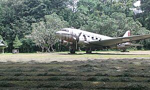
The Lae Botanic Gardens are not always open to the public. There is an old Australian airplane in the middle of the gardens.
Bumbu River
The Bumbu River starts in the Adzera Mountain range. It flows through several areas like Taraka and Kamkumung. Finally, it reaches the Huon Gulf. After a big flood in 1992, some people living near the river had to move. They went to a temporary settlement called Tent Siti (Tent City).
Angau General Hospital
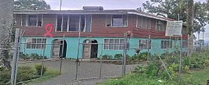
Angau General Hospital is in central Lae, near the old Lae Airfield. It is a main hospital for the Morobe Province and other nearby provinces. It has the only special facility for cancer treatment in the country. This means many cancer patients from all over PNG come here for care.
Lae (Nadzab) Airport
Nadzab Airport is located about 35 kilometers (22 miles) outside Lae City. It is along the Highlands Highway, next to the Markham River. You can take local buses or special secure transfers to get to the city from the airport.
If you are coming from Port Moresby, you can only reach Lae by flying. Several airlines, like Air Niugini, Airlines of Papua New Guinea, and Travel Air, fly this route.
Other Interesting Places
- Sir Ignatius Kilage Stadium
- Lae Golf Course
- National Polytechnic Institute of Papua New Guinea
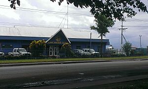
- Lae Yacht Club
- Lae Showgrounds
- Papindo Shopping Centre at 7th Street
Healthcare in Lae
If you visit Lae, it's a good idea to have health insurance. The Lae International Hospital is a good hospital. It has 19 beds, including one for emergencies. It has doctors from different countries and local nurses. There is also a public hospital called Angau Memorial Hospital.
Getting Around Lae
Three different airlines fly to Lae Nadzab Airport. This is the main airport for the city.
Lae's Twin Towns
Lae has "twin towns" in other countries. These are cities that have a special friendship and partnership.
 Cairns, Queensland, Australia (since 1984)
 Dili, Timor Leste (since 2000)
See also
- Invasion of Salamaua–Lae
 | Anna J. Cooper |
 | Mary McLeod Bethune |
 | Lillie Mae Bradford |


