Lake Ōhau facts for kids
Quick facts for kids Lake Ōhau |
|
|---|---|
Lake Ōhau
|
|
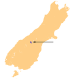
| Location | Mackenzie Basin, Waitaki District, Canterbury region, South Island |
| Coordinates | 44°15′S 169°51′E / 44.250°S 169.850°E |
| Type | glacial lake |
| Primary inflows | Hopkins, Dobson |
| Primary outflows | Ōhau |
| Catchment area | 1,198 km2 (463 sq mi) |
| Basin countries | New Zealand |
| Surface area | 54 km2 (21 sq mi) |
| Average depth | 74 m (243 ft) |
| Max. depth | 129 m (423 ft) |
| Water volume | 4.02 km3 (3,260,000 acre⋅ft) |
| Surface elevation | 520 m (1,710 ft) |
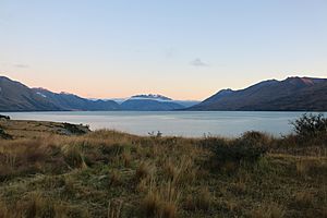
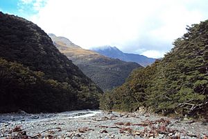
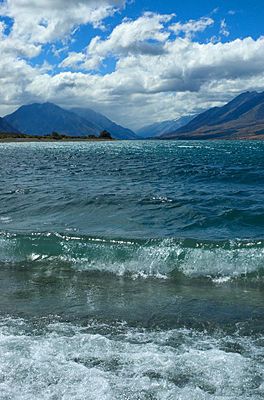
Lake Ōhau is a beautiful lake in the Mackenzie Basin, a special area in the South Island of New Zealand. Two rivers, the Hopkins and Dobson, flow into the northern part of Lake Ōhau. These rivers start high up in the Southern Alps mountains.
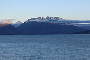
The water then flows out of the lake through the Ōhau River. This river helps power a big electricity project called the Waitaki River hydroelectric project. Tall mountains surround the lake. The Barrier Range is on the west side, and the Ben Ohau Range is on the east.
The New Zealand Ministry for Culture and Heritage says the name Ōhau means "place of Hau." But some people think it might mean "windy place." Lake Ōhau is the smallest of three large lakes in the Mackenzie Basin. The other two are Lake Pukaki and Lake Tekapo. Lake Ōhau covers about 60 square kilometres.
The Lake Ohau Alpine Village is located on the western shore of the lake. Lake Ōhau is part of the traditional border between the Otago and Canterbury regions. The lake is officially in the Waitaki District within the Canterbury region.
Contents
- Getting to Lake Ōhau
- Weather at Lake Ōhau
- Māori Stories and Traditions
- People Living by the Lake
- Stargazing at Lake Ōhau
- Farming Around the Lake
- Skiing Adventures
- Fishing Fun
- Mountain Biking Trails
- Exploring Lake Middleton
- Tramping and Hiking Around Lake Ōhau
- Exploring Ben Ohau
- Plants and Animals of Lake Ōhau
- Lake Ōhau Fire 2020
- Flooding in 2022
Getting to Lake Ōhau
Lake Ōhau is about a four-hour drive south of Christchurch. It is also about a three-hour drive north of Dunedin. You can get there by turning off State Highway 8 between Twizel and Omarama. Then, you drive about 17 kilometres on Lake Ōhau Road to reach the lake.
Weather at Lake Ōhau
The warmest time of year at Lake Ōhau is February. The average temperature then is about 15.4 °C (59.7 °F). The coldest month is July, with an average temperature of about 2.8 °C (37.0 °F).
The amount of rain changes throughout the year. February gets about 57mm of rain, while October gets about 101mm. Snow often falls in the winter months of June, July, and August.
Māori Stories and Traditions
The legends of the Ngāi Tahu people tell a special story about Lake Ōhau. They say that the explorer Rākaihautū dug this lake. He used his Polynesian digging stick, which was called Tūwhakaroria. Rākaihautū arrived in New Zealand in a large canoe called the Uruao waka. He then traveled down the middle of the South Island, digging out many freshwater lakes.
Ngāi Tahu people used to visit Lake Ōhau to gather food at different times of the year. The lake was well known for its eels and weka (a type of bird). They would collect and preserve these foods to help them get through the winter months.
People Living by the Lake
Lake Ōhau is one of the quietest lakes in New Zealand, with very few people living there. The Lake Ōhau Alpine Village has about 140 sections of land, but only around 30 houses. Most of these houses are holiday homes.
Sadly, a wildfire in October 2020 destroyed 48 houses in the village. Even with this, visitors love the peace and quiet around Lake Ōhau. Many tourists visit the lake all year round.
Stargazing at Lake Ōhau
Lake Ōhau is famous for its amazing stargazing. The skies are very clear and there isn't much light pollution from cities. In 2012, a huge area of 4300 square kilometres was named the Aoraki Mackenzie Dark Sky Reserve. The eastern shore of Lake Ōhau is part of this special reserve. It is one of only eight such reserves in the entire world!
Farming Around the Lake
Farming has been the main way people make a living around Lake Ōhau since the late 1800s. There are several large high-country farms in the area. A book called "Frugal Country and Hard on the Boots" tells the history of farming around Lake Ōhau.
In 1857, a large farm called Benmore Station was leased. It covered a huge area of land south and east of Lake Ōhau. By the 1870s, this farm had 101,500 hectares and 65,000 sheep! Later, these very large farms were divided into smaller ones. This happened around 1916 because people thought too few people owned too much land. Sheep and beef farming still continues around Lake Ōhau today.
Skiing Adventures
The Ōhau Ski Field is located on the western side of the lake. It's a 20-minute drive up a good access road from the Lake Ohau Lodge. The ski field is known for its good snow, different types of runs, and friendly feeling. It was first set up in 1953 on Mount Sutton.
As of 2020, it has a double chairlift, a platter lift, and a snow mat. The chairlift goes up to 1825 metres above sea level. From there, many skiers walk another 100 metres higher to see amazing views of the Southern Alps. Ōhau Ski Field also has machines that can make a lot of snow.
Fishing Fun
Lake Ōhau is a great place for fishing. You can catch brown trout and rainbow trout here. Sometimes, you can even catch small sockeye salmon that live in the lake. People enjoy fishing from a boat, casting from the shore, or fly fishing.
The Dobson and Hopkins rivers, which flow into Lake Ōhau, are also good spots for catching trout. It's easy to get to the lake's edge because there are gravel roads along most of the eastern and western shores. You can launch a boat from many places around the lake.
Mountain Biking Trails
Lake Ōhau is part of the Alps to Ocean Cycle Trail. This long bike trail was built after it was approved in 2010.
Part of the Alps 2 Ocean trail goes from Twizel to Lake Ōhau Lodge. This section is 38 kilometres long. Riders follow roads along canals to the edge of Lake Ōhau. Then, the trail becomes an off-road path that goes along the lake to the lodge. This part of the trail is easy and doesn't have much traffic.
Another part of the trail starts at the Lake Ōhau Lodge. This 45-kilometre section goes up the lower slopes of the Ohau Range. It climbs to the highest point of the Alps 2 Ocean trail, which is 900 metres above sea level. After that, there's a long downhill ride with some rough parts. The trail then reaches a historic woolshed. From there, bikers ride on quiet country roads to Omarama.
Exploring Lake Middleton
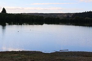
Next to Lake Ōhau is a much smaller lake called Lake Middleton. Its shoreline is just under two kilometres long, and its surface area is about 24 hectares. It's a popular spot in summer for camping, boating, and fishing. The lake is 523 metres above sea level.
You don't need to book a spot at the campsite. Cars and motor homes can easily access it. Boats can also be launched into the lake. There are plans to build a walking track around Lake Middleton, but it's taking some time.
The northern end of the lake has a buoy line to mark a swimming area. In 2019, most of the water samples met the swimming quality standards. However, this part of the lake is getting filled with sediment and weeds. The swimming area is now not considered suitable for swimming.
Lake Middleton is home to many native animals and plants. These include four types of fish, 27 kinds of birds, 26 types of plants, 14 kinds of water bugs, and lizards.
Tramping and Hiking Around Lake Ōhau
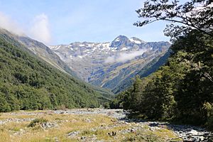
There are many options for tramping (hiking) around Lake Ōhau. You can do short walks like the Freehold Creek Track, which is 6 kilometres long and takes 2–3 hours. Or, you can go on longer trips that last overnight up the Hopkins and Huxley Valleys.
Several backcountry huts in the Hopkins Valley are great to visit. These include Monument Hut, Red Hut, Elcho Hut, and Erceg Hut.
The Huxley Valley branches off the Hopkins Valley. It has several huts, including Huxley Forks Hut. You can reach Brodrick Hut from the north branch of the Huxley river. From Brodrick Hut, you can climb over Brodrick Pass (1630 metres above sea level). Then you can go down into the Landsborough Valley. The climb to the pass is 600 metres up and has a clear track.
It's also possible to walk along the Main Divide from Brodrick Pass to climb Mount McKenzie (2156 metres above sea level). From there, you can see amazing views of Mt Hooker, Mt Dechen, Mt Strachan, and Mt Cook.
Both the North Temple and South Temple Tracks are shorter day walks. You can reach them from the top of Lake Ōhau. You can even link the two tracks by crossing the impressive Gunsight Pass. The South Temple Hut offers a place to stay for weekend hikers. You can see beautiful views from the Temple Valley Circuit track.
The Dasler Pinnacles (2315 metres above sea level) is a challenging two-day hike. You can start this hike from the top of Lake Ōhau. Hikers walk up the Hopkins river valley past Monument Hut and Red Hut. Then there's a short but steep climb to Dasler Bivvy. This small hut has two bunks. The views from Dasler Bivvy aren't great, but you can get better ones by climbing another 15 minutes up through the subalpine plants.
Climbing the Dasler Pinnacles takes six to ten hours from Dasler Bivvy. This climb needs good weather, some skill to climb over rocks, and a good head for heights.
The Te Araroa trail also passes by Lake Ōhau. The section from Lake Tekapo to Lake Ōhau is an easy but long 87 kilometres. It usually takes two to three days to walk. Another section, the East Ahuriri stage, is 26.5 kilometres long. It climbs Freehold Creek, passes Dumb-bell Lake, and then follows the East Ahuriri River. This stage usually takes one to two days to walk.
Exploring Ben Ohau
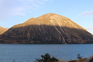
Ben Ohau is a mountain that is often photographed in New Zealand. It sits right next to Lake Ōhau. You can climb Ben Ohau, which is a 4-hour walk. You will go up over 800 metres to the top of Ben Ohau (1500 metres above sea level).
The walk starts along Glen Lyon road, about 23 kilometres from Twizel. There's a car park where the track begins. The track itself is an old four-wheel-drive track. From the top, you can see Lake Ōhau, Lake Pukaki, Lake Benmore, and Lake Ruataniwha. You can also see the mountains all around. Ben Ohau is also known by its Māori name, Te Ruataniwha.
The Ngāi Tahu legends tell a story about Te Ruataniwha. He was an ancestor on the Ārai-te-uru waka (canoe) that tipped over near Shag Point. Many passengers went to explore the land. The legend says they had to be back at the canoe before daylight. Many did not make it, including Te Ruataniwha. He was then turned into the mountain of Ben Ohau.
Plants and Animals of Lake Ōhau
You can find Himalayan tahr in the Ben Ohau Range. These animals eat native tussocks and plants. Conservationists are working to manage their numbers to protect the local plants.
Chamois and red deer also live in the mountains around Lake Ōhau. You might also see many rabbits, which are an introduced species.
The beech forests near Lake Ōhau have special mistletoe plants. These include scarlet mistletoe (Peraxilla colensoi), red mistletoe (Peraxilla tetrapetala), and yellow mistletoe (Alepis flavida). These plants are considered 'Declining,' meaning their numbers are going down. The Ōhau Conservation Trust works to protect these unique plants and the environment around Lake Ōhau.
The tussock slopes of the Ben Ohau Range are home to many small creatures. These include moths, butterflies, lizards, grasshoppers, spiders, and beetles. In the forests, you might spot birds like the tomtit/miromiro, fantail/pīwakawaka, bellbird/korimako, rifleman/tītitipounamu, and morepork/ruru koukou. Higher up the Hopkins Valley, you might see the kārearea, kea, and rock wren/pīwauwau.
The beech forests near Lake Ōhau are a mix of mountain and silver beech trees.
Wilding Pines (Pinus Cortorta, Pinus sylvestris) are a problem near Lake Ōhau. These pines grow very fast in the Mackenzie Basin. They can grow at high altitudes and take away water from streams and lakes. They also outcompete native trees and tussock land. The Ōhau Conservation Trust is working to remove these wilding pines and keep the Lake Ōhau landscape natural.
Lake Ōhau Fire 2020
On Sunday, October 4, 2020, a large wildfire happened near Lake Ōhau. It destroyed 48 houses in the Lake Ohau Alpine Village. The fire started near Freehold Creek and Parsons Creek and then spread. It burned over 5032 hectares of land.
Strong winds and a dry winter, possibly due to climate change, helped the fire spread. The fire was very expensive, with insurance claims totaling NZ$34.8 million. Fire and Emergency NZ investigated the fire. They believe it started because of a problem with a power pole. However, the company responsible for the power lines disagrees with their findings.
Flooding in 2022
In July 2022, Lake Ōhau experienced a very big storm. It caused significant flooding, almost a "one in 100 year" event. Access to the Lake Ōhau Alpine Village and Ōhau ski field was cut off. A bridge on the Lake Ōhau road was washed out by the floodwaters. Even with the damage, power and telephone lines continued to work.
|
Error: no page names specified (help). In Spanish: Lago Ohau para niños
 | Toni Morrison |
 | Barack Obama |
 | Martin Luther King Jr. |
 | Ralph Bunche |


