Laurel, Montana facts for kids
Quick facts for kids
Laurel, Montana
|
||
|---|---|---|

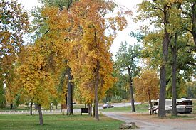
Riverside Park along the Nez Perce National Historic Trail.
|
||
|
||

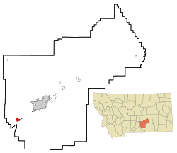
Location of Laurel, Montana
|
||
| Country | United States | |
| State | Montana | |
| County | Yellowstone | |
| Settled | 1879 | |
| Incorporated | October 10, 1908 | |
| Government | ||
| • Type | Mayor – Alderman | |
| Area | ||
| • City | 2.607 sq mi (6.752 km2) | |
| • Land | 2.605 sq mi (6.746 km2) | |
| • Water | 0.002 sq mi (0.004 km2) | |
| Elevation | 3,301 ft (1,006 m) | |
| Population
(2020)
|
||
| • City | 7,222 | |
| • Estimate
(2022)
|
7,203 | |
| • Density | 3,310/sq mi (1,279/km2) | |
| • Urban | 8,789 | |
| • Urban density | 1,481/sq mi (571.8/km2) | |
| • Metro | 190,208 | |
| • Metro density | 29.4/sq mi (11.34/km2) | |
| Time zone | UTC–7 (Mountain (MST)) | |
| • Summer (DST) | UTC–6 (MDT) | |
| ZIP Code |
59044
|
|
| Area code(s) | 406 | |
| FIPS code | 30-42700 | |
| GNIS feature ID | 0773254 | |
Laurel is a city in Yellowstone County, Montana, United States. It is the third largest community in the Billings Metropolitan Statistical Area. Laurel is located in the Yellowstone Valley. It is an important point for the BNSF Railway, where trains change direction. In 2020, about 7,222 people lived there.
Laurel is home to a large Cenex Harvest States oil refinery. It also has BNSF's Laurel Yard. This is the biggest rail yard between St. Paul, Minnesota and Pasco, Washington.
Contents
History
Before Laurel became a city, people traveled through the area. This happened during the gold rush when gold was found nearby. Travelers used wagons or small boats on the Yellowstone River. The government was also planning a railroad to the west coast.
Settlers began building homes in the Laurel area in 1879. A small building served as a train station and post office. It was located near where the railroad yards are today. When the railroad reached Laurel in 1882, the community grew quickly.
In 1883, the town's name changed from Carlton to Laurel. It was named after a local shrub. The post office opened in 1886. Laurel became an official city on October 10, 1908. This is when its first city council and mayor were elected.
Geography
Laurel is located at 45°40′26″N 108°46′15″W / 45.67389°N 108.77083°W. It is about 3,301 feet (1,006 meters) above sea level.
The city covers about 2.605 square miles (6.746 square kilometers) of land. Only a tiny part, 0.002 square miles (0.004 square kilometers), is water.
Most of Laurel is on the north side of the Yellowstone River. The Clarks Fork river joins the Yellowstone River about 2 miles (3 kilometers) southeast of town.
Climate
| Climate data for Laurel, Montana | |||||||||||||
|---|---|---|---|---|---|---|---|---|---|---|---|---|---|
| Month | Jan | Feb | Mar | Apr | May | Jun | Jul | Aug | Sep | Oct | Nov | Dec | Year |
| Record high °F (°C) | 68 (20) |
72 (22) |
80 (27) |
90 (32) |
96 (36) |
105 (41) |
108 (42) |
105 (41) |
103 (39) |
90 (32) |
77 (25) |
73 (23) |
108 (42) |
| Mean daily maximum °F (°C) | 33 (1) |
40 (4) |
48 (9) |
58 (14) |
67 (19) |
78 (26) |
86 (30) |
84 (29) |
72 (22) |
59 (15) |
43 (6) |
35 (2) |
59 (15) |
| Mean daily minimum °F (°C) | 15 (−9) |
20 (−7) |
26 (−3) |
35 (2) |
44 (7) |
53 (12) |
58 (14) |
57 (14) |
47 (8) |
37 (3) |
26 (−3) |
18 (−8) |
36 (3) |
| Record low °F (°C) | −30 (−34) |
−38 (−39) |
−19 (−28) |
−5 (−21) |
14 (−10) |
32 (0) |
41 (5) |
35 (2) |
22 (−6) |
−7 (−22) |
−22 (−30) |
−32 (−36) |
−38 (−39) |
| Average precipitation inches (mm) | 0.81 (21) |
0.58 (15) |
1.12 (28) |
1.74 (44) |
2.48 (63) |
1.89 (48) |
1.28 (33) |
0.85 (22) |
1.34 (34) |
1.26 (32) |
0.75 (19) |
0.67 (17) |
14.77 (375) |
Laurel has a climate with warm summers and cold winters. The hottest temperature ever recorded was 108°F (42°C) in July. The coldest was -38°F (-39°C) in February. The city gets about 14.77 inches (375 mm) of rain each year.
Population and People
| Historical population | |||
|---|---|---|---|
| Census | Pop. | %± | |
| 1890 | 50 | — | |
| 1900 | 368 | 636.0% | |
| 1910 | 806 | 119.0% | |
| 1920 | 2,338 | 190.1% | |
| 1930 | 2,558 | 9.4% | |
| 1940 | 2,754 | 7.7% | |
| 1950 | 3,663 | 33.0% | |
| 1960 | 4,601 | 25.6% | |
| 1970 | 4,454 | −3.2% | |
| 1980 | 5,481 | 23.1% | |
| 1990 | 5,686 | 3.7% | |
| 2000 | 6,255 | 10.0% | |
| 2010 | 6,718 | 7.4% | |
| 2020 | 7,222 | 7.5% | |
| 2022 (est.) | 7,203 | 7.2% | |
| source: U.S. Decennial Census 2020 Census |
|||
The population of Laurel has grown a lot over the years. In 1890, only 50 people lived there. By 2020, the population had grown to 7,222 people.
In 2020, there were 7,222 people living in Laurel. There were 2,960 households, which are groups of people living together. About 1,859 of these were families.
In 2010, there were 6,718 people in Laurel. Most people were White (95.3%). About 3% of the population was Hispanic or Latino. The average age in the city was 37 years old.
Economy
Laurel has several major employers. These include the Cenex Harvest States oil refinery and Montana Rail Link. The Laurel School District 7-70 also provides many jobs. Wood's Power Grip is another important company.
Farming and ranching are also very important to Laurel's economy. The Billings Canal, which is used for watering crops, starts in Laurel.
Fun Things to Do
Laurel is home to the Yellowstone National Cemetery. This is a special burial ground for people who served in the United States military.
The Laurel fire department is famous for its amazing Fourth of July fireworks show. It is considered one of the best events in the Northwest. They also have a fireworks show after the Christmas parade.
Laurel has an 18-hole golf course that opened in 1968. A new clubhouse was built in 2023. There is also a frisbee golf course and horseshoe pits in two parks. Kiwanis Park has a basketball court. A group is raising money to build a large recreation center. This center will have a community center, gym, swimming pool, and skate park.
Other exciting places near Laurel include Yellowstone National Park. You can also visit the Little Bighorn Battlefield National Monument. Another nearby spot is Pompey's Pillar National Monument. Here, William Clark carved his name in 1806. The Laurel Public Library serves the town. Laurel has also been recognized as a Tree City USA for many years.
Getting Around
Many people who live in Laurel travel about 15 miles (24 km) to Billings. Billings is Montana's largest city. Laurel is also important because it is on one of the main roads to Red Lodge. Red Lodge is a popular mountain town about 45 miles (72 km) southwest on US 212. It is also the start of the beautiful Beartooth Highway.
The City of Laurel offers two types of public transportation. Residents can use a Demand-Response Service. There is also a Van Pool service to Billings.
Laurel has its own airport, the Laurel Municipal Airport. It is about 2.4 miles (3.9 km) north of the city center.
Intermountain Health has a medical clinic in Laurel. For hospital care, residents go to nearby Billings.
Education
Laurel has its own public school system. It includes the Laurel Elementary School District and the Laurel High School District.
The Laurel Public School District runs three elementary schools: South, West, and Graff. It also has one middle school and one high school. The school teams are called the Laurel Locomotives. Their school colors are purple and gold.
Media
The Laurel Outlook is a weekly newspaper in Laurel. You can read it in print or online.
The FM radio station KRSQ is licensed in Laurel. It plays popular Top 40 music.
Notable People
- Chet Blaylock, a former member of the Montana State Senate.
- Patrick Casey, a middle-distance runner who competed for Montana State University and University of Oklahoma.
See also
 In Spanish: Laurel (Montana) para niños
 | Laphonza Butler |
 | Daisy Bates |
 | Elizabeth Piper Ensley |


